
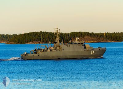
NATO WARSHIP 42
Military ops
Current Trip
MILITARY OPS
| Time Travelled | 3 days |
|---|---|
| Remaining Time | --- |
| Distance Travelled | 487.16 nm |
| Remaining Distance | --- |
| AVG Speed | 7 Knots |
| MAX Speed | 12.7 Knots |
| AVG Wind | 14.5 knots |
| MAX Wind | 21 knots |
| MIN Temp | 10.3°C / 50.54°F |
| MAX Temp | 17.6°C / 63.68°F |
| Dybgang | 3.2 m |
| Position Modtaget | Nu |
Current Position
| Longitude | -3.05093° |
|---|---|
| Latitude | 58.80425° |
| Status | Under way using engine |
| Fart | 8.6 Knots |
| Kurs | 168.7° |
| Område | North Sea |
| Station | T-AIS |
| Position Modtaget | Nu |
Info
Information
The current position of NATO WARSHIP 42 is in North Sea with coordinates 58.80425° / -3.05093° as reported on 2024-05-23 20:46 by AIS to our vessel tracker app. The vessel's current speed is 8.6 Knots
The vessel NATO WARSHIP 42 (MMSI: 230014000) is a Military ops It's sailing under the flag of [FI] Finland.
In this page you can find informations about the vessels current position, last detected port calls, and current voyage information. If the vessels is not in coverage by AIS you will find the latest position.
The current position of NATO WARSHIP 42 is detected by our AIS receivers and we are not responsible for the reliability of the data. The last position was recorded while the vessel was in Coverage by the Ais receivers of our vessel tracking app.
The current draught of NATO WARSHIP 42 as reported by AIS is 3.2 meters
Weather
| Temperature | 10.7°C / 51.26°F |
|---|---|
| Wind Speed | 11 knots |
| Direction | 360° N |
| Pressure | 1012.7 hPa |
| Humidity | 98.5 % |
| Cloud Coverage | 100 % |
Featured Company
Last Port Calls
| Port | Arrival | Departure | Time In Port |
|---|---|---|---|
| 2024-05-17 09:01 | 2024-05-20 10:47 | 3 d | |
| 2024-05-13 23:26 | 2024-05-14 22:23 | 22 h | |
| 2024-05-09 09:29 | 2024-05-13 10:54 | 4 d | |
| 2024-04-29 18:13 | 2024-05-02 10:52 | 2 d | |
| 2024-04-12 09:54 | 2024-04-15 08:22 | 2 d | |
| 2024-04-05 11:11 | 2024-04-08 10:44 | 2 d |
Last Trips
| Origin | Departure | Destination | Arrival | Distance | |
|---|---|---|---|---|---|
| 2024-05-14 22:23 | 2024-05-17 09:01 | 238.62 nm | |||
| 2024-05-13 10:54 | 2024-05-13 23:26 | 120.39 nm | |||
| 2024-05-02 10:52 | 2024-05-09 09:29 | 145.17 nm | |||
| 2024-04-15 08:22 | 2024-04-29 18:13 | 975.75 nm | |||
| 2024-04-08 10:44 | 2024-04-12 09:54 | 233.38 nm |
Events
| Tid | Hændelsen | Detaljer | Position / Dest | Info |
|---|---|---|---|---|
| 2024-05-23 20:13 | Status er ændret | Under way using engine At anchor |
58.87523 / -3.04986
MILITARY OPS
|
Fart: 5.5 kn Kurs: 195.3° |
| 2024-05-23 20:07 | START Sejllads | 3.84 nm, North West of ST MARGARET'S HOPE |
58.88217 / -3.03676
MILITARY OPS
|
Fart: 4.6 kn Kurs: 267° |
| 2024-05-23 17:49 | Status er ændret | At anchor Under way using engine |
58.88022 / -3.03217
MILITARY OPS
|
Fart: 0.4 kn Kurs: 51° |
| 2024-05-23 17:03 | Dybgangen er ændret | 3.2 3 |
58.88026 / -3.03195
MILITARY OPS
|
Fart: 0.5 kn Kurs: 38° |
| 2024-05-23 17:00 | Dybgangen er ændret | 3 3.2 |
58.88029 / -3.03214
MILITARY OPS
|
Fart: 0.5 kn Kurs: 354° |
| 2024-05-23 15:51 | Dybgangen er ændret | 3.2 3 |
58.88034 / -3.03220
MILITARY OPS
|
Fart: 0.1 kn Kurs: 20° |
| 2024-05-23 15:45 | Dybgangen er ændret | 3 3.2 |
58.88025 / -3.03185
MILITARY OPS
|
Fart: 0.4 kn Kurs: 32° |
| 2024-05-23 15:33 | Dybgangen er ændret | 3.2 3 |
58.88028 / -3.03220
MILITARY OPS
|
Fart: 0.1 kn Kurs: 31° |
| 2024-05-23 15:28 | Dybgangen er ændret | 3 3.2 |
58.88023 / -3.03165
MILITARY OPS
|
Fart: 0.2 kn Kurs: 20° |
| 2024-05-23 15:15 | Dybgangen er ændret | 3.2 3 |
58.88028 / -3.03227
MILITARY OPS
|
Fart: 0.2 kn Kurs: 48° |