

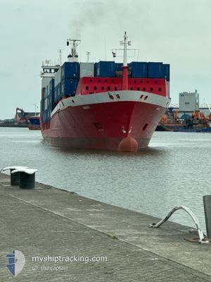
NANTO
Container Ship

Current Trip
| Time Travelled | 1 day |
|---|---|
| Remaining Time | 1 day |
| Distance Travelled | 352.13 nm |
| Remaining Distance | 668.50 nm |
| AVG Speed | 15.3 Knots |
| MAX Speed | 16.5 Knots |
| AVG Wind | 14.8 knots |
| MAX Wind | 26 knots |
| MIN Temp | 15.8°C / 60.44°F |
| MAX Temp | 18°C / 64.4°F |
| Dybgang | 7.6 m |
| Position Modtaget | 2 h, 54 m siden |
Current Position
| Longitude | --- |
|---|---|
| Latitude | --- |
| Status | Under way using engine |
| Fart | 15.5 Knots |
| Kurs | 231.6° |
| Område | North Atlantic Ocean |
| Station | T-AIS |
| Position Modtaget | 2 h, 54 m siden |
Information
The current position of NANTO is in North Atlantic Ocean with coordinates 35.88252° / -5.99007° as reported on 2025-04-10 07:30 by AIS to our vessel tracker app. The vessel's current speed is 15.5 Knots and is heading at the port of LAS PALMAS. The estimated time of arrival as calculated by MyShipTracking vessel tracking app is 2025-04-12 04:46 LT
The vessel NANTO (IMO: 9083043, MMSI: 276870000) is a Container Ship that was built in 1994 ( 31 år gamle ). It's sailing under the flag of [EE] Estonia.
In this page you can find informations about the vessels current position, last detected port calls, and current voyage information. If the vessels is not in coverage by AIS you will find the latest position.
The current position of NANTO is detected by our AIS receivers and we are not responsible for the reliability of the data. The last position was recorded while the vessel was in Coverage by the Ais receivers of our vessel tracking app.
The current draught of NANTO as reported by AIS is 7.6 meters
Weather
| Temperature | 17.9°C / 64.22°F |
|---|---|
| Wind Speed | 21 knots |
| Direction | 81° E |
| Pressure | 1010.1 hPa |
| Humidity | 84.5 % |
| Cloud Coverage | 100 % |


Featured Company
Last Port Calls
| Port | Arrival | Departure | Time In Port |
|---|---|---|---|
| 2025-04-08 07:23 | 2025-04-09 11:35 | 1 d | |
| 2025-04-06 12:01 | 2025-04-07 13:18 | 1 d | |
| 2025-04-02 21:00 | 2025-04-03 05:07 | 8 h | |
| 2025-04-02 07:25 | 2025-04-02 14:01 | 6 h | |
| 2025-04-01 21:22 | 2025-04-02 03:50 | 6 h | |
| 2025-03-28 10:34 | 2025-03-29 16:45 | 1 d | |
| 2025-03-26 11:40 | 2025-03-27 19:12 | 1 d | |
| 2025-03-21 12:49 | 2025-03-22 04:46 | 15 h | |
| 2025-03-16 21:49 | 2025-03-17 13:47 | 15 h | |
| 2025-03-13 09:35 | 2025-03-13 22:11 | 12 h |
Last Trips
| Origin | Departure | Destination | Arrival | Distance | |
|---|---|---|---|---|---|
| 2025-04-07 13:18 | 2025-04-08 07:23 | 224.94 nm | |||
| 2025-04-03 05:07 | 2025-04-06 12:01 | 1121.36 nm | |||
| 2025-04-02 14:01 | 2025-04-02 21:00 | 111.72 nm | |||
| 2025-04-02 03:50 | 2025-04-02 07:25 | 54.07 nm | |||
| 2025-03-29 16:45 | 2025-04-01 21:22 | 1239.88 nm | |||
| 2025-03-27 19:12 | 2025-03-28 10:34 | 224.36 nm | |||
| 2025-03-22 04:46 | 2025-03-26 11:40 | 1599.10 nm | |||
| 2025-03-17 13:47 | 2025-03-21 12:49 | 1516.24 nm | |||
| 2025-03-13 22:11 | 2025-03-16 21:49 | 1140.84 nm | |||
| 2025-03-13 02:23 | 2025-03-13 09:35 | 112.82 nm |
Events
| Tid | Hændelsen | Detaljer | Position / Dest | Info |
|---|---|---|---|---|
| 2025-04-10 07:36 | Status er ændret | Default Under way using engine |
35.86725 / -6.01208
ES LPA
|
Fart: 15.5 kn Kurs: 231.6° |
| 2025-04-10 07:30 | Ændre havområde | Moroccan part of the North Atlantic Ocean Moroccan part of the Strait of Gibraltar |
35.88252 / -5.99007
North Atlantic Ocean
ES LPA
|
Fart: 15.5 kn Kurs: 231.6° |
| 2025-04-10 07:30 | Status er ændret | Under way using engine Default |
35.88252 / -5.99007
ES LPA
|
Fart: 15.6 kn Kurs: 232° |
| 2025-04-10 07:30 | Udenfor Dækning |
35.88252 / -5.99007
North Atlantic Ocean
ES LPA
|
Fart: 15.5 kn Kurs: 231.6° |
|
| 2025-04-10 07:20 | Status er ændret | Default Under way using engine |
35.90728 / -5.94684
ES LPA
|
Fart: 15.7 kn Kurs: 257.9° |
| 2025-04-10 07:11 | Status er ændret | Under way using engine Default |
35.91997 / -5.89987
ES LPA
|
Fart: 16 kn Kurs: 261° |
| 2025-04-10 07:08 | Status er ændret | Default Under way using engine |
35.92233 / -5.88603
ES LPA
|
Fart: 16 kn Kurs: 259.8° |
| 2025-04-10 06:53 | Status er ændret | Under way using engine Default |
35.93393 / -5.80357
ES LPA
|
Fart: 15.6 kn Kurs: 261° |
| 2025-04-10 06:52 | Status er ændret | Default Under way using engine |
35.93446 / -5.79990
ES LPA
|
Fart: 15.5 kn Kurs: 259.8° |
| 2025-04-10 06:43 | Ændre havområde | Moroccan part of the Strait of Gibraltar Spanish part of the Strait of Gibraltar |
35.94231 / -5.75346
Strait of Gibraltar
ES LPA
|
Fart: 15.4 kn Kurs: 261° |