
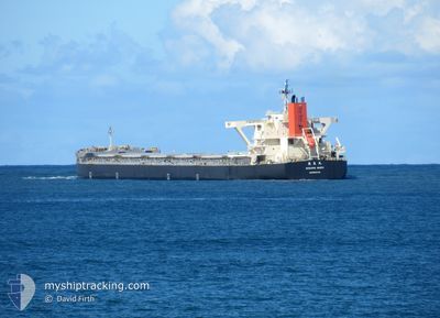
NAGARA MARU
Cargo
Current Trip
| Time Travelled | 7 days |
|---|---|
| Remaining Time | 8 days |
| Distance Travelled | 2085.25 nm |
| Remaining Distance | 2237.76 nm |
| AVG Speed | 11.3 Knots |
| MAX Speed | 13.6 Knots |
| AVG Wind | 15.5 knots |
| MAX Wind | 34 knots |
| MIN Temp | 8.3°C / 46.94°F |
| MAX Temp | 29.8°C / 85.64°F |
| Dybgang | 8.1 m |
| Position Modtaget | 4 d siden |
Current Position
| Longitude | --- |
|---|---|
| Latitude | --- |
| Status | Under way using engine |
| Fart | 11.6 Knots |
| Kurs | 169.2° |
| Område | Philippine Sea |
| Station | T-AIS |
| Position Modtaget | 4 d siden |
Info
Information
The current position of NAGARA MARU is in Philippine Sea with coordinates 19.60420° / 140.68273° as reported on 2024-12-22 17:10 by AIS to our vessel tracker app. The vessel's current speed is 11.6 Knots and is heading at the port of NEWCASTLE. The estimated time of arrival as calculated by MyShipTracking vessel tracking app is 2025-01-04 10:07 LT
The vessel NAGARA MARU (IMO: 9728447, MMSI: 636018256) is a Cargo It's sailing under the flag of [LR] Liberia.
In this page you can find informations about the vessels current position, last detected port calls, and current voyage information. If the vessels is not in coverage by AIS you will find the latest position.
The current position of NAGARA MARU is detected by our AIS receivers and we are not responsible for the reliability of the data. The last position was recorded while the vessel was in Coverage by the Ais receivers of our vessel tracking app.
The current draught of NAGARA MARU as reported by AIS is 8.1 meters
Weather
| Temperature | 29.4°C / 84.92°F |
|---|---|
| Wind Speed | 8 knots |
| Direction | 133° SE |
| Pressure | 1010.3 hPa |
| Humidity | 71.4 % |
| Cloud Coverage | 100 % |
Featured Company
Last Trips
Events
| Tid | Hændelsen | Detaljer | Position / Dest | Info |
|---|---|---|---|---|
| 2024-12-22 17:16 | Status er ændret | Default Under way using engine |
19.58597 / 140.68622
AU_NTL
|
Fart: 11.6 kn Kurs: 169.2° |
| 2024-12-22 17:10 | Udenfor Dækning |
19.60420 / 140.68273
Philippine Sea
AU_NTL
|
Fart: 11.6 kn Kurs: 169.2° |
|
| 2024-12-22 13:55 | Ændre havområde | High seas of the Philippine Sea Japanese part of the Philippine Sea |
20.23209 / 140.54709
Philippine Sea
AU_NTL
|
Fart: 11.8 kn Kurs: 169.8° |
| 2024-12-22 13:55 | Status er ændret | Under way using engine Default |
20.23209 / 140.54709
AU_NTL
|
Fart: 11.8 kn Kurs: 166° |
| 2024-12-22 13:55 | Indenfor Dækning |
20.23209 / 140.54709
Philippine Sea
AU_NTL
|
Fart: 11.8 kn Kurs: 169.8° |
|
| 2024-12-19 07:41 | Status er ændret | Default Under way using engine |
34.43397 / 137.07428
AU_NTL
|
Fart: 12 kn Kurs: 158.2° |
| 2024-12-19 07:35 | Status er ændret | Under way using engine Default |
34.45190 / 137.06728
AU_NTL
|
Fart: 11.9 kn Kurs: 158° |
| 2024-12-19 07:35 | Udenfor Dækning |
34.45190 / 137.06728
Philippine Sea
AU_NTL
|
Fart: 12 kn Kurs: 158.2° |
|
| 2024-12-19 06:50 | Status er ændret | Default Under way using engine |
34.57012 / 136.99010
AU_NTL
|
Fart: 11.9 kn Kurs: 132.8° |
| 2024-12-19 06:45 | Status er ændret | Under way using engine Default |
34.58193 / 136.97521
AU_NTL
|
Fart: 11.3 kn Kurs: 147° |