
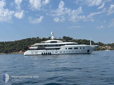
M\Y NORTH STAR
Pleasure Craft
Current Trip
AG-ANU
| Time Travelled | 18 h, 2 mins |
|---|---|
| Remaining Time | --- |
| Distance Travelled | 16.95 nm |
| Remaining Distance | --- |
| AVG Speed | 10.8 Knots |
| MAX Speed | 13.7 Knots |
| AVG Wind | 18.8 knots |
| MAX Wind | 19.9 knots |
| MIN Temp | 25.9°C / 78.62°F |
| MAX Temp | 26.3°C / 79.34°F |
| Dybgang | 3.6 m |
| Position Modtaget | 1 m siden |
Current Position
| Longitude | --- |
|---|---|
| Latitude | --- |
| Status | At anchor |
| Fart | 0.1 Knots |
| Kurs | 97° |
| Område | Caribbean Sea |
| Station | T-AIS |
| Position Modtaget | 1 m siden |
Info
Information
The current position of M\Y NORTH STAR is in Caribbean Sea with coordinates 17.08744° / -61.90212° as reported on 2025-02-17 06:18 by AIS to our vessel tracker app. The vessel's current speed is 0.1 Knots
The vessel M\Y NORTH STAR (IMO: 9849942, MMSI: 232020030) is a Pleasure Craft It's sailing under the flag of [GB] United Kingdom.
In this page you can find informations about the vessels current position, last detected port calls, and current voyage information. If the vessels is not in coverage by AIS you will find the latest position.
The current position of M\Y NORTH STAR is detected by our AIS receivers and we are not responsible for the reliability of the data. The last position was recorded while the vessel was in Coverage by the Ais receivers of our vessel tracking app.
The current draught of M\Y NORTH STAR as reported by AIS is 3.6 meters
Weather
| Temperature | 25.3°C / 77.54°F |
|---|---|
| Wind Speed | 19 knots |
| Direction | 91° E |
| Pressure | 1016.6 hPa |
| Humidity | 74.9 % |
| Cloud Coverage | 3 % |
Featured Company
Last Port Calls
| Port | Arrival | Departure | Time In Port |
|---|---|---|---|
| 2025-02-12 08:48 | 2025-02-16 08:18 | 3 d | |
| 2025-01-29 08:55 | 2025-02-03 11:52 | 5 d | |
| 2025-01-14 09:20 | 2025-01-17 13:09 | 3 d | |
| 2024-12-02 08:37 | 2024-12-10 17:19 | 8 d |
Last Trips
| Origin | Departure | Destination | Arrival | Distance | |
|---|---|---|---|---|---|
| 2025-02-03 11:52 | 2025-02-12 08:48 | 276.85 nm | |||
| 2025-01-17 13:09 | 2025-01-29 08:55 | 241.58 nm | |||
| 2024-12-10 17:19 | 2025-01-14 09:20 | 1047.25 nm | |||
| 2024-11-20 16:46 | 2024-12-02 08:37 | 3472.28 nm |
Events
| Tid | Hændelsen | Detaljer | Position / Dest | Info |
|---|---|---|---|---|
| 2025-02-16 14:12 | Status er ændret | At anchor Under way using engine |
17.08725 / -61.90216
AG-ANU
|
Fart: 0.1 kn Kurs: 58° |
| 2025-02-16 13:51 | STOP Sejllads | 3.27 nm, South West of ST JOHNS |
17.08790 / -61.90219
AG-ANU
|
Fart: 0.3 kn Kurs: 67° |
| 2025-02-16 12:19 | START Sejllads | 0.29 nm, West of ANTIGUA |
17.01200 / -61.77780
AG-ANU
|
Fart: 4.5 kn Kurs: 256° |
| 2025-02-16 12:18 | Afsejlet fra sidste havn |
|
17.01217 / -61.77682
AG-ANU
|
Fart: 1.8 kn Kurs: 261° |
| 2025-02-12 12:53 | STOP Sejllads |
17.01331 / -61.77254
[AG] ANTIGUA
|
Fart: 0.2 kn Kurs: 30° |
|
| 2025-02-12 12:48 | Skibe i havn |
|
17.01243 / -61.77469
[AG] ANTIGUA
|
Fart: 3 kn Kurs: 78° |
| 2025-02-12 12:40 | START Sejllads | 0.52 nm, West of ANTIGUA |
17.01171 / -61.78181
AG-ANU
|
Fart: 3.4 kn Kurs: 112° |
| 2025-02-12 12:35 | Status er ændret | Under way using engine At anchor |
17.01162 / -61.78286
AG-ANU
|
Fart: 0.5 kn Kurs: 87° |
| 2025-02-12 09:43 | Status er ændret | At anchor Under way using engine |
17.01197 / -61.78385
AG-ANU
|
Fart: 0.1 kn Kurs: 68° |
| 2025-02-12 09:19 | STOP Sejllads | 0.64 nm, West of ANTIGUA |
17.01119 / -61.78381
AG-ANU
|
Fart: Kurs: 75° |