
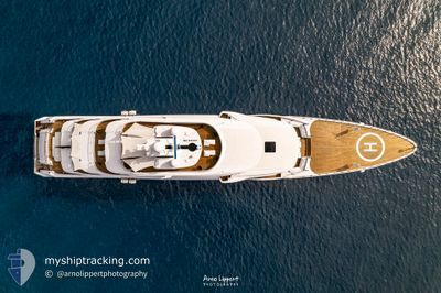
MY DRAGON
Cargo
Current Trip
| Trip Time | 22 h, 8 mins |
|---|---|
| Trip Distance | 311.84 nm |
| AVG Speed | 14 Knots |
| MAX Speed | 15 Knots |
| Dybgang | 3.5 m |
| AVG Wind | 11.4 knots |
| MAX Wind | 28.7 knots |
| MIN Temp | 23.6°C / 74.48°F |
| MAX Temp | 29.1°C / 84.38°F |
| Position Modtaget | 7 d siden |
Current Position
| Longitude | 13.48316° |
|---|---|
| Latitude | 43.61745° |
| Status | Under way using engine |
| Fart | 0.7 Knots |
| Kurs | 317° |
| Område | Adriatic Sea |
| Station | T-AIS |
| Position Modtaget | 7 d siden |
Info
Information
The current position of MY DRAGON is in Adriatic Sea with coordinates 43.61745° / 13.48316° as reported on 2024-09-09 12:29 by AIS to our vessel tracker app. The vessel's current speed is 0.7 Knots and is currently inside the port of ANCONA.
The vessel MY DRAGON (IMO: 9853838, MMSI: 319288300) is a Cargo It's sailing under the flag of [KY] Cayman Is.
In this page you can find informations about the vessels current position, last detected port calls, and current voyage information. If the vessels is not in coverage by AIS you will find the latest position.
The current position of MY DRAGON is detected by our AIS receivers and we are not responsible for the reliability of the data. The last position was recorded while the vessel was in Coverage by the Ais receivers of our vessel tracking app.
The current draught of MY DRAGON as reported by AIS is 3.5 meters
Weather
| Temperature | 29.3°C / 84.74°F |
|---|---|
| Wind Speed | 14 knots |
| Direction | 266° W |
| Pressure | 1001.6 hPa |
| Humidity | 39.1 % |
| Cloud Coverage | 17 % |
Featured Company
Last Port Calls
| Port | Arrival | Departure | Time In Port |
|---|---|---|---|
| 2024-09-09 12:52 | |||
| 2024-09-08 11:19 | 2024-09-08 14:44 | 3 h | |
| 2024-08-13 08:11 | 2024-08-13 12:45 | 4 h | |
| 2024-07-09 15:36 |
Most Visited Ports (Last year)
| Port | Arrivals | |
|---|---|---|
| 1 | ||
| 1 | ||
| 1 |
Last Trips
| Origin | Departure | Destination | Arrival | Distance | |
|---|---|---|---|---|---|
| 2024-09-08 14:44 | 2024-09-09 12:52 | 311.84 nm | |||
| 2024-08-13 12:45 | 2024-09-08 11:19 | 1473.99 nm | |||
| 2024-07-09 15:36 | 2024-08-13 08:11 | 972.78 nm |
Events
| Tid | Hændelsen | Detaljer | Position / Dest | Info |
|---|---|---|---|---|
| 2024-09-09 12:29 | Udenfor Dækning |
43.61745 / 13.48316
Adriatic Sea
[IT] ANCONA
|
Fart: 0.7 kn Kurs: 313° |
|
| 2024-09-09 12:29 | Indenfor Dækning |
43.61745 / 13.48316
Adriatic Sea
[IT] ANCONA
|
Fart: 0.7 kn Kurs: 313° |
|
| 2024-09-09 11:17 | Udenfor Dækning |
43.61725 / 13.48436
Adriatic Sea
[IT] ANCONA
|
Fart: Kurs: 16.3° |
|
| 2024-09-09 10:52 | STOP Sejllads |
43.61727 / 13.48422
[IT] ANCONA
|
Fart: 0.1 kn Kurs: 259° |
|
| 2024-09-09 10:52 | Skibe i havn |
|
43.61727 / 13.48422
[IT] ANCONA
|
Fart: 7.4 kn Kurs: 204.2° |
| 2024-09-09 06:34 | Indenfor Dækning |
43.08509 / 14.40039
Adriatic Sea
IT AOI
|
Fart: 14.5 kn Kurs: 315.7° |
|
| 2024-09-09 05:11 | Udenfor Dækning |
42.83758 / 14.73769
Adriatic Sea
IT AOI
|
Fart: 14.8 kn Kurs: 315.6° |
|
| 2024-09-08 17:12 | Ændre havområde | Italian part of the Adriatic Sea Montenegrin part of the Adriatic Sea |
41.57614 / 18.08127
Adriatic Sea
IT AOI
|
Fart: 14.6 kn Kurs: 285.5° |
| 2024-09-08 15:22 | Fundet i havområde | Montenegrin part of the Adriatic Sea |
41.44404 / 18.65072
Adriatic Sea
IT AOI
|
Fart: 14.7 kn Kurs: 285.9° |
| 2024-09-08 12:44 | Status er ændret | Under way using engine Moored |
41.30031 / 19.45740
IT AOI
|
Fart: 8.2 kn Kurs: 164.9° |