
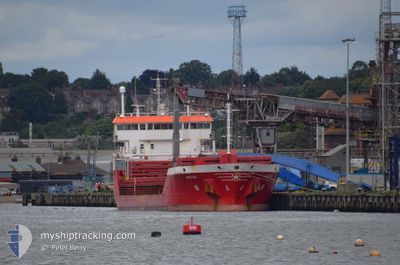
MUROS
General Cargo
Current Trip
| Time Travelled | 11 days |
|---|---|
| Remaining Time | --- |
| Distance Travelled | 1992.06 nm |
| Remaining Distance | --- |
| AVG Speed | 10.4 Knots |
| MAX Speed | 14.8 Knots |
| AVG Wind | 14.1 knots |
| MAX Wind | 37 knots |
| MIN Temp | 10.5°C / 50.9°F |
| MAX Temp | 22.4°C / 72.32°F |
| Dybgang | 6.8 m |
| Position Modtaget | 5 d siden |
Current Position
| Longitude | --- |
|---|---|
| Latitude | --- |
| Status | Under way using engine |
| Fart | 9 Knots |
| Kurs | 52° |
| Område | Celtic Sea |
| Station | T-AIS |
| Position Modtaget | 5 d siden |
Info
Information
The current position of MUROS is in Celtic Sea with coordinates 48.81398° / -5.55241° as reported on 2024-10-17 23:44 by AIS to our vessel tracker app. The vessel's current speed is 9 Knots and is heading at the port of RUNCORN. The estimated time of arrival as calculated by MyShipTracking vessel tracking app is 2024-10-19 06:01 LT
The vessel MUROS (IMO: 9397640, MMSI: 255989000) is a General Cargo that was built in 2007 ( 17 år gamle ). It's sailing under the flag of [PT] Portugal.
In this page you can find informations about the vessels current position, last detected port calls, and current voyage information. If the vessels is not in coverage by AIS you will find the latest position.
The current position of MUROS is detected by our AIS receivers and we are not responsible for the reliability of the data. The last position was recorded while the vessel was in Coverage by the Ais receivers of our vessel tracking app.
The current draught of MUROS as reported by AIS is 6.8 meters
Weather
| Temperature | 10.7°C / 51.26°F |
|---|---|
| Wind Speed | 8 knots |
| Direction | 188° S |
| Pressure | 1029.2 hPa |
| Humidity | 85.7 % |
| Cloud Coverage | 71 % |
Featured Company
Last Port Calls
| Port | Arrival | Departure | Time In Port |
|---|---|---|---|
| 2024-10-09 09:54 | 2024-10-11 07:51 | 1 d | |
| 2024-10-03 16:44 | 2024-10-08 12:32 | 4 d | |
| 2024-09-21 05:05 | 2024-09-21 18:01 | 12 h | |
| 2024-09-18 02:35 | 2024-09-19 18:41 | 1 d | |
| 2024-09-17 18:47 | 2024-09-17 18:52 | 4 m | |
| 2024-09-12 06:56 | 2024-09-13 18:01 | 1 d | |
| 2024-09-04 16:48 | 2024-09-07 17:39 | 3 d | |
| 2024-08-12 07:02 | 2024-08-14 21:43 | 2 d | |
| 2024-08-02 15:02 | 2024-08-06 18:06 | 4 d |
Last Trips
| Origin | Departure | Destination | Arrival | Distance | |
|---|---|---|---|---|---|
| 2024-10-08 14:32 | 2024-10-09 11:54 | 225.40 nm | |||
| 2024-09-21 20:01 | 2024-10-03 18:44 | 2671.22 nm | |||
| 2024-09-19 20:41 | 2024-09-21 07:05 | 380.34 nm | |||
| 2024-09-17 20:52 | 2024-09-18 04:35 | 82.14 nm | |||
| 2024-09-13 20:01 | 2024-09-17 20:47 | 985.96 nm | |||
| 2024-09-07 19:39 | 2024-09-12 08:56 | 358.91 nm | |||
| 2024-08-14 22:43 | 2024-09-04 18:48 | 1868.66 nm | |||
| 2024-08-06 20:06 | 2024-08-12 08:02 | 1417.48 nm | |||
| 2024-07-24 23:18 | 2024-08-02 17:02 | 420.35 nm |
Events
| Tid | Hændelsen | Detaljer | Position / Dest | Info |
|---|---|---|---|---|
| 2024-10-21 13:44 | STOP Sejllads | 9.78 nm, North West of CONWY |
53.37037 / -4.07608
GBRUN
|
Fart: 0.2 kn Kurs: 204° |
| 2024-10-19 07:35 | STOP Sejllads | 9.75 nm, North West of CONWY |
53.36778 / -4.07748
GBRUN
|
Fart: 0.2 kn Kurs: 273° |
| 2024-10-17 23:57 | Status er ændret | Default Under way using engine |
48.83837 / -5.51643
GBRUN
|
Fart: 9 kn Kurs: 52° |
| 2024-10-17 23:44 | Status er ændret | Under way using engine Default |
48.81398 / -5.55241
GBRUN
|
Fart: 8.2 kn Kurs: 39° |
| 2024-10-17 23:44 | Udenfor Dækning |
48.81398 / -5.55241
Celtic Sea
GBRUN
|
Fart: 9 kn Kurs: 52° |
|
| 2024-10-17 23:27 | Status er ændret | Default Under way using engine |
48.78212 / -5.59323
GBRUN
|
Fart: 9.3 kn Kurs: 53.6° |
| 2024-10-17 23:21 | Ændre havområde | French part of the Celtic Sea Portuguese part of the North Atlantic Ocean |
48.77170 / -5.60638
Celtic Sea
GBRUN
|
Fart: 9.3 kn Kurs: 53.6° |
| 2024-10-17 23:21 | Status er ændret | Under way using engine Default |
48.77170 / -5.60638
GBRUN
|
Fart: 8.5 kn Kurs: 38° |
| 2024-10-17 23:11 | Indenfor Dækning |
48.77170 / -5.60638
Celtic Sea
GBRUN
|
Fart: 9.3 kn Kurs: 53.6° |
|
| 2024-10-15 14:07 | Udenfor Dækning |
39.70844 / -9.81290
North Atlantic Ocean
GBRUN
|
Fart: 10.8 kn Kurs: 359.2° |