
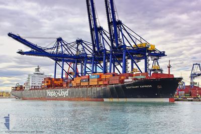
MSC ROBERTA V
Container Ship
Current Trip
| Time Travelled | 3 days |
|---|---|
| Remaining Time | --- |
| Distance Travelled | 762.27 nm |
| Remaining Distance | --- |
| AVG Speed | 12.7 Knots |
| MAX Speed | 16.6 Knots |
| AVG Wind | 9.1 knots |
| MAX Wind | 21.8 knots |
| MIN Temp | 26.4°C / 79.52°F |
| MAX Temp | 28.7°C / 83.66°F |
| Dybgang | 10.6 m |
| Position Modtaget | 2025-10-04 08:45 |
Current Position
| Longitude | --- |
|---|---|
| Latitude | --- |
| Status | Under way using engine |
| Fart | 13.6 Knots |
| Kurs | 128.9° |
| Område | Gulf of Oman |
| Station | T-AIS |
| Position Modtaget | 2025-10-04 08:45 |
Info
Information
The current position of MSC ROBERTA V is in Gulf of Oman with coordinates 24.98276° / 57.30987° as reported on 2025-10-04 08:45 by AIS to our vessel tracker app. The vessel's current speed is 13.6 Knots and is heading at the port of NHAVA SHEVA.
The vessel MSC ROBERTA V (IMO: 9038907, MMSI: 636017006) is a Container Ship that was built in 1993 ( 33 år gamle ). It's sailing under the flag of [LR] Liberia.
In this page you can find informations about the vessels current position, last detected port calls, and current voyage information. If the vessels is not in coverage by AIS you will find the latest position.
The current position of MSC ROBERTA V is detected by our AIS receivers and we are not responsible for the reliability of the data. The last position was recorded while the vessel was in Coverage by the Ais receivers of our vessel tracking app.
The current draught of MSC ROBERTA V as reported by AIS is 10.6 meters
Weather
| Temperature | 27.8°C / 82.04°F |
|---|---|
| Wind Speed | 17 knots |
| Direction | 352° N |
| Pressure | 1007.9 hPa |
| Humidity | 81.3 % |
| Cloud Coverage | 100 % |
Featured Company
Last Port Calls
| Port | Arrival | Departure | Time In Port |
|---|---|---|---|
| 2025-12-25 18:39 | 2025-12-30 21:47 | 5 d | |
| 2025-12-02 12:37 | 2025-12-03 07:24 | 18 h | |
| 2025-11-30 17:03 | 2025-12-01 12:36 | 19 h | |
| 2025-11-28 19:43 | 2025-11-29 07:31 | 11 h | |
| 2025-11-24 10:10 | 2025-11-25 23:43 | 1 d | |
| 2025-11-21 11:42 | 2025-11-22 05:06 | 17 h | |
| 2025-11-10 20:28 | 2025-11-12 23:47 | 2 d | |
| 2025-11-08 07:39 |
Most Visited Ports (Last year)
| Port | Arrivals | |
|---|---|---|
| 11 | ||
| 9 | ||
| 8 | ||
| 3 | ||
| 3 | ||
| 3 |
Last Trips
| Origin | Departure | Destination | Arrival | Distance | |
|---|---|---|---|---|---|
| 2025-12-03 07:24 | 2025-12-25 18:39 | 3511.33 nm | |||
| 2025-12-01 12:36 | 2025-12-02 12:37 | 240.75 nm | |||
| 2025-11-29 07:31 | 2025-11-30 17:03 | 433.07 nm | |||
| 2025-11-25 23:43 | 2025-11-28 19:43 | 559.07 nm | |||
| 2025-11-22 05:06 | 2025-11-24 10:10 | 428.37 nm | |||
| 2025-11-12 23:47 | 2025-11-21 11:42 | 2792.60 nm | |||
| 2025-11-08 07:39 | 2025-11-10 20:28 | 560.51 nm |
Events
| Tid | Hændelsen | Detaljer | Position / Dest | Info |
|---|---|---|---|---|
| 2025-12-30 18:47 | Afsejlet fra sidste havn |
|
-4.04721 / 39.63636
INNSA
|
Fart: 4.8 kn Kurs: 82° |
| 2025-12-30 18:44 | START Sejllads |
-4.04728 / 39.62818
[KE] MOMBASA
|
Fart: 4.8 kn Kurs: 82° |
|
| 2025-12-25 15:40 | STOP Sejllads |
-4.04762 / 39.62461
[KE] MOMBASA
|
Fart: 0.1 kn Kurs: 60° |
|
| 2025-12-25 15:39 | Skibe i havn |
|
-4.04762 / 39.62461
[KE] MOMBASA
|
Fart: 0.6 kn Kurs: 70° |
| 2025-12-25 13:53 | START Sejllads | 7.23 nm, South East of MOMBASA |
-4.11576 / 39.73976
INNSA
|
Fart: 3.5 kn Kurs: 330° |
| 2025-12-25 13:17 | STOP Sejllads | 7.44 nm, South East of MOMBASA |
-4.11936 / 39.74150
INNSA
|
Fart: 0.1 kn Kurs: 332° |
| 2025-12-25 12:01 | START Sejllads | 11.58 nm, East of MOMBASA |
-4.02405 / 39.83205
INNSA
|
Fart: 3.3 kn Kurs: 290° |
| 2025-12-24 12:05 | STOP Sejllads | 10.7 nm, South East of MOMBASA |
-4.17654 / 39.76388
INNSA
|
Fart: 0.3 kn Kurs: 325° |