
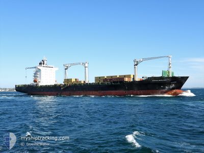
MSC RESILIENT III
Not available
Current Trip
| Time Travelled | 4 days |
|---|---|
| Remaining Time | --- |
| Distance Travelled | 306.47 nm |
| Remaining Distance | --- |
| AVG Speed | 9 Knots |
| MAX Speed | 17.3 Knots |
| AVG Wind | 10.8 knots |
| MAX Wind | 24 knots |
| MIN Temp | 15.5°C / 59.9°F |
| MAX Temp | 21.8°C / 71.24°F |
| Dybgang | 9 m |
| Position Modtaget | 3 d siden |
Current Position
| Longitude | --- |
|---|---|
| Latitude | --- |
| Status | Under way using engine |
| Fart | 7.8 Knots |
| Kurs | 33° |
| Område | South Atlantic Ocean |
| Station | T-AIS |
| Position Modtaget | 3 d siden |
Info
Information
The current position of MSC RESILIENT III is in South Atlantic Ocean with coordinates -32.54386° / 18.14678° as reported on 2025-03-08 01:38 by AIS to our vessel tracker app. The vessel's current speed is 7.8 Knots
The vessel MSC RESILIENT III (MMSI: 636019443) is a Not available It's sailing under the flag of [LR] Liberia.
In this page you can find informations about the vessels current position, last detected port calls, and current voyage information. If the vessels is not in coverage by AIS you will find the latest position.
The current position of MSC RESILIENT III is detected by our AIS receivers and we are not responsible for the reliability of the data. The last position was recorded while the vessel was in Coverage by the Ais receivers of our vessel tracking app.
The current draught of MSC RESILIENT III as reported by AIS is 9 meters
Weather
| Temperature | 19.3°C / 66.74°F |
|---|---|
| Wind Speed | 5 knots |
| Direction | 195° SSW |
| Pressure | 1017.9 hPa |
| Humidity | 61.3 % |
| Cloud Coverage | 3 % |
Featured Company
Last Port Calls
| Port | Arrival | Departure | Time In Port |
|---|---|---|---|
| 2025-03-03 23:51 | 2025-03-07 04:27 | 3 d | |
| 2025-02-25 05:44 | 2025-02-27 11:20 | 2 d | |
| 2025-02-17 18:04 | 2025-02-18 12:16 | 18 h | |
| 2025-01-30 13:16 | 2025-01-31 17:10 | 1 d | |
| 2025-01-28 07:42 | 2025-01-29 05:20 | 21 h | |
| 2025-01-25 21:47 | 2025-01-26 07:38 | 9 h | |
| 2025-01-21 09:05 | 2025-01-22 13:07 | 1 d | |
| 2025-01-01 08:04 |
Last Trips
| Origin | Departure | Destination | Arrival | Distance | |
|---|---|---|---|---|---|
| 2025-02-27 13:20 | 2025-03-04 01:51 | 943.28 nm | |||
| 2025-02-18 14:16 | 2025-02-25 07:44 | 673.32 nm | |||
| 2025-01-31 12:10 | 2025-02-17 20:04 | 7031.84 nm | |||
| 2025-01-29 00:20 | 2025-01-30 08:16 | 425.88 nm | |||
| 2025-01-26 02:38 | 2025-01-28 02:42 | 443.74 nm | |||
| 2025-01-22 08:07 | 2025-01-25 16:47 | 360.26 nm | |||
| 2025-01-01 10:04 | 2025-01-21 04:05 | 6874.88 nm |
Events
| Tid | Hændelsen | Detaljer | Position / Dest | Info |
|---|---|---|---|---|
| 2025-03-11 01:28 | STOP Sejllads | 11.75 nm, North of LAAIPLEK |
-32.57765 / 18.16454
ZACPT
|
Fart: 0.2 kn Kurs: 261° |
| 2025-03-10 10:59 | START Sejllads | 15.2 nm, North of LAAIPLEK |
-32.53278 / 18.24706
ZACPT
|
Fart: 4.7 kn Kurs: 242° |
| 2025-03-10 01:30 | STOP Sejllads | 12.23 nm, North of LAAIPLEK |
-32.57073 / 18.18107
ZACPT
|
Fart: 0.3 kn Kurs: 83° |
| 2025-03-09 13:08 | START Sejllads | 19.32 nm, North of LAAIPLEK |
-32.46827 / 18.27513
ZACPT
|
Fart: 4.1 kn Kurs: 293° |
| 2025-03-09 02:23 | STOP Sejllads | 15.48 nm, North East of STOMPNEUS BAY |
-32.51202 / 18.15408
ZACPT
|
Fart: 0.3 kn Kurs: 340° |
| 2025-03-09 01:25 | START Sejllads | 10.93 nm, North East of STOMPNEUS BAY |
-32.57741 / 18.10791
ZACPT
|
Fart: 4.2 kn Kurs: 28° |
| 2025-03-08 12:22 | STOP Sejllads | 12.21 nm, North of LAAIPLEK |
-32.56956 / 18.15217
ZACPT
|
Fart: 0.1 kn Kurs: 255° |
| 2025-03-08 01:40 | Status er ændret | Default Under way using engine |
-32.53977 / 18.14976
ZACPT
|
Fart: 7.8 kn Kurs: 33° |
| 2025-03-08 01:38 | Status er ændret | Under way using engine Default |
-32.54386 / 18.14678
ZACPT
|
Fart: 7.9 kn Kurs: 32° |
| 2025-03-08 01:38 | Udenfor Dækning |
-32.54386 / 18.14678
South Atlantic Ocean
|
Fart: 7.8 kn Kurs: 33° |