
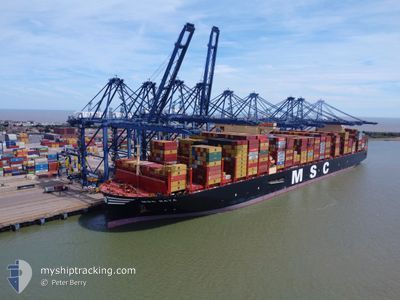
MSC RAYA
Cargo
Current Trip
| Time Travelled | 19 days |
|---|---|
| Remaining Time | --- |
| Distance Travelled | 8576.77 nm |
| Remaining Distance | --- |
| AVG Speed | 18.1 Knots |
| MAX Speed | 22.1 Knots |
| AVG Wind | 11.2 knots |
| MAX Wind | 24.7 knots |
| MIN Temp | 19.2°C / 66.56°F |
| MAX Temp | 29.6°C / 85.28°F |
| Dybgang | 16.2 m |
| Position Modtaget | 5 d siden |
Current Position
| Longitude | --- |
|---|---|
| Latitude | --- |
| Status | Under way using engine |
| Fart | 19 Knots |
| Kurs | 324.4° |
| Område | South Atlantic Ocean |
| Station | T-AIS |
| Position Modtaget | 5 d siden |
Info
Information
The current position of MSC RAYA is in South Atlantic Ocean with coordinates -30.34833° / 14.33259° as reported on 2026-01-03 15:31 by AIS to our vessel tracker app. The vessel's current speed is 19 Knots and is heading at the port of ASHDOD. The estimated time of arrival as calculated by MyShipTracking vessel tracking app is 2026-01-19 04:00 LT
The vessel MSC RAYA (IMO: 9930052, MMSI: 636022103) is a Cargo It's sailing under the flag of [LR] Liberia.
In this page you can find informations about the vessels current position, last detected port calls, and current voyage information. If the vessels is not in coverage by AIS you will find the latest position.
The current position of MSC RAYA is detected by our AIS receivers and we are not responsible for the reliability of the data. The last position was recorded while the vessel was in Coverage by the Ais receivers of our vessel tracking app.
The current draught of MSC RAYA as reported by AIS is 16.2 meters
Weather
| Temperature | 26.7°C / 80.06°F |
|---|---|
| Wind Speed | 6 knots |
| Direction | 130° SE |
| Pressure | 1013.8 hPa |
| Humidity | 78.5 % |
| Cloud Coverage | 60 % |
Featured Company
Last Port Calls
Last Trips
| Origin | Departure | Destination | Arrival | Distance | |
|---|---|---|---|---|---|
| 2025-12-19 16:25 | 2025-12-19 20:42 | 8.18 nm | |||
| 2025-12-02 10:13 | 2025-12-19 15:31 | 3499.63 nm | |||
| 2025-11-28 17:48 | 2025-11-30 20:09 | 758.33 nm | |||
| 2025-11-16 19:24 | 2025-11-26 11:41 | 3056.00 nm | |||
| 2025-10-16 20:27 | 2025-11-14 02:08 | 11778.76 nm |
Events
| Tid | Hændelsen | Detaljer | Position / Dest | Info |
|---|---|---|---|---|
| 2026-01-03 15:32 | Status er ændret | Default Under way using engine |
-30.34409 / 14.32897
SGSIN > ILASH
|
Fart: 19 kn Kurs: 324.4° |
| 2026-01-03 15:31 | Udenfor Dækning |
-30.34833 / 14.33259
South Atlantic Ocean
SGSIN > ILASH
|
Fart: 19 kn Kurs: 324.4° |
|
| 2026-01-03 15:24 | Status er ændret | Under way using engine Default |
-30.37677 / 14.35685
SGSIN > ILASH
|
Fart: 19.1 kn Kurs: 322° |
| 2026-01-03 15:20 | Indenfor Dækning |
-30.37419 / 14.35471
South Atlantic Ocean
SGSIN > ILASH
|
Fart: 19 kn Kurs: 323.8° |
|
| 2026-01-03 00:51 | Status er ændret | Default Under way using engine |
-33.88968 / 17.80989
SGSIN > ILASH
|
Fart: 18.4 kn Kurs: 324.4° |
| 2026-01-03 00:44 | Udenfor Dækning |
-33.92127 / 17.83794
South Atlantic Ocean
SGSIN > ILASH
|
Fart: 18.4 kn Kurs: 324.4° |
|
| 2026-01-02 23:20 | Status er ændret | Under way using engine Default |
-34.26782 / 18.15300
SGSIN > ILASH
|
Fart: 19.3 kn Kurs: 321° |
| 2026-01-02 23:12 | Status er ændret | Default Under way using engine |
-34.30456 / 18.18966
SGSIN > ILASH
|
Fart: 19.6 kn Kurs: 320.4° |
| 2026-01-02 23:10 | Status er ændret | Under way using engine Default |
-34.31296 / 18.19804
SGSIN > ILASH
|
Fart: 19.6 kn Kurs: 320° |
| 2026-01-02 23:04 | Status er ændret | Default Under way using engine |
-34.33831 / 18.22321
SGSIN > ILASH
|
Fart: 19.6 kn Kurs: 320.5° |