
MSC NISHA V
Container Ship
Current Trip
| Time Travelled | 1 day |
|---|---|
| Remaining Time | --- |
| Distance Travelled | 454.94 nm |
| Remaining Distance | --- |
| AVG Speed | 15.1 Knots |
| MAX Speed | 15.1 Knots |
| AVG Wind | 8.6 knots |
| MAX Wind | 14.6 knots |
| MIN Temp | 15.9°C / 60.62°F |
| MAX Temp | 18.9°C / 66.02°F |
| Dybgang | 9.9 m |
| Position Modtaget | 10 m siden |
Current Position
| Longitude | 16.59612° |
|---|---|
| Latitude | 37.61837° |
| Status | Under way using engine |
| Fart | 16.3 Knots |
| Kurs | 287.8° |
| Område | Ionian Sea |
| Station | T-AIS |
| Position Modtaget | 10 m siden |
Info
Information
The current position of MSC NISHA V is in Ionian Sea with coordinates 37.61837° / 16.59612° as reported on 2024-05-03 04:07 by AIS to our vessel tracker app. The vessel's current speed is 16.3 Knots
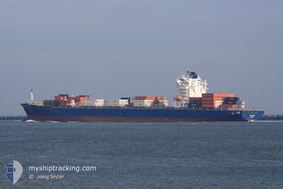
The vessel MSC NISHA V (IMO: 9326768, MMSI: 636021913) is a Container Ship that was built in 2006 ( 18 år gamle ). It's sailing under the flag of [LR] Liberia.
In this page you can find informations about the vessels current position, last detected port calls, and current voyage information. If the vessels is not in coverage by AIS you will find the latest position.
The current position of MSC NISHA V is detected by our AIS receivers and we are not responsible for the reliability of the data. The last position was recorded while the vessel was in Coverage by the Ais receivers of our vessel tracking app.
The current draught of MSC NISHA V as reported by AIS is 9.9 meters
Weather
| Temperature | 17.3°C / 63.14°F |
|---|---|
| Wind Speed | 14 knots |
| Direction | 308° NW |
| Pressure | 1015.5 hPa |
| Humidity | 58.9 % |
| Cloud Coverage | 7 % |
Featured Company
Last Port Calls
| Port | Arrival | Departure | Time In Port |
|---|---|---|---|
| 2024-04-30 14:13 | 2024-05-01 23:12 | 1 d | |
| 2024-04-28 01:32 | 2024-04-29 04:11 | 1 d | |
| 2024-04-25 14:50 | 2024-04-27 04:27 | 1 d | |
| 2024-04-23 12:42 | 2024-04-23 22:49 | 10 h | |
| 2024-04-14 13:00 | 2024-04-15 04:58 | 15 h | |
| 2024-04-12 17:29 | 2024-04-14 03:42 | 1 d | |
| 2024-04-07 06:43 | 2024-04-10 11:43 | 3 d | |
| 2024-03-20 13:28 | 2024-03-21 06:21 | 16 h |
Last Trips
| Origin | Departure | Destination | Arrival | Distance | |
|---|---|---|---|---|---|
| 2024-04-29 07:11 | 2024-04-30 17:13 | 232.50 nm | |||
| 2024-04-27 07:27 | 2024-04-28 04:32 | 250.99 nm | |||
| 2024-04-24 01:49 | 2024-04-25 17:50 | 293.28 nm | |||
| 2024-04-15 06:58 | 2024-04-23 15:42 | 2959.09 nm | |||
| 2024-04-14 05:42 | 2024-04-14 15:00 | 119.50 nm | |||
| 2024-04-10 13:43 | 2024-04-12 19:29 | 808.52 nm | |||
| 2024-03-21 00:21 | 2024-04-07 08:43 | 5604.59 nm | |||
| 2024-02-28 17:30 | 2024-03-20 07:28 | 6403.15 nm |
Events
| Tid | Hændelsen | Detaljer | Position / Dest | Info |
|---|---|---|---|---|
| 2024-05-03 04:07 | Ændre havområde | Italian part of the Ionian Sea Greek part of the Ionian Sea |
37.61837 / 16.59612
Ionian Sea
|
Fart: 16.3 kn Kurs: 287.8° |
| 2024-05-03 04:07 | Status er ændret | Under way using engine Default |
37.61837 / 16.59612
GR PIR
|
Fart: 15 kn Kurs: 288° |
| 2024-05-03 04:07 | Indenfor Dækning |
37.61837 / 16.59612
Ionian Sea
|
Fart: 16.3 kn Kurs: 287.8° |
|
| 2024-05-02 22:44 | Status er ændret | Default Under way using engine |
37.16500 / 18.34667
GR PIR
|
Fart: 16 kn Kurs: 287.5° |
| 2024-05-02 22:37 | Udenfor Dækning |
37.15803 / 18.38040
Ionian Sea
|
Fart: 16 kn Kurs: 287.5° |
|
| 2024-05-02 21:56 | Status er ændret | Under way using engine Default |
37.09922 / 18.60761
GR PIR
|
Fart: 16 kn Kurs: 287° |
| 2024-05-02 21:38 | Indenfor Dækning |
37.09922 / 18.60761
Ionian Sea
|
Fart: 16.8 kn Kurs: 287.7° |
|
| 2024-05-02 20:32 | Status er ændret | Default Under way using engine |
36.98000 / 19.06833
GR PIR
|
Fart: 57.6 kn Kurs: 287.6° |
| 2024-05-02 20:31 | Status er ændret | Under way using engine Default |
36.97967 / 19.07071
GR PIR
|
Fart: 16.1 kn Kurs: 288° |
| 2024-05-02 20:31 | Udenfor Dækning |
36.97967 / 19.07071
Ionian Sea
|
Fart: 57.6 kn Kurs: 287.6° |