
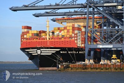
MSC NICOLA MASTRO
Cargo D
Current Trip
| Time Travelled | 21 days |
|---|---|
| Remaining Time | 1 day |
| Distance Travelled | 10119.62 nm |
| Remaining Distance | 707.05 nm |
| AVG Speed | 19.1 Knots |
| MAX Speed | 21.8 Knots |
| AVG Wind | 12.8 knots |
| MAX Wind | 24.5 knots |
| MIN Temp | 17.5°C / 63.5°F |
| MAX Temp | 30.4°C / 86.72°F |
| Dybgang | 16.4 m |
| Position Modtaget | 9 d siden |
Current Position
| Longitude | --- |
|---|---|
| Latitude | --- |
| Status | Under way using engine |
| Fart | 19.8 Knots |
| Kurs | 324.6° |
| Område | South Atlantic Ocean |
| Station | T-AIS |
| Position Modtaget | 9 d siden |
Info
Information
The current position of MSC NICOLA MASTRO is in South Atlantic Ocean with coordinates -31.39376° / 15.12123° as reported on 2025-02-07 18:05 by AIS to our vessel tracker app. The vessel's current speed is 19.8 Knots and is heading at the port of SINES. The estimated time of arrival as calculated by MyShipTracking vessel tracking app is 2025-02-18 11:14 LT
The vessel MSC NICOLA MASTRO (IMO: 9930064, MMSI: 636022605) is a Cargo D It's sailing under the flag of [LR] Liberia.
In this page you can find informations about the vessels current position, last detected port calls, and current voyage information. If the vessels is not in coverage by AIS you will find the latest position.
The current position of MSC NICOLA MASTRO is detected by our AIS receivers and we are not responsible for the reliability of the data. The last position was recorded while the vessel was in Coverage by the Ais receivers of our vessel tracking app.
The current draught of MSC NICOLA MASTRO as reported by AIS is 16.4 meters
Weather
| Temperature | 17.5°C / 63.5°F |
|---|---|
| Wind Speed | 16 knots |
| Direction | 39° NE |
| Pressure | 1018.6 hPa |
| Humidity | 64.3 % |
| Cloud Coverage | --- |
Featured Company
Last Port Calls
| Port | Arrival | Departure | Time In Port |
|---|---|---|---|
| 2025-01-24 18:45 | 2025-01-26 05:16 | 1 d | |
| 2025-01-16 12:33 | 2025-01-17 23:17 | 1 d | |
| 2025-01-01 14:13 | 2025-01-02 20:09 | 1 d | |
| 2024-12-28 02:37 | 2024-12-30 15:02 | 2 d |
Last Trips
| Origin | Departure | Destination | Arrival | Distance | |
|---|---|---|---|---|---|
| 2025-01-17 23:17 | 2025-01-24 18:45 | 1604.25 nm | |||
| 2025-01-02 20:09 | 2025-01-16 12:33 | 3351.90 nm | |||
| 2024-12-30 15:02 | 2025-01-01 14:13 | 842.40 nm | |||
| 2024-11-29 18:34 | 2024-12-28 02:37 | 11054.24 nm |
Events
| Tid | Hændelsen | Detaljer | Position / Dest | Info |
|---|---|---|---|---|
| 2025-02-07 18:09 | Status er ændret | Default Under way using engine |
-31.37437 / 15.10539
PTSIE
|
Fart: 19.8 kn Kurs: 324.6° |
| 2025-02-07 18:05 | Status er ændret | Under way using engine Default |
-31.39376 / 15.12123
PTSIE
|
Fart: 19.9 kn Kurs: 324° |
| 2025-02-07 18:05 | Udenfor Dækning |
-31.39376 / 15.12123
South Atlantic Ocean
PTSIE
|
Fart: 19.8 kn Kurs: 324.6° |
|
| 2025-02-07 17:52 | Status er ændret | Default Under way using engine |
-31.45055 / 15.16910
PTSIE
|
Fart: 19.9 kn Kurs: 319.9° |
| 2025-02-07 16:23 | Status er ændret | Under way using engine Default |
-31.83505 / 15.53197
PTSIE
|
Fart: 19.8 kn Kurs: 323° |
| 2025-02-07 16:04 | Status er ændret | Default Under way using engine |
-31.91628 / 15.60392
PTSIE
|
Fart: 20 kn Kurs: 322.3° |
| 2025-02-07 15:22 | Status er ændret | Under way using engine Default |
-32.10620 / 15.77321
PTSIE
|
Fart: 20.3 kn Kurs: 323° |
| 2025-02-07 14:28 | Status er ændret | Default Under way using engine |
-32.34736 / 15.98638
PTSIE
|
Fart: 20.8 kn Kurs: 321.9° |
| 2025-02-07 14:02 | Status er ændret | Under way using engine Default |
-32.46752 / 16.09580
PTSIE
|
Fart: 20.6 kn Kurs: 323° |
| 2025-02-07 13:56 | Status er ændret | Default Under way using engine |
-32.49239 / 16.11849
PTSIE
|
Fart: 20.7 kn Kurs: 321.8° |