
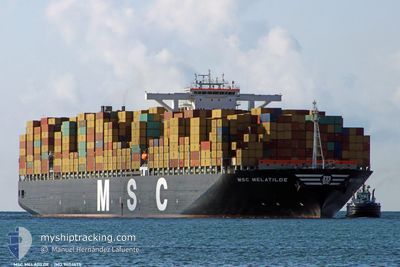
MSC MELATILDE
Container Ship
Current Trip
SGSIN
| Time Travelled | 6 days |
|---|---|
| Remaining Time | --- |
| Distance Travelled | 2614.84 nm |
| Remaining Distance | --- |
| AVG Speed | 15.7 Knots |
| MAX Speed | 16.6 Knots |
| AVG Wind | 7.7 knots |
| MAX Wind | 22 knots |
| MIN Temp | 18.4°C / 65.12°F |
| MAX Temp | 28.9°C / 84.02°F |
| Dybgang | 11.1 m |
| Position Modtaget | 1 d siden |
Current Position
| Longitude | --- |
|---|---|
| Latitude | --- |
| Status | Under way using engine |
| Fart | 14.9 Knots |
| Kurs | 119.1° |
| Område | South Atlantic Ocean |
| Station | T-AIS |
| Position Modtaget | 1 d siden |
Info
Information
The current position of MSC MELATILDE is in South Atlantic Ocean with coordinates -34.67086° / 18.72079° as reported on 2025-03-16 07:53 by AIS to our vessel tracker app. The vessel's current speed is 14.9 Knots
The vessel MSC MELATILDE (IMO: 9404675, MMSI: 357240000) is a Container Ship that was built in 2010 ( 15 år gamle ). It's sailing under the flag of [PA] Panama.
In this page you can find informations about the vessels current position, last detected port calls, and current voyage information. If the vessels is not in coverage by AIS you will find the latest position.
The current position of MSC MELATILDE is detected by our AIS receivers and we are not responsible for the reliability of the data. The last position was recorded while the vessel was in Coverage by the Ais receivers of our vessel tracking app.
The current draught of MSC MELATILDE as reported by AIS is 11.1 meters
Weather
| Temperature | 21.9°C / 71.42°F |
|---|---|
| Wind Speed | 13 knots |
| Direction | 311° NW |
| Pressure | 1018.7 hPa |
| Humidity | 93.5 % |
| Cloud Coverage | 100 % |
Featured Company
Last Port Calls
| Port | Arrival | Departure | Time In Port |
|---|---|---|---|
| 2025-03-09 16:40 | 2025-03-11 07:36 | 1 d | |
| 2025-03-04 01:45 | 2025-03-06 19:13 | 2 d | |
| 2025-02-25 18:23 | 2025-02-27 01:31 | 1 d | |
| 2025-01-22 13:52 | 2025-01-23 18:53 | 1 d | |
| 2025-01-16 04:09 | 2025-01-17 01:53 | 21 h | |
| 2025-01-06 04:50 | 2025-01-06 17:48 | 12 h | |
| 2025-01-04 07:53 | 2025-01-05 02:45 | 18 h | |
| 2025-01-01 21:30 |
Last Trips
| Origin | Departure | Destination | Arrival | Distance | |
|---|---|---|---|---|---|
| 2025-03-06 19:13 | 2025-03-09 16:40 | 1020.00 nm | |||
| 2025-02-27 01:31 | 2025-03-04 01:45 | 437.35 nm | |||
| 2025-01-23 18:53 | 2025-02-25 18:23 | 8752.32 nm | |||
| 2025-01-17 01:53 | 2025-01-22 13:52 | 1579.38 nm | |||
| 2025-01-06 17:48 | 2025-01-16 04:09 | 1790.86 nm | |||
| 2025-01-05 02:45 | 2025-01-06 04:50 | 163.14 nm | |||
| 2025-01-01 21:30 | 2025-01-04 07:53 | 736.63 nm |
Events
| Tid | Hændelsen | Detaljer | Position / Dest | Info |
|---|---|---|---|---|
| 2025-03-16 08:00 | Status er ændret | Default Under way using engine |
-34.68391 / 18.74960
SGSIN
|
Fart: 14.9 kn Kurs: 119.1° |
| 2025-03-16 07:53 | Status er ændret | Under way using engine Default |
-34.67086 / 18.72079
SGSIN
|
Fart: 14.9 kn Kurs: 119° |
| 2025-03-16 07:53 | Udenfor Dækning |
-34.67086 / 18.72079
South Atlantic Ocean
SGSIN
|
Fart: 14.9 kn Kurs: 119.1° |
|
| 2025-03-16 07:28 | Status er ændret | Default Under way using engine |
-34.62111 / 18.60924
SGSIN
|
Fart: 15.4 kn Kurs: 130.4° |
| 2025-03-16 07:14 | Status er ændret | Under way using engine Default |
-34.58070 / 18.55213
SGSIN
|
Fart: 15.7 kn Kurs: 131° |
| 2025-03-16 07:02 | Status er ændret | Default Under way using engine |
-34.54618 / 18.50428
SGSIN
|
Fart: 15.9 kn Kurs: 131° |
| 2025-03-16 06:05 | Status er ændret | Under way using engine Default |
-34.37754 / 18.27393
SGSIN
|
Fart: 16.2 kn Kurs: 124° |
| 2025-03-16 05:47 | Status er ændret | Default Under way using engine |
-34.33134 / 18.19819
SGSIN
|
Fart: 16.2 kn Kurs: 129.3° |
| 2025-03-16 04:01 | Dybgangen er ændret | 11.1 16.3 |
-33.94068 / 17.88783
SGSIN
|
Fart: 15.8 kn Kurs: 150.4° |
| 2025-03-16 04:01 | ETA er ændret | 2025/03/31 18:00 2025/01/23 12:00 |
-33.94068 / 17.88783
SGSIN
|
Fart: 15.8 kn Kurs: 150.4° |