
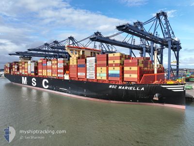
MSC MARIELLA
Cargo
Current Trip
| Time Travelled | 13 days |
|---|---|
| Remaining Time | --- |
| Distance Travelled | 5758.27 nm |
| Remaining Distance | --- |
| AVG Speed | 18.2 Knots |
| MAX Speed | 20.6 Knots |
| AVG Wind | 15.6 knots |
| MAX Wind | 34.8 knots |
| MIN Temp | 14.8°C / 58.64°F |
| MAX Temp | 30.9°C / 87.62°F |
| Dybgang | 16.4 m |
| Position Modtaget | 11 h, 10 m siden |
Current Position
| Longitude | 17.79853° |
|---|---|
| Latitude | -34.28961° |
| Status | Under way using engine |
| Fart | 19 Knots |
| Kurs | 321.4° |
| Område | South Atlantic Ocean |
| Station | T-AIS |
| Position Modtaget | 11 h, 10 m siden |
Info
Information
The current position of MSC MARIELLA is in South Atlantic Ocean with coordinates -34.28961° / 17.79853° as reported on 2024-06-06 05:05 by AIS to our vessel tracker app. The vessel's current speed is 19 Knots and is heading at the port of SINES. The estimated time of arrival as calculated by MyShipTracking vessel tracking app is 2024-06-18 01:00 LT
The vessel MSC MARIELLA (IMO: 9934747, MMSI: 636022920) is a Cargo It's sailing under the flag of [LR] Liberia.
In this page you can find informations about the vessels current position, last detected port calls, and current voyage information. If the vessels is not in coverage by AIS you will find the latest position.
The current position of MSC MARIELLA is detected by our AIS receivers and we are not responsible for the reliability of the data. The last position was recorded while the vessel was in Coverage by the Ais receivers of our vessel tracking app.
The current draught of MSC MARIELLA as reported by AIS is 16.4 meters
Weather
| Temperature | 16.7°C / 62.06°F |
|---|---|
| Wind Speed | 17 knots |
| Direction | 223° SW |
| Pressure | 1019.1 hPa |
| Humidity | 67 % |
| Cloud Coverage | 90 % |
Featured Company
Last Port Calls
| Port | Arrival | Departure | Time In Port |
|---|---|---|---|
| 2024-05-22 20:24 | 2024-05-24 11:56 | 1 d | |
| 2024-05-16 02:06 | 2024-05-17 03:31 | 1 d | |
| 2024-05-13 21:47 | 2024-05-14 00:44 | 2 h | |
| 2024-05-13 20:56 | 2024-05-13 21:30 | 34 m | |
| 2024-05-13 19:44 | 2024-05-13 20:51 | 1 h | |
| 2024-05-13 19:32 | 2024-05-13 19:40 | 7 m | |
| 2024-05-13 18:47 | 2024-05-13 19:27 | 40 m | |
| 2024-05-13 18:32 | 2024-05-13 18:39 | 7 m | |
| 2024-05-13 17:11 | 2024-05-13 18:18 | 1 h | |
| 2024-05-13 16:23 | 2024-05-13 17:03 | 40 m |
Most Visited Ports (Last year)
| Port | Arrivals | |
|---|---|---|
| 59 | ||
| 5 | ||
| 3 | ||
| 3 | ||
| 3 | ||
| 3 |
Last Trips
| Origin | Departure | Destination | Arrival | Distance | |
|---|---|---|---|---|---|
| 2024-05-17 11:31 | 2024-05-23 04:24 | 1557.41 nm | |||
| 2024-05-14 08:44 | 2024-05-16 10:06 | 815.68 nm | |||
| 2024-05-14 05:30 | 2024-05-14 05:47 | 0.11 nm | |||
| 2024-05-14 04:51 | 2024-05-14 04:56 | 0.11 nm | |||
| 2024-05-14 03:40 | 2024-05-14 03:44 | 0.11 nm | |||
| 2024-05-14 03:27 | 2024-05-14 03:32 | 0.11 nm | |||
| 2024-05-14 02:39 | 2024-05-14 02:47 | 0.11 nm | |||
| 2024-05-14 02:18 | 2024-05-14 02:32 | 0.11 nm | |||
| 2024-05-14 01:03 | 2024-05-14 01:11 | 0.11 nm | |||
| 2024-05-14 00:15 | 2024-05-14 00:23 | 0.11 nm |
Events
| Tid | Hændelsen | Detaljer | Position / Dest | Info |
|---|---|---|---|---|
| 2024-06-06 05:44 | Status er ændret | Default Under way using engine |
-34.12910 / 17.64438
SINES
|
Fart: 19 kn Kurs: 321.4° |
| 2024-06-06 05:05 | Udenfor Dækning |
-34.28961 / 17.79853
South Atlantic Ocean
SINES
|
Fart: 19 kn Kurs: 321.4° |
|
| 2024-06-06 05:04 | Status er ændret | Under way using engine Default |
-34.29038 / 17.79926
SINES
|
Fart: 19.2 kn Kurs: 321° |
| 2024-06-06 04:47 | Status er ændret | Default Under way using engine |
-34.36550 / 17.86868
SINES
|
Fart: 19.4 kn Kurs: 322° |
| 2024-06-06 02:40 | Status er ændret | Under way using engine Default |
-34.75142 / 18.54383
SINES
|
Fart: 19.1 kn Kurs: 294° |
| 2024-06-06 02:38 | Indenfor Dækning |
-34.75049 / 18.54150
South Atlantic Ocean
SINES
|
Fart: 19.3 kn Kurs: 295.3° |
|
| 2024-06-06 01:33 | Udenfor Dækning |
-34.84783 / 18.95125
South Atlantic Ocean
SINES
|
Fart: 18.1 kn Kurs: 283.9° |
|
| 2024-06-06 00:35 | Fundet i havområde | South African part of the South Atlantic Ocean |
-34.91710 / 19.30059
South Atlantic Ocean
SINES
|
Fart: 18 kn Kurs: 283.9° |
| 2024-06-06 00:35 | Status er ændret | Under way using engine Default |
-34.91710 / 19.30059
SINES
|
Fart: 17 kn Kurs: 284° |
| 2024-06-06 00:35 | Indenfor Dækning |
-34.91710 / 19.30059
South Atlantic Ocean
SINES
|
Fart: 18 kn Kurs: 283.9° |