

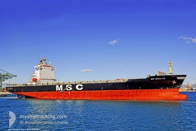
MSC MARIA PIA
Container Ship
Current Trip
| Time Travelled | 15 h, 4 mins |
|---|---|
| Remaining Time | --- |
| Distance Travelled | 77.13 nm |
| Remaining Distance | 65.93 nm |
| AVG Speed | 10.6 Knots |
| MAX Speed | 16.6 Knots |
| AVG Wind | 11.4 knots |
| MAX Wind | 14.9 knots |
| MIN Temp | 8.5°C / 47.3°F |
| MAX Temp | 14.9°C / 58.82°F |
| Dybgang | 9 m |
| Position Modtaget | 1 m siden |
Current Position
| Longitude | --- |
|---|---|
| Latitude | --- |
| Status | Moored |
| Fart | |
| Kurs | 195° |
| Område | Baltic Sea |
| Station | T-AIS |
| Position Modtaget | 1 m siden |
Information
The current position of MSC MARIA PIA is in Baltic Sea with coordinates 58.93600° / 17.98035° as reported on 2025-06-03 11:33 by AIS to our vessel tracker app. The vessel's current speed is 0 Knots and is heading at the port of STOCKHOLM. The estimated time of arrival as calculated by MyShipTracking vessel tracking app is 2025-06-03 02:00 LT
The vessel MSC MARIA PIA (MMSI: 354711000) is a Container Ship that was built in 1997 ( 28 år gamle ). It's sailing under the flag of [PA] Panama.
In this page you can find informations about the vessels current position, last detected port calls, and current voyage information. If the vessels is not in coverage by AIS you will find the latest position.
The current position of MSC MARIA PIA is detected by our AIS receivers and we are not responsible for the reliability of the data. The last position was recorded while the vessel was in Coverage by the Ais receivers of our vessel tracking app.
The current draught of MSC MARIA PIA as reported by AIS is 9 meters
Weather
| Temperature | 15.1°C / 59.18°F |
|---|---|
| Wind Speed | 13 knots |
| Direction | 202° SSW |
| Pressure | 1009.3 hPa |
| Humidity | 56.8 % |
| Cloud Coverage | 8 % |
Featured Company
Last Port Calls
| Port | Arrival | Departure | Time In Port |
|---|---|---|---|
| 2025-05-30 04:07 | 2025-06-02 20:31 | 3 d | |
| 2025-05-27 12:32 | 2025-05-28 05:42 | 17 h | |
| 2025-05-23 15:22 | 2025-05-25 10:43 | 1 d | |
| 2025-05-20 06:46 | 2025-05-21 02:39 | 19 h | |
| 2025-05-17 12:46 | 2025-05-18 03:05 | 14 h | |
| 2025-05-15 17:44 | 2025-05-16 19:15 | 1 d | |
| 2025-05-14 06:58 | 2025-05-14 23:10 | 16 h | |
| 2025-05-09 12:01 | 2025-05-10 02:21 | 14 h | |
| 2025-05-08 02:31 | 2025-05-08 12:19 | 9 h | |
| 2025-05-06 14:23 | 2025-05-07 22:27 | 1 d |
Most Visited Ports (Last year)
| Port | Arrivals | |
|---|---|---|
| 24 | ||
| 23 | ||
| 23 | ||
| 17 | ||
| 4 | ||
| 4 |
Last Trips
| Origin | Departure | Destination | Arrival | Distance | |
|---|---|---|---|---|---|
| 2025-05-28 07:42 | 2025-05-30 06:07 | 543.89 nm | |||
| 2025-05-25 12:43 | 2025-05-27 14:32 | 733.86 nm | |||
| 2025-05-21 04:39 | 2025-05-23 17:22 | 674.05 nm | |||
| 2025-05-18 06:05 | 2025-05-20 08:46 | 686.70 nm | |||
| 2025-05-16 21:15 | 2025-05-17 15:46 | 268.89 nm | |||
| 2025-05-15 01:10 | 2025-05-15 19:44 | 282.92 nm | |||
| 2025-05-10 03:21 | 2025-05-14 08:58 | 1323.44 nm | |||
| 2025-05-08 14:19 | 2025-05-09 13:01 | 282.61 nm | |||
| 2025-05-08 00:27 | 2025-05-08 04:31 | 53.58 nm | |||
| 2025-05-03 07:00 | 2025-05-06 16:23 | 1141.84 nm |
Events
| Tid | Hændelsen | Detaljer | Position / Dest | Info |
|---|---|---|---|---|
| 2025-06-03 11:33 | Dybgangen er ændret | 9 9.5 |
58.93598 / 17.98038
SESTO
|
Fart: Kurs: 195° |
| 2025-06-03 11:03 | Dybgangen er ændret | 9.5 9 |
58.93598 / 17.98031
SESTO
|
Fart: Kurs: 195° |
| 2025-06-03 11:03 | ETA er ændret | 2025/06/03 02:00 |
58.93598 / 17.98031
SESTO
|
Fart: Kurs: 195° |
| 2025-06-03 10:51 | Dybgangen er ændret | 9 9.5 |
58.93597 / 17.98040
SESTO
|
Fart: Kurs: 196° |
| 2025-06-03 10:33 | Dybgangen er ændret | 9.5 9 |
58.93582 / 17.98024
SESTO
|
Fart: Kurs: 196° |
| 2025-06-03 10:33 | ETA er ændret | 2025/06/03 02:00 |
58.93582 / 17.98024
SESTO
|
Fart: Kurs: 196° |
| 2025-06-03 10:15 | Dybgangen er ændret | 9 9.5 |
58.93604 / 17.98036
SESTO
|
Fart: Kurs: 196° |
| 2025-06-03 08:57 | Dybgangen er ændret | 9.5 9 |
58.93606 / 17.98035
SESTO
|
Fart: Kurs: 195° |
| 2025-06-03 08:57 | ETA er ændret | 2025/06/03 02:00 |
58.93606 / 17.98035
SESTO
|
Fart: Kurs: 195° |
| 2025-06-03 08:51 | Dybgangen er ændret | 9 9.5 |
58.93599 / 17.98032
SESTO
|
Fart: Kurs: 195° |