
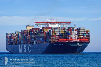
MSC JADE
Cargo A
Current Trip
CIABJ
| Time Travelled | 5 days |
|---|---|
| Remaining Time | --- |
| Distance Travelled | 427.22 nm |
| Remaining Distance | --- |
| AVG Speed | 12.9 Knots |
| MAX Speed | 15 Knots |
| AVG Wind | 10 knots |
| MAX Wind | 18 knots |
| MIN Temp | 26.3°C / 79.34°F |
| MAX Temp | 27.9°C / 82.22°F |
| Dybgang | 15.3 m |
| Position Modtaget | 10 d siden |
Current Position
| Longitude | --- |
|---|---|
| Latitude | --- |
| Status | Under way using engine |
| Fart | 13.5 Knots |
| Kurs | 147° |
| Område | North Atlantic Ocean |
| Station | T-AIS |
| Position Modtaget | 10 d siden |
Info
Information
The current position of MSC JADE is in North Atlantic Ocean with coordinates 10.18742° / -17.00992° as reported on 2025-12-25 08:44 by AIS to our vessel tracker app. The vessel's current speed is 13.5 Knots
The vessel MSC JADE (IMO: 9762326, MMSI: 636017506) is a Cargo A It's sailing under the flag of [LR] Liberia.
In this page you can find informations about the vessels current position, last detected port calls, and current voyage information. If the vessels is not in coverage by AIS you will find the latest position.
The current position of MSC JADE is detected by our AIS receivers and we are not responsible for the reliability of the data. The last position was recorded while the vessel was in Coverage by the Ais receivers of our vessel tracking app.
The current draught of MSC JADE as reported by AIS is 15.3 meters
Weather
| Temperature | 27.1°C / 80.78°F |
|---|---|
| Wind Speed | 10 knots |
| Direction | 234° SW |
| Pressure | 1009.7 hPa |
| Humidity | 83.4 % |
| Cloud Coverage | --- |
Featured Company
Last Port Calls
| Port | Arrival | Departure | Time In Port |
|---|---|---|---|
| 2025-12-28 15:30 | 2025-12-30 06:39 | 1 d | |
| 2025-12-15 10:16 | 2025-12-17 00:33 | 1 d | |
| 2025-12-13 01:51 | 2025-12-14 10:41 | 1 d | |
| 2025-12-07 23:16 | 2025-12-10 04:01 | 2 d | |
| 2025-12-06 07:26 | 2025-12-07 11:45 | 1 d | |
| 2025-12-04 23:00 | 2025-12-06 01:03 | 1 d | |
| 2025-12-01 05:11 | 2025-12-02 09:24 | 1 d | |
| 2025-11-30 09:15 | 2025-12-01 05:00 | 19 h | |
| 2025-11-26 11:10 | 2025-11-28 12:02 | 2 d |
Last Trips
| Origin | Departure | Destination | Arrival | Distance | |
|---|---|---|---|---|---|
| 2025-12-17 00:33 | 2025-12-28 15:30 | 4621.07 nm | |||
| 2025-12-14 10:41 | 2025-12-15 10:16 | 372.56 nm | |||
| 2025-12-10 04:01 | 2025-12-13 01:51 | 769.38 nm | |||
| 2025-12-07 11:45 | 2025-12-07 23:16 | 63.48 nm | |||
| 2025-12-06 01:03 | 2025-12-06 07:26 | 61.60 nm | |||
| 2025-12-02 09:24 | 2025-12-04 23:00 | 895.48 nm | |||
| 2025-12-01 05:00 | 2025-12-01 05:11 | 1.21 nm | |||
| 2025-11-28 12:02 | 2025-11-30 09:15 | 135.88 nm | |||
| 2025-10-24 23:48 | 2025-11-26 11:10 | 12798.92 nm |
Events
| Tid | Hændelsen | Detaljer | Position / Dest | Info |
|---|---|---|---|---|
| 2025-12-31 15:25 | STOP Sejllads | 6.68 nm, South of LOME |
6.03179 / 1.32382
CIABJ
|
Fart: 0.3 kn Kurs: 123° |
| 2025-12-31 14:28 | START Sejllads | 3.07 nm, South East of LOME |
6.11618 / 1.33365
CIABJ
|
Fart: 4.8 kn Kurs: 215° |
| 2025-12-31 11:53 | STOP Sejllads | 2.14 nm, South East of LOME |
6.12341 / 1.31990
CIABJ
|
Fart: 0.3 kn Kurs: 284° |
| 2025-12-30 06:39 | Afsejlet fra sidste havn |
|
5.24587 / -3.99827
CIABJ
|
Fart: 6.7 kn Kurs: 127° |
| 2025-12-30 06:19 | START Sejllads |
5.26920 / -4.02259
[CI] ABIDJAN
|
Fart: 3.8 kn Kurs: 180° |
|
| 2025-12-28 16:33 | STOP Sejllads |
5.28013 / -4.01818
[CI] ABIDJAN
|
Fart: Kurs: 68° |
|
| 2025-12-28 15:30 | Skibe i havn |
|
5.25307 / -4.00747
[CI] ABIDJAN
|
Fart: 7.2 kn Kurs: 311° |