

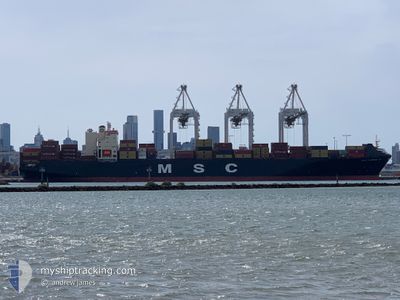
MSC FLORIANA VI
Container Ship

Current Trip
| Trip Time | 4 days |
|---|---|
| Trip Distance | 2046.49 nm |
| AVG Speed | 16.2 Knots |
| MAX Speed | 19.7 Knots |
| Dybgang | 12.6 m |
| AVG Wind | 8.3 knots |
| MAX Wind | 18.8 knots |
| MIN Temp | 20.9°C / 69.62°F |
| MAX Temp | 28°C / 82.4°F |
| Position Modtaget | 2 m siden |
Current Position
| Longitude | --- |
|---|---|
| Latitude | --- |
| Status | Moored |
| Fart | 0.1 Knots |
| Kurs | 232° |
| Område | Persian Gulf |
| Station | T-AIS |
| Position Modtaget | 2 m siden |
Information
The current position of MSC FLORIANA VI is in Persian Gulf with coordinates 24.80634° / 54.64908° as reported on 2025-02-15 23:56 by AIS to our vessel tracker app. The vessel's current speed is 0.1 Knots and is currently inside the port of KHALIFA.
The vessel MSC FLORIANA VI (IMO: 9168831, MMSI: 636022985) is a Container Ship that was built in 1999 ( 26 år gamle ). It's sailing under the flag of [LR] Liberia.
In this page you can find informations about the vessels current position, last detected port calls, and current voyage information. If the vessels is not in coverage by AIS you will find the latest position.
The current position of MSC FLORIANA VI is detected by our AIS receivers and we are not responsible for the reliability of the data. The last position was recorded while the vessel was in Coverage by the Ais receivers of our vessel tracking app.
The current draught of MSC FLORIANA VI as reported by AIS is 12.6 meters
Weather
| Temperature | 20.4°C / 68.72°F |
|---|---|
| Wind Speed | 6 knots |
| Direction | 326° NW |
| Pressure | 1015 hPa |
| Humidity | 81.3 % |
| Cloud Coverage | 66 % |
Featured Company
Last Port Calls
| Port | Arrival | Departure | Time In Port |
|---|---|---|---|
| 2025-02-14 18:03 | |||
| 2025-02-08 09:53 | 2025-02-09 20:05 | 1 d | |
| 2025-02-04 10:45 | 2025-02-05 23:41 | 1 d | |
| 2025-01-30 09:47 | 2025-02-01 05:13 | 1 d | |
| 2025-01-26 08:49 | 2025-01-28 17:57 | 2 d | |
| 2025-01-23 10:44 | 2025-01-24 18:49 | 1 d | |
| 2025-01-13 07:37 | 2025-01-14 11:43 | 1 d | |
| 2025-01-10 19:31 | 2025-01-11 00:47 | 5 h | |
| 2025-01-08 02:45 | 2025-01-08 19:04 | 16 h | |
| 2024-12-24 17:36 | 2024-12-29 11:12 | 4 d |
Last Trips
| Origin | Departure | Destination | Arrival | Distance | |
|---|---|---|---|---|---|
| 2025-02-10 01:35 | 2025-02-14 22:03 | 2046.49 nm | |||
| 2025-02-06 05:11 | 2025-02-08 15:23 | 95.71 nm | |||
| 2025-02-01 10:43 | 2025-02-04 16:15 | 693.27 nm | |||
| 2025-01-28 23:27 | 2025-01-30 15:17 | 691.42 nm | |||
| 2025-01-25 00:19 | 2025-01-26 14:19 | 190.61 nm | |||
| 2025-01-14 15:43 | 2025-01-23 16:14 | 2273.17 nm | |||
| 2025-01-11 04:47 | 2025-01-13 11:37 | 60.77 nm | |||
| 2025-01-09 00:04 | 2025-01-10 23:31 | 807.77 nm | |||
| 2024-12-29 13:12 | 2025-01-08 07:45 | 4208.97 nm | |||
| 2024-12-22 17:13 | 2024-12-24 19:36 | 255.28 nm |
Events
| Tid | Hændelsen | Detaljer | Position / Dest | Info |
|---|---|---|---|---|
| 2025-02-14 19:39 | Status er ændret | Moored Under way using engine |
24.80629 / 54.64911
[AE] KHALIFA
|
Fart: 0.1 kn Kurs: 232° |
| 2025-02-14 18:48 | STOP Sejllads |
24.80552 / 54.64966
[AE] KHALIFA
|
Fart: 0.3 kn Kurs: 237° |
|
| 2025-02-14 18:03 | Skibe i havn |
|
24.83264 / 54.67199
[AE] KHALIFA
|
Fart: 6.7 kn Kurs: 143° |
| 2025-02-14 09:05 | Fundet i havområde | United Arab Emirates part of the Persian Gulf |
26.14248 / 55.95251
Persian Gulf
LKCMB>AEKHL
|
Fart: 16.2 kn Kurs: 250° |
| 2025-02-14 08:55 | Ændre havområde | Omani part of the Persian Gulf Omani part of the Gulf of Oman |
26.15723 / 55.99701
Persian Gulf
LKCMB>AEKHL
|
Fart: 15.9 kn Kurs: 249° |
| 2025-02-14 08:55 | Status er ændret | Under way using engine Default |
26.15812 / 55.99972
LKCMB>AEKHL
|
Fart: 15.9 kn Kurs: 249° |
| 2025-02-14 08:41 | Indenfor Dækning |
26.15723 / 55.99701
Persian Gulf
LKCMB>AEKHL
|
Fart: 15.9 kn Kurs: 249° |
|
| 2025-02-14 03:17 | Status er ændret | Default Under way using engine |
25.95303 / 56.66461
LKCMB>AEKHL
|
Fart: 15.7 kn Kurs: 2° |
| 2025-02-14 03:12 | Udenfor Dækning |
25.93178 / 56.66358
Gulf of Oman
LKCMB>AEKHL
|
Fart: 15.7 kn Kurs: 2° |
|
| 2025-02-14 02:17 | Ændre havområde | Omani part of the Gulf of Oman United Arab Emirates part of the Gulf of Oman |
25.68429 / 56.64695
Gulf of Oman
LKCMB>AEKHL
|
Fart: 16.3 kn Kurs: 3° |