
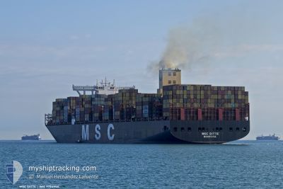
MSC DITTE
Cargo A
Current Trip
| Trip Time | 1 day |
|---|---|
| Trip Distance | 715.22 nm |
| AVG Speed | 14 Knots |
| MAX Speed | 20.9 Knots |
| Dybgang | 15.3 m |
| AVG Wind | 17 knots |
| MAX Wind | 30 knots |
| MIN Temp | 2°C / 35.6°F |
| MAX Temp | 8.6°C / 47.48°F |
| Position Modtaget | 15 d siden |
Current Position
| Longitude | --- |
|---|---|
| Latitude | --- |
| Status | Under way using engine |
| Fart | 16.8 Knots |
| Kurs | 72.7° |
| Område | Singapore Strait |
| Station | T-AIS |
| Position Modtaget | 15 d siden |
Info
Information
The current position of MSC DITTE is in Singapore Strait with coordinates 1.28041° / 104.31483° as reported on 2025-11-20 19:33 by AIS to our vessel tracker app. The vessel's current speed is 16.8 Knots and is currently inside the port of BUSAN NEW PORT.
The vessel MSC DITTE (IMO: 9754953, MMSI: 636017569) is a Cargo A It's sailing under the flag of [LR] Liberia.
In this page you can find informations about the vessels current position, last detected port calls, and current voyage information. If the vessels is not in coverage by AIS you will find the latest position.
The current position of MSC DITTE is detected by our AIS receivers and we are not responsible for the reliability of the data. The last position was recorded while the vessel was in Coverage by the Ais receivers of our vessel tracking app.
The current draught of MSC DITTE as reported by AIS is 15.3 meters
Weather
| Temperature | 10°C / 50°F |
|---|---|
| Wind Speed | 15 knots |
| Direction | 249° WSW |
| Pressure | 1021.9 hPa |
| Humidity | 63.8 % |
| Cloud Coverage | 2 % |
Featured Company
Last Port Calls
| Port | Arrival | Departure | Time In Port |
|---|---|---|---|
| 2025-12-05 17:36 | |||
| 2025-12-02 17:41 | 2025-12-03 17:37 | 23 h | |
| 2025-11-18 13:27 | 2025-11-20 21:55 | 2 d | |
| 2025-10-22 06:48 | 2025-10-23 15:56 | 1 d | |
| 2025-10-18 11:14 | 2025-10-18 19:14 | 8 h | |
| 2025-10-06 07:00 | 2025-10-08 05:14 | 1 d | |
| 2025-10-04 07:00 | 2025-10-05 02:08 | 19 h | |
| 2025-10-01 09:18 |
Last Trips
| Origin | Departure | Destination | Arrival | Distance | |
|---|---|---|---|---|---|
| 2025-12-03 17:37 | 2025-12-05 17:36 | 715.22 nm | |||
| 2025-11-20 21:55 | 2025-12-02 17:41 | 3058.42 nm | |||
| 2025-10-23 15:56 | 2025-11-18 13:27 | 8603.52 nm | |||
| 2025-10-18 19:14 | 2025-10-22 06:48 | 417.62 nm | |||
| 2025-10-08 05:14 | 2025-10-18 11:14 | 4583.53 nm | |||
| 2025-10-05 02:08 | 2025-10-06 07:00 | 374.05 nm | |||
| 2025-10-01 09:18 | 2025-10-04 07:00 | 754.60 nm |
Events
| Tid | Hændelsen | Detaljer | Position / Dest | Info |
|---|---|---|---|---|
| 2025-12-05 08:41 | STOP Sejllads |
35.07307 / 128.79538
[KR] BUSAN NEW PORT
|
Fart: 0.3 kn Kurs: 74° |
|
| 2025-12-05 08:36 | Skibe i havn |
|
35.07318 / 128.79585
[KR] BUSAN NEW PORT
|
Fart: 2.9 kn Kurs: 61° |
| 2025-12-03 09:37 | Afsejlet fra sidste havn |
|
38.95644 / 117.88005
CNXMN
|
Fart: 12.6 kn Kurs: 102° |
| 2025-12-03 09:09 | START Sejllads |
38.98454 / 117.78872
[CN] TIANJIN
|
Fart: 4.8 kn Kurs: 140° |
|
| 2025-12-02 09:49 | STOP Sejllads |
38.99344 / 117.78871
[CN] TIANJIN
|
Fart: 0.2 kn Kurs: 348° |
|
| 2025-12-02 09:41 | Skibe i havn |
|
38.99323 / 117.78768
[CN] TIANJIN
|
Fart: 0.8 kn Kurs: 350° |
| 2025-12-02 06:33 | START Sejllads | 15.78 nm, South West of CAOFEIDIAN |
38.88517 / 118.28740
CNXMN
|
Fart: 3.3 kn Kurs: 287° |
| 2025-12-02 04:21 | STOP Sejllads | 16.2 nm, South West of CAOFEIDIAN |
38.87558 / 118.28402
CNXMN
|
Fart: Kurs: 358° |
| 2025-11-30 22:09 | START Sejllads | 9.37 nm, North East of DALIAN |
39.01667 / 121.87516
CNXMN
|
Fart: 3.3 kn Kurs: 91° |
| 2025-11-30 03:57 | STOP Sejllads | 9.04 nm, North East of DALIAN |
39.01120 / 121.87067
CNXMN
|
Fart: 0.3 kn Kurs: 303° |