
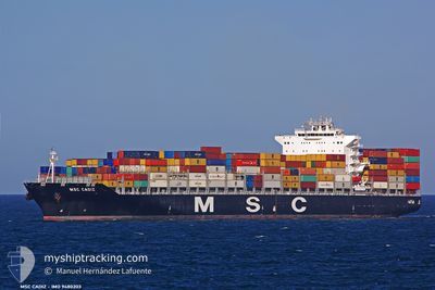
MSC CADIZ
Container Ship
Current Trip
BRSPB>ARBUE
| Time Travelled | 5 days |
|---|---|
| Remaining Time | --- |
| Distance Travelled | 133.67 nm |
| Remaining Distance | --- |
| AVG Speed | 10.2 Knots |
| MAX Speed | 12.7 Knots |
| AVG Wind | 11.2 knots |
| MAX Wind | 18 knots |
| MIN Temp | 16.6°C / 61.88°F |
| MAX Temp | 23°C / 73.4°F |
| Dybgang | 8.9 m |
| Position Modtaget | 8 d siden |
Current Position
| Longitude | --- |
|---|---|
| Latitude | --- |
| Status | Under way using engine |
| Fart | 16.3 Knots |
| Kurs | 220.9° |
| Område | South Atlantic Ocean |
| Station | T-AIS |
| Position Modtaget | 8 d siden |
Information
The current position of MSC CADIZ is in South Atlantic Ocean with coordinates -28.60153° / -48.14453° as reported on 2025-03-10 00:10 by AIS to our vessel tracker app. The vessel's current speed is 16.3 Knots
The vessel MSC CADIZ (IMO: 9480203, MMSI: 218847000) is a Container Ship that was built in 2011 ( 14 år gamle ). It's sailing under the flag of [DE] Germany.
In this page you can find informations about the vessels current position, last detected port calls, and current voyage information. If the vessels is not in coverage by AIS you will find the latest position.
The current position of MSC CADIZ is detected by our AIS receivers and we are not responsible for the reliability of the data. The last position was recorded while the vessel was in Coverage by the Ais receivers of our vessel tracking app.
The current draught of MSC CADIZ as reported by AIS is 8.9 meters
Weather
| Temperature | 23°C / 73.4°F |
|---|---|
| Wind Speed | 7 knots |
| Direction | 238° WSW |
| Pressure | 1015.3 hPa |
| Humidity | 77.9 % |
| Cloud Coverage | --- |
Featured Company
Last Port Calls
| Port | Arrival | Departure | Time In Port |
|---|---|---|---|
| 2025-03-12 02:59 | 2025-03-13 00:43 | 21 h | |
| 2025-03-07 17:24 | 2025-03-08 22:55 | 1 d | |
| 2025-03-02 10:11 | 2025-03-03 16:37 | 1 d | |
| 2025-02-19 23:43 | 2025-02-21 10:19 | 1 d | |
| 2025-02-14 08:22 | 2025-02-15 00:22 | 15 h | |
| 2025-02-07 15:55 | 2025-02-09 04:27 | 1 d | |
| 2025-02-07 04:44 | 2025-02-07 04:53 | 9 m | |
| 2025-02-06 15:05 | 2025-02-07 04:33 | 13 h | |
| 2025-02-06 14:37 | 2025-02-06 14:50 | 12 m | |
| 2025-02-04 04:59 | 2025-02-05 12:36 | 1 d |
Most Visited Ports (Last year)
| Port | Arrivals | |
|---|---|---|
| 6 | ||
| 5 | ||
| 5 | ||
| 4 | ||
| 4 | ||
| 4 |
Last Trips
| Origin | Departure | Destination | Arrival | Distance | |
|---|---|---|---|---|---|
| 2025-03-08 19:55 | 2025-03-11 23:59 | 1142.04 nm | |||
| 2025-03-03 13:37 | 2025-03-07 14:24 | 1137.42 nm | |||
| 2025-02-21 05:19 | 2025-03-02 07:11 | 3263.13 nm | |||
| 2025-02-14 20:22 | 2025-02-19 18:43 | 817.21 nm | |||
| 2025-02-08 23:27 | 2025-02-14 04:22 | 1061.27 nm | |||
| 2025-02-06 23:53 | 2025-02-07 10:55 | 84.54 nm | |||
| 2025-02-06 23:33 | 2025-02-06 23:44 | 0.43 nm | |||
| 2025-02-06 09:50 | 2025-02-06 10:05 | 0.84 nm | |||
| 2025-02-05 07:36 | 2025-02-06 09:37 | 395.22 nm | |||
| 2025-01-26 23:51 | 2025-02-03 23:59 | 136.28 nm |
Events
| Tid | Hændelsen | Detaljer | Position / Dest | Info |
|---|---|---|---|---|
| 2025-03-13 13:13 | STOP Sejllads | 9.27 nm, South East of PUNTA CARRETAS |
-35.04050 / -56.02906
BRSPB>ARBUE
|
Fart: 0.3 kn Kurs: 200° |
| 2025-03-13 00:43 | Afsejlet fra sidste havn |
|
-34.62616 / -58.32542
BRSPB>ARBUE
|
Fart: 4.8 kn Kurs: 70° |
| 2025-03-13 00:20 | START Sejllads |
-34.64052 / -58.34300
[AR] BUENOS AIRES
|
Fart: 3.7 kn Kurs: 324° |
|
| 2025-03-12 03:42 | STOP Sejllads |
-34.64490 / -58.34131
[AR] BUENOS AIRES
|
Fart: Kurs: 341° |
|
| 2025-03-12 02:59 | Skibe i havn |
|
-34.62836 / -58.33192
[AR] BUENOS AIRES
|
Fart: 7.6 kn Kurs: 238° |
| 2025-03-12 01:01 | START Sejllads | 8.04 nm, North of LA PLATA |
-34.71677 / -57.86169
BRSPB>ARBUE
|
Fart: 12.2 kn Kurs: 304° |
| 2025-03-11 21:10 | STOP Sejllads | 7.78 nm, North of LA PLATA |
-34.72382 / -57.84638
BRSPB>ARBUE
|
Fart: 0.1 kn Kurs: 123° |
| 2025-03-10 00:16 | Status er ændret | Default Under way using engine |
-28.62298 / -48.16562
BRSPB>ARBUE
|
Fart: 16.3 kn Kurs: 220.9° |
| 2025-03-10 00:10 | Udenfor Dækning |
-28.60153 / -48.14453
South Atlantic Ocean
BRSPB>ARBUE
|
Fart: 16.3 kn Kurs: 220.9° |
|
| 2025-03-09 19:56 | ETA er ændret | 2025/03/11 11:00 2025/03/11 20:00 |
-27.65173 / -47.35469
BRSPB>ARBUE
|
Fart: 16.2 kn Kurs: 217.6° |