
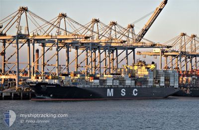
MSC ANCHORAGE
Container Ship
Current Trip
| Time Travelled | 11 days |
|---|---|
| Remaining Time | --- |
| Distance Travelled | 4077.15 nm |
| Remaining Distance | --- |
| AVG Speed | 15.4 Knots |
| MAX Speed | 18.2 Knots |
| AVG Wind | 10.6 knots |
| MAX Wind | 22 knots |
| MIN Temp | 27°C / 80.6°F |
| MAX Temp | 30.3°C / 86.54°F |
| Dybgang | 14.9 m |
| Position Modtaget | 1 d siden |
Current Position
| Longitude | 101.27322° |
|---|---|
| Latitude | -14.00460° |
| Status | Under way using engine |
| Fart | 15.5 Knots |
| Kurs | 150.5° |
| Område | Indian Ocean |
| Station | T-AIS |
| Position Modtaget | 1 d siden |
Info
Information
The current position of MSC ANCHORAGE is in Indian Ocean with coordinates -14.00460° / 101.27322° as reported on 2024-05-20 09:35 by AIS to our vessel tracker app. The vessel's current speed is 15.5 Knots and is heading at the port of MELBOURNE. The estimated time of arrival as calculated by MyShipTracking vessel tracking app is 2024-05-26 04:00 LT
The vessel MSC ANCHORAGE (IMO: 9619440, MMSI: 636015666) is a Container Ship that was built in 2013 ( 11 år gamle ). It's sailing under the flag of [LR] Liberia.
In this page you can find informations about the vessels current position, last detected port calls, and current voyage information. If the vessels is not in coverage by AIS you will find the latest position.
The current position of MSC ANCHORAGE is detected by our AIS receivers and we are not responsible for the reliability of the data. The last position was recorded while the vessel was in Coverage by the Ais receivers of our vessel tracking app.
The current draught of MSC ANCHORAGE as reported by AIS is 14.9 meters
Weather
| Temperature | 27°C / 80.6°F |
|---|---|
| Wind Speed | 22 knots |
| Direction | 108° ESE |
| Pressure | 1012.3 hPa |
| Humidity | 78.3 % |
| Cloud Coverage | 28 % |
Featured Company
Last Port Calls
| Port | Arrival | Departure | Time In Port |
|---|---|---|---|
| 2024-05-08 15:20 | 2024-05-10 12:32 | 1 d | |
| 2024-05-03 07:40 | 2024-05-04 08:16 | 1 d | |
| 2024-04-30 07:12 | 2024-05-01 10:48 | 1 d | |
| 2024-04-10 23:45 | 2024-04-13 03:05 | 2 d | |
| 2024-04-02 21:24 | 2024-04-05 09:41 | 2 d | |
| 2024-03-25 07:17 | 2024-03-27 08:55 | 2 d | |
| 2024-03-19 12:32 | 2024-03-20 03:29 | 14 h | |
| 2024-03-13 07:43 | 2024-03-14 06:33 | 22 h | |
| 2024-03-09 18:23 | 2024-03-11 12:08 | 1 d | |
| 2024-03-08 12:51 | 2024-03-09 01:23 | 12 h |
Most Visited Ports (Last year)
| Port | Arrivals | |
|---|---|---|
| 4 | ||
| 4 | ||
| 3 | ||
| 3 | ||
| 3 | ||
| 3 |
Last Trips
| Origin | Departure | Destination | Arrival | Distance | |
|---|---|---|---|---|---|
| 2024-05-04 13:46 | 2024-05-08 20:50 | 548.85 nm | |||
| 2024-05-01 15:48 | 2024-05-03 13:10 | 551.07 nm | |||
| 2024-04-13 05:05 | 2024-04-30 12:12 | 9967.22 nm | |||
| 2024-04-05 09:41 | 2024-04-11 01:45 | 1916.37 nm | |||
| 2024-03-27 08:55 | 2024-04-02 21:24 | 2439.14 nm | |||
| 2024-03-20 03:29 | 2024-03-25 07:17 | 1023.79 nm | |||
| 2024-03-14 07:33 | 2024-03-19 12:32 | 1491.61 nm | |||
| 2024-03-11 13:08 | 2024-03-13 08:43 | 414.66 nm | |||
| 2024-03-09 01:23 | 2024-03-09 19:23 | 209.36 nm | |||
| 2024-03-07 21:58 | 2024-03-08 12:51 | 198.11 nm |
Events
| Tid | Hændelsen | Detaljer | Position / Dest | Info |
|---|---|---|---|---|
| 2024-05-20 09:36 | Status er ændret | Default Under way using engine |
-14.00573 / 101.27387
MELBOURNE
|
Fart: 15.5 kn Kurs: 150.5° |
| 2024-05-20 09:35 | Status er ændret | Under way using engine Default |
-14.00460 / 101.27322
MELBOURNE
|
Fart: 15.5 kn Kurs: 150° |
| 2024-05-20 09:35 | Udenfor Dækning |
-14.00460 / 101.27322
Indian Ocean
MELBOURNE
|
Fart: 15.5 kn Kurs: 150.5° |
|
| 2024-05-20 09:24 | Indenfor Dækning |
-14.00460 / 101.27322
Indian Ocean
MELBOURNE
|
Fart: 15.5 kn Kurs: 150.5° |
|
| 2024-05-20 08:39 | Status er ændret | Default Under way using engine |
-13.79573 / 101.15142
MELBOURNE
|
Fart: 15.5 kn Kurs: 150.5° |
| 2024-05-20 08:34 | Udenfor Dækning |
-13.77635 / 101.14016
Indian Ocean
MELBOURNE
|
Fart: 15.5 kn Kurs: 150.5° |
|
| 2024-05-20 08:12 | Status er ændret | Under way using engine Default |
-13.69373 / 101.09212
MELBOURNE
|
Fart: 15.5 kn Kurs: 150° |
| 2024-05-20 07:56 | Status er ændret | Default Under way using engine |
-13.63173 / 101.05608
MELBOURNE
|
Fart: 15.5 kn Kurs: 150.5° |
| 2024-05-20 07:42 | Ændre havområde | High seas of the Indian Ocean Cocos Islands part of the Indian Ocean |
-13.58129 / 101.02676
Indian Ocean
MELBOURNE
|
Fart: 15.5 kn Kurs: 150.5° |
| 2024-05-20 07:41 | Status er ændret | Under way using engine Default |
-13.57904 / 101.02545
MELBOURNE
|
Fart: 15.5 kn Kurs: 150° |