

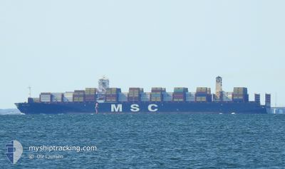
MSC AINO
Cargo A

Current Trip
| Time Travelled | 1 day |
|---|---|
| Remaining Time | 8 h, 55 mins |
| Distance Travelled | 144.91 nm |
| Remaining Distance | 160.40 nm |
| AVG Speed | 9.8 Knots |
| MAX Speed | 18.3 Knots |
| AVG Wind | 2.5 knots |
| MAX Wind | 8.3 knots |
| MIN Temp | 22.1°C / 71.78°F |
| MAX Temp | 25.9°C / 78.62°F |
| Dybgang | 12.3 m |
| Position Modtaget | 11 h, 16 m siden |
Current Position
| Longitude | --- |
|---|---|
| Latitude | --- |
| Status | Under way using engine |
| Fart | 11.6 Knots |
| Kurs | 200.3° |
| Område | South Atlantic Ocean |
| Station | T-AIS |
| Position Modtaget | 11 h, 16 m siden |
Information
The current position of MSC AINO is in South Atlantic Ocean with coordinates -24.02646° / -46.34563° as reported on 2025-03-27 08:42 by AIS to our vessel tracker app. The vessel's current speed is 11.6 Knots and is heading at the port of PARANAGUA. The estimated time of arrival as calculated by MyShipTracking vessel tracking app is 2025-03-28 01:53 LT
The vessel MSC AINO (IMO: 9770751, MMSI: 636019348) is a Cargo A It's sailing under the flag of [LR] Liberia.
In this page you can find informations about the vessels current position, last detected port calls, and current voyage information. If the vessels is not in coverage by AIS you will find the latest position.
The current position of MSC AINO is detected by our AIS receivers and we are not responsible for the reliability of the data. The last position was recorded while the vessel was in Coverage by the Ais receivers of our vessel tracking app.
The current draught of MSC AINO as reported by AIS is 12.3 meters
Weather
| Temperature | 25.7°C / 78.26°F |
|---|---|
| Wind Speed | 7 knots |
| Direction | 99° E |
| Pressure | 1013.4 hPa |
| Humidity | 75 % |
| Cloud Coverage | 7 % |


Featured Company
Last Port Calls
| Port | Arrival | Departure | Time In Port |
|---|---|---|---|
| 2025-03-25 22:26 | 2025-03-25 23:23 | 56 m | |
| 2025-03-02 10:01 | 2025-03-04 04:58 | 1 d | |
| 2025-02-24 20:00 | 2025-02-25 06:13 | 10 h | |
| 2025-02-11 23:46 | 2025-02-13 10:33 | 1 d | |
| 2025-02-10 09:00 | 2025-02-11 20:53 | 1 d | |
| 2025-01-15 11:46 | 2025-01-15 12:36 | 50 m | |
| 2025-01-06 03:39 | 2025-01-07 23:05 | 1 d | |
| 2025-01-05 00:42 | 2025-01-05 14:34 | 13 h | |
| 2025-01-01 18:37 |
Last Trips
| Origin | Departure | Destination | Arrival | Distance | |
|---|---|---|---|---|---|
| 2025-03-04 04:58 | 2025-03-25 22:26 | 9382.01 nm | |||
| 2025-02-25 06:13 | 2025-03-02 10:01 | 1490.69 nm | |||
| 2025-02-13 10:33 | 2025-02-24 20:00 | 3136.65 nm | |||
| 2025-02-11 20:53 | 2025-02-11 23:46 | 11.04 nm | |||
| 2025-01-15 12:36 | 2025-02-10 09:00 | 9115.75 nm | |||
| 2025-01-07 23:05 | 2025-01-15 11:46 | 1081.23 nm | |||
| 2025-01-05 14:34 | 2025-01-06 03:39 | 146.42 nm | |||
| 2025-01-01 18:37 | 2025-01-05 00:42 | 810.33 nm |
Events
| Tid | Hændelsen | Detaljer | Position / Dest | Info |
|---|---|---|---|---|
| 2025-03-27 08:49 | Status er ændret | Default Under way using engine |
-24.05023 / -46.35543
PARANAGUA
|
Fart: 11.6 kn Kurs: 200.3° |
| 2025-03-27 08:42 | Udenfor Dækning |
-24.02646 / -46.34563
South Atlantic Ocean
PARANAGUA
|
Fart: 11.6 kn Kurs: 200.3° |
|
| 2025-03-27 08:37 | Status er ændret | Under way using engine Default |
-24.01286 / -46.34018
PARANAGUA
|
Fart: 8.9 kn Kurs: 210° |
| 2025-03-27 08:33 | Status er ændret | Default Under way using engine |
-24.00475 / -46.33613
PARANAGUA
|
Fart: 9.3 kn Kurs: 216.6° |
| 2025-03-27 07:33 | Dybgangen er ændret | 12.3 14.2 |
-23.91880 / -46.34601
PARANAGUA
|
Fart: 4 kn Kurs: 103° |
| 2025-03-27 07:33 | Destination er ændret | PARANAGUA SANTOS |
-23.91880 / -46.34601
PARANAGUA
|
Fart: 4 kn Kurs: 103° |
| 2025-03-27 07:33 | ETA er ændret | 2025/03/27 18:00 2025/03/26 01:00 |
-23.91880 / -46.34601
PARANAGUA
|
Fart: 4 kn Kurs: 103° |
| 2025-03-27 07:32 | START Sejllads | 3.17 nm, North West of SANTOS |
-23.91869 / -46.34669
SANTOS
|
Fart: 3.2 kn Kurs: 98° |
| 2025-03-27 07:18 | Status er ændret | Under way using engine Default |
-23.92024 / -46.35106
SANTOS
|
Fart: 0.3 kn Kurs: 279° |
| 2025-03-27 07:15 | Indenfor Dækning |
-23.91982 / -46.35074
South Atlantic Ocean
|
Fart: 1 kn Kurs: 356.5° |