
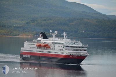
MS POLARLYS
Ro-Ro/Passenger Ship
Current Trip
| Trip Time | 4 h, 27 mins |
|---|---|
| Trip Distance | 55.09 nm |
| AVG Speed | 12.9 Knots |
| MAX Speed | 14.9 Knots |
| Dybgang | 5 m |
| AVG Wind | 15.3 knots |
| MAX Wind | 24 knots |
| MIN Temp | 3.8°C / 38.84°F |
| MAX Temp | 9.4°C / 48.92°F |
| Position Modtaget | 3 m siden |
Current Position
| Longitude | --- |
|---|---|
| Latitude | --- |
| Status | Moored |
| Fart | 0.1 Knots |
| Kurs | 253° |
| Område | Norwegian Sea |
| Station | T-AIS |
| Position Modtaget | 3 m siden |
Info
Information
The current position of MS POLARLYS is in Norwegian Sea with coordinates 62.47576° / 6.15278° as reported on 2025-12-11 15:11 by AIS to our vessel tracker app. The vessel's current speed is 0.1 Knots and is currently inside the port of ALESUND.
The vessel MS POLARLYS (IMO: 9107796, MMSI: 259322000) is a Ro-Ro/Passenger Ship that was built in 1996 ( 29 år gamle ). It's sailing under the flag of [NO] Norway.
In this page you can find informations about the vessels current position, last detected port calls, and current voyage information. If the vessels is not in coverage by AIS you will find the latest position.
The current position of MS POLARLYS is detected by our AIS receivers and we are not responsible for the reliability of the data. The last position was recorded while the vessel was in Coverage by the Ais receivers of our vessel tracking app.
The current draught of MS POLARLYS as reported by AIS is 5 meters
Weather
| Temperature | 8.2°C / 46.76°F |
|---|---|
| Wind Speed | 10 knots |
| Direction | 194° SSW |
| Pressure | 1002.2 hPa |
| Humidity | 86.6 % |
| Cloud Coverage | 100 % |
Featured Company
Last Port Calls
| Port | Arrival | Departure | Time In Port |
|---|---|---|---|
| 2025-12-11 09:56 | |||
| 2025-12-11 05:15 | 2025-12-11 05:29 | 14 m | |
| 2025-12-11 02:53 | 2025-12-11 03:10 | 16 m | |
| 2025-12-10 15:02 | 2025-12-10 20:33 | 5 h | |
| 2025-12-10 08:13 | 2025-12-10 08:25 | 12 m | |
| 2025-12-10 05:40 | 2025-12-10 06:04 | 24 m | |
| 2025-12-10 00:20 | 2025-12-10 01:16 | 55 m | |
| 2025-12-09 21:21 | 2025-12-09 21:46 | 24 m | |
| 2025-12-09 16:17 | 2025-12-09 17:41 | 1 h | |
| 2025-12-09 06:23 | 2025-12-09 09:34 | 3 h |
Last Trips
| Origin | Departure | Destination | Arrival | Distance | |
|---|---|---|---|---|---|
| 2025-12-11 05:29 | 2025-12-11 09:56 | 55.09 nm | |||
| 2025-12-11 03:10 | 2025-12-11 05:15 | 27.82 nm | |||
| 2025-12-10 20:33 | 2025-12-11 02:53 | 91.12 nm | |||
| 2025-12-10 08:25 | 2025-12-10 15:02 | 88.53 nm | |||
| 2025-12-10 06:04 | 2025-12-10 08:13 | 27.23 nm | |||
| 2025-12-10 01:16 | 2025-12-10 05:40 | 53.12 nm | |||
| 2025-12-09 21:46 | 2025-12-10 00:20 | 34.63 nm | |||
| 2025-12-09 17:41 | 2025-12-09 21:21 | 49.41 nm | |||
| 2025-12-09 09:34 | 2025-12-09 16:17 | 92.62 nm | |||
| 2025-12-08 21:32 | 2025-12-09 06:23 | 124.85 nm |
Events
| Tid | Hændelsen | Detaljer | Position / Dest | Info |
|---|---|---|---|---|
| 2025-12-11 14:50 | Status er ændret | Moored Default |
62.47576 / 6.15279
[NO] ALESUND
|
Fart: 0.1 kn Kurs: 253° |
| 2025-12-11 14:47 | Status er ændret | Default Moored |
62.47575 / 6.15280
[NO] ALESUND
|
Fart: 0.1 kn Kurs: 253° |
| 2025-12-11 09:06 | Status er ændret | Moored Under way using engine |
62.47576 / 6.15280
[NO] ALESUND
|
Fart: 0.1 kn Kurs: 254° |
| 2025-12-11 09:05 | ETA er ændret | 2025/12/16 08:08 2025/12/16 08:00 |
62.47576 / 6.15279
[NO] ALESUND
|
Fart: 0.1 kn Kurs: 254° |
| 2025-12-11 08:58 | STOP Sejllads |
62.47577 / 6.15280
[NO] ALESUND
|
Fart: 0.3 kn Kurs: 254° |
|
| 2025-12-11 08:56 | Skibe i havn |
|
62.47663 / 6.15377
[NO] ALESUND
|
Fart: 6.3 kn Kurs: 105.8° |
| 2025-12-11 07:45 | START Sejllads | 2.17 nm, North East of MJOLSTADNESET |
62.33950 / 5.73597
NO KKN
|
Fart: 5.7 kn Kurs: 43.3° |
| 2025-12-11 07:29 | STOP Sejllads | 1.9 nm, North East of MJOLSTADNESET |
62.33657 / 5.72829
NO KKN
|
Fart: 0.1 kn Kurs: 37° |
| 2025-12-11 04:29 | Afsejlet fra sidste havn |
|
61.94426 / 5.13597
NO KKN
|
Fart: 6.8 kn Kurs: 55° |
| 2025-12-11 04:27 | START Sejllads |
61.94024 / 5.12740
[NO] MALOY
|
Fart: 6.8 kn Kurs: 55° |