
MODUS
General Cargo
Current Trip
RU KZP
| Time Travelled | --- |
|---|---|
| Remaining Time | --- |
| Distance Travelled | --- |
| Remaining Distance | --- |
| AVG Speed | --- |
| MAX Speed | --- |
| AVG Wind | --- |
| MAX Wind | --- |
| MIN Temp | --- |
| MAX Temp | --- |
| Dybgang | 2.9 m |
| Position Modtaget | 2022-04-12 08:45 |
Current Position
| Longitude | 29.25696° |
|---|---|
| Latitude | 41.31283° |
| Status | Under way using engine |
| Fart | 6.8 Knots |
| Kurs | 46.6° |
| Område | Black Sea |
| Station | T-AIS |
| Position Modtaget | 2022-04-12 08:45 |
Info
Information
The current position of MODUS is in Black Sea with coordinates 41.31283° / 29.25696° as reported on 2022-04-12 08:45 by AIS to our vessel tracker app. The vessel's current speed is 6.8 Knots
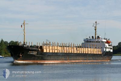
The vessel MODUS (IMO: 7942958, MMSI: 273430210) is a General Cargo that was built in 1981 ( 43 år gamle ). It's sailing under the flag of [RU] Russia.
In this page you can find informations about the vessels current position, last detected port calls, and current voyage information. If the vessels is not in coverage by AIS you will find the latest position.
The current position of MODUS is detected by our AIS receivers and we are not responsible for the reliability of the data. The last position was recorded while the vessel was in Coverage by the Ais receivers of our vessel tracking app.
The current draught of MODUS as reported by AIS is 2.9 meters
Weather
| Temperature | 11.2°C / 52.16°F |
|---|---|
| Wind Speed | 5 knots |
| Direction | 33° NNE |
| Pressure | 1013.6 hPa |
| Humidity | 81.8 % |
| Cloud Coverage | 99 % |
Featured Company
Most Visited Ports (Last year)
| Port | Arrivals | |
|---|---|---|
| 25 |
Events
| Tid | Hændelsen | Detaljer | Position / Dest | Info |
|---|---|---|---|---|
| 2024-05-09 14:09 | Skibe i havn |
|
45.33508 / 36.65709
[RU] KAVKAZ
|
Fart: 7 kn Kurs: 249° |
| 2024-05-09 11:20 | START Sejllads | 6.17 nm, South of TAMAN |
45.02077 / 36.67263
RU KZP
|
Fart: 4.2 kn Kurs: 303° |
| 2024-05-08 08:47 | STOP Sejllads | 8.26 nm, South West of TAMAN |
44.99643 / 36.58646
RU KZP
|
Fart: 0.1 kn Kurs: 238° |
| 2024-05-08 00:29 | STOP Sejllads | 8.31 nm, South West of TAMAN |
44.99567 / 36.58622
RU KZP
|
Fart: 0.1 kn Kurs: 262° |
| 2024-05-07 23:15 | START Sejllads | 6.11 nm, South of TAMAN |
45.02140 / 36.65910
RU KZP
|
Fart: 4.7 kn Kurs: 239° |
| 2024-05-07 22:24 | STOP Sejllads | 6.26 nm, South of TAMAN |
45.02026 / 36.68505
RU KZP
|
Fart: 0.1 kn Kurs: 262° |
| 2024-05-06 07:19 | STOP Sejllads | 6.2 nm, South of TAMAN |
45.02096 / 36.68322
RU KZP
|
Fart: 0.3 kn Kurs: 182° |
| 2024-05-06 05:56 | START Sejllads | 8.14 nm, East of TAMAN |
45.07825 / 36.84262
RU KZP
|
Fart: 6.2 kn Kurs: 239° |
| 2024-05-03 17:51 | STOP Sejllads | 9.28 nm, East of TAMAN |
45.08881 / 36.87500
RU KZP
|
Fart: 0.2 kn Kurs: 9° |
| 2024-05-03 16:25 | START Sejllads | 6.12 nm, South of TAMAN |
45.02581 / 36.70475
RU KZP
|
Fart: 5.7 kn Kurs: 62° |