

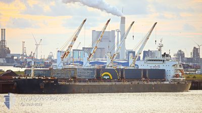
MITSOS
Bulk Carrier

Current Trip
| Time Travelled | 3 days |
|---|---|
| Remaining Time | --- |
| Distance Travelled | 479.43 nm |
| Remaining Distance | 8.39 nm |
| AVG Speed | 16.1 Knots |
| MAX Speed | 18.8 Knots |
| AVG Wind | 12.7 knots |
| MAX Wind | 27 knots |
| MIN Temp | 19.5°C / 67.1°F |
| MAX Temp | 26.8°C / 80.24°F |
| Dybgang | 6.8 m |
| Position Modtaget | 3 d siden |
Current Position
| Longitude | --- |
|---|---|
| Latitude | --- |
| Status | Under way using engine |
| Fart | 16.8 Knots |
| Kurs | 219.1° |
| Område | Indian Ocean |
| Station | T-AIS |
| Position Modtaget | 3 d siden |
Information
The current position of MITSOS is in Indian Ocean with coordinates -30.13817° / 31.28227° as reported on 2025-03-20 02:17 by AIS to our vessel tracker app. The vessel's current speed is 16.8 Knots and is heading at the port of PORT ELIZABETH. The estimated time of arrival as calculated by MyShipTracking vessel tracking app is 2025-03-21 10:00 LT
The vessel MITSOS (IMO: 9637210, MMSI: 538009538) is a Bulk Carrier that was built in 2013 ( 12 år gamle ). It's sailing under the flag of [MH] Marshall Is.
In this page you can find informations about the vessels current position, last detected port calls, and current voyage information. If the vessels is not in coverage by AIS you will find the latest position.
The current position of MITSOS is detected by our AIS receivers and we are not responsible for the reliability of the data. The last position was recorded while the vessel was in Coverage by the Ais receivers of our vessel tracking app.
The current draught of MITSOS as reported by AIS is 6.8 meters
Weather
| Temperature | 23.1°C / 73.58°F |
|---|---|
| Wind Speed | 7 knots |
| Direction | 154° SSE |
| Pressure | 1013.9 hPa |
| Humidity | 78.6 % |
| Cloud Coverage | 27 % |


Featured Company
Last Port Calls
| Port | Arrival | Departure | Time In Port |
|---|---|---|---|
| 2025-03-12 15:04 | 2025-03-19 21:53 | 7 d | |
| 2025-01-15 06:36 | 2025-01-19 07:14 | 4 d |
Last Trips
| Origin | Departure | Destination | Arrival | Distance | |
|---|---|---|---|---|---|
| 2025-01-19 07:14 | 2025-03-12 15:04 | 7326.25 nm | |||
| 2024-12-12 13:12 | 2025-01-15 06:36 | 8483.86 nm |
Events
| Tid | Hændelsen | Detaljer | Position / Dest | Info |
|---|---|---|---|---|
| 2025-03-21 02:41 | STOP Sejllads | 5.48 nm, South East of COEGA |
-33.87172 / 25.76709
ZAPLZ
|
Fart: 0.3 kn Kurs: 210° |
| 2025-03-20 02:24 | Status er ændret | Default Under way using engine |
-30.16304 / 31.25855
ZAPLZ
|
Fart: 16.8 kn Kurs: 219.1° |
| 2025-03-20 02:17 | Udenfor Dækning |
-30.13817 / 31.28227
Indian Ocean
ZAPLZ
|
Fart: 16.8 kn Kurs: 219.1° |
|
| 2025-03-20 02:17 | Status er ændret | Under way using engine Default |
-30.13739 / 31.28302
ZAPLZ
|
Fart: 16.9 kn Kurs: 216° |
| 2025-03-20 02:01 | Status er ændret | Default Under way using engine |
-30.07705 / 31.33451
ZAPLZ
|
Fart: 17.1 kn Kurs: 215.6° |
| 2025-03-20 01:45 | Status er ændret | Under way using engine Default |
-30.01336 / 31.38328
ZAPLZ
|
Fart: 16.2 kn Kurs: 214° |
| 2025-03-20 01:39 | Status er ændret | Default Under way using engine |
-29.99193 / 31.39988
ZAPLZ
|
Fart: 15.3 kn Kurs: 216.6° |
| 2025-03-20 00:10 | Dybgangen er ændret | 6.8 13.4 |
-29.65323 / 31.67835
ZAPLZ
|
Fart: 17.4 kn Kurs: 214.2° |
| 2025-03-20 00:10 | Destination er ændret | ZAPLZ ZA RCB |
-29.65323 / 31.67835
ZAPLZ
|
Fart: 17.4 kn Kurs: 214.2° |
| 2025-03-20 00:10 | ETA er ændret | 2025/03/21 08:00 2025/03/01 22:30 |
-29.65323 / 31.67835
ZAPLZ
|
Fart: 17.4 kn Kurs: 214.2° |