
MINOS
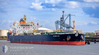
Crude Oil Tanker
Current Trip
| Time Travelled | 19 days |
|---|---|
| Remaining Time | 3 days |
| Distance Travelled | 5578.86 nm |
| Remaining Distance | 825.39 nm |
| AVG Speed | 11.6 Knots |
| MAX Speed | 16.5 Knots |
| AVG Wind | 15.7 knots |
| MAX Wind | 26 knots |
| MIN Temp | 1.7°C / 35.06°F |
| MAX Temp | 25.8°C / 78.44°F |
| Dybgang | 14.7 m |
| Position Modtaget | 2 d siden |
Current Position
| Longitude | --- |
|---|---|
| Latitude | --- |
| Status | Under way using engine |
| Fart | 8.7 Knots |
| Kurs | 171.9° |
| Område | Gulf of Suez |
| Station | T-AIS |
| Position Modtaget | 2 d siden |
Info
Information
The current position of MINOS is in Gulf of Suez with coordinates 29.87042° / 32.55129° as reported on 2025-12-07 18:23 by AIS to our vessel tracker app. The vessel's current speed is 8.7 Knots and is heading at the port of PORT SAID. The estimated time of arrival as calculated by MyShipTracking vessel tracking app is 2025-12-13 08:12 LT
The vessel MINOS (IMO: 9489297, MMSI: 538006517) is a Crude Oil Tanker that was built in 2008 ( 17 år gamle ). It's sailing under the flag of [MH] Marshall Is.
In this page you can find informations about the vessels current position, last detected port calls, and current voyage information. If the vessels is not in coverage by AIS you will find the latest position.
The current position of MINOS is detected by our AIS receivers and we are not responsible for the reliability of the data. The last position was recorded while the vessel was in Coverage by the Ais receivers of our vessel tracking app.
The current draught of MINOS as reported by AIS is 14.7 meters
Weather
| Temperature | 25.6°C / 78.08°F |
|---|---|
| Wind Speed | 15 knots |
| Direction | 27° NNE |
| Pressure | 1013.5 hPa |
| Humidity | 78.4 % |
| Cloud Coverage | 54 % |
Featured Company
Last Port Calls
| Port | Arrival | Departure | Time In Port |
|---|---|---|---|
| 2025-12-07 10:48 | 2025-12-07 19:46 | 8 h | |
| 2025-11-19 08:09 | 2025-11-20 14:37 | 1 d |
Most Visited Ports (Last year)
| Port | Arrivals | |
|---|---|---|
| 4 | ||
| 2 | ||
| 1 | ||
| 1 | ||
| 1 | ||
| 1 |
Last Trips
| Origin | Departure | Destination | Arrival | Distance | |
|---|---|---|---|---|---|
| 2025-11-20 14:37 | 2025-12-07 10:48 | 4769.34 nm |
Events
| Tid | Hændelsen | Detaljer | Position / Dest | Info |
|---|---|---|---|---|
| 2025-12-07 18:28 | Status er ændret | Default Under way using engine |
29.85804 / 32.55318
EG_PSD
|
Fart: 8.7 kn Kurs: 171.9° |
| 2025-12-07 18:23 | Udenfor Dækning |
29.87042 / 32.55129
Gulf of Suez
|
Fart: 8.7 kn Kurs: 171.9° |
|
| 2025-12-07 17:47 | Ændre havområde | Egyptian part of the Gulf of Suez Maltese part of the Mediterranean Sea - Eastern Basin |
29.94438 / 32.57665
Gulf of Suez
|
Fart: 8.7 kn Kurs: 219° |
| 2025-12-07 17:46 | Afsejlet fra sidste havn |
|
29.94571 / 32.57784
EG_PSD
|
Fart: 8.8 kn Kurs: 218° |
| 2025-12-07 16:41 | ETA er ændret | 2025/12/06 20:59 2025/12/06 12:00 |
30.14191 / 32.56985
[EG] SUEZ CANAL
|
Fart: 11.2 kn Kurs: 181° |
| 2025-12-07 16:29 | Status er ændret | Under way using engine Default |
30.17937 / 32.56897
[EG] SUEZ CANAL
|
Fart: 10.8 kn Kurs: 159° |
| 2025-12-07 16:20 | Indenfor Dækning |
30.17379 / 32.56920
Mediterranean Sea - Eastern Basin
[EG] SUEZ CANAL
|
Fart: 10.9 kn Kurs: 178.4° |
|
| 2025-12-07 08:48 | Skibe i havn |
|
31.22962 / 32.34616
[EG] SUEZ CANAL
|
Fart: 5.8 kn Kurs: 195° |
| 2025-12-07 06:02 | START Sejllads | 12.43 nm, North of PORT SAID |
31.45890 / 32.32525
EG_PSD
|
Fart: 5 kn Kurs: 2° |
| 2025-12-06 22:52 | STOP Sejllads | 11.99 nm, North of PORT SAID |
31.45167 / 32.32333
EG_PSD
|
Fart: Kurs: -1° |