
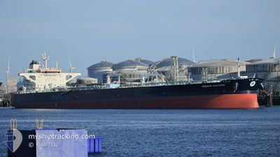
MINERVA KALYPSO
Tanker
Current Trip
SIDI KERIR
| Time Travelled | 4 days |
|---|---|
| Remaining Time | --- |
| Distance Travelled | 544.75 nm |
| Remaining Distance | --- |
| AVG Speed | 7 Knots |
| MAX Speed | 7 Knots |
| AVG Wind | 12.1 knots |
| MAX Wind | 26.2 knots |
| MIN Temp | 14°C / 57.2°F |
| MAX Temp | 21.1°C / 69.98°F |
| Dybgang | 9 m |
| Position Modtaget | 1 d siden |
Current Position
| Longitude | 29.59511° |
|---|---|
| Latitude | 31.09017° |
| Status | Under way using engine |
| Fart | 0.3 Knots |
| Kurs | 17° |
| Område | Mediterranean Sea - Eastern Basin |
| Station | T-AIS |
| Position Modtaget | 1 d siden |
Info
Information
The current position of MINERVA KALYPSO is in Mediterranean Sea - Eastern Basin with coordinates 31.09017° / 29.59511° as reported on 2024-05-02 22:24 by AIS to our vessel tracker app. The vessel's current speed is 0.3 Knots
The vessel MINERVA KALYPSO (IMO: 9785225, MMSI: 241502000) is a Tanker It's sailing under the flag of [GR] Greece.
In this page you can find informations about the vessels current position, last detected port calls, and current voyage information. If the vessels is not in coverage by AIS you will find the latest position.
The current position of MINERVA KALYPSO is detected by our AIS receivers and we are not responsible for the reliability of the data. The last position was recorded while the vessel was in Coverage by the Ais receivers of our vessel tracking app.
The current draught of MINERVA KALYPSO as reported by AIS is 9 meters
Weather
| Temperature | 19.4°C / 66.92°F |
|---|---|
| Wind Speed | 14 knots |
| Direction | 304° NW |
| Pressure | 1014 hPa |
| Humidity | 86.6 % |
| Cloud Coverage | --- |
Featured Company
Last Port Calls
| Port | Arrival | Departure | Time In Port |
|---|---|---|---|
| 2024-04-28 09:04 | 2024-04-29 19:49 | 1 d | |
| 2024-04-16 07:30 | 2024-04-16 08:54 | 1 h | |
| 2024-04-01 05:19 | 2024-04-02 06:19 | 1 d | |
| 2024-03-26 20:24 | 2024-03-28 11:04 | 1 d |
Most Visited Ports (Last year)
| Port | Arrivals | |
|---|---|---|
| 3 | ||
| 2 | ||
| 2 | ||
| 2 | ||
| 1 | ||
| 1 |
Last Trips
| Origin | Departure | Destination | Arrival | Distance | |
|---|---|---|---|---|---|
| 2024-04-16 11:54 | 2024-04-28 12:04 | 1350.14 nm | |||
| 2024-04-02 08:19 | 2024-04-16 10:30 | 2703.30 nm | |||
| 2024-03-28 12:04 | 2024-04-01 07:19 | 1078.17 nm | |||
| 2024-02-29 18:52 | 2024-03-26 21:24 | 2101.31 nm |
Events
| Tid | Hændelsen | Detaljer | Position / Dest | Info |
|---|---|---|---|---|
| 2024-05-03 21:17 | START Sejllads | 10.89 nm, West of EL DEKHEILA |
31.11444 / 29.59788
SIDI KERIR
|
Fart: 3.9 kn Kurs: 350° |
| 2024-05-02 22:31 | Status er ændret | Default Under way using engine |
31.09004 / 29.59530
SIDI KERIR
|
Fart: 0.3 kn Kurs: 17° |
| 2024-05-02 22:24 | Udenfor Dækning |
31.09017 / 29.59511
Mediterranean Sea - Eastern Basin
SIDI KERIR
|
Fart: 0.3 kn Kurs: 147.3° |
|
| 2024-05-02 22:20 | STOP Sejllads | 11.37 nm, West of EL DEKHEILA |
31.09045 / 29.59511
SIDI KERIR
|
Fart: 0.2 kn Kurs: 26° |
| 2024-05-02 16:47 | Status er ændret | Under way using engine Default |
31.42669 / 29.39420
SIDI KERIR
|
Fart: 5.1 kn Kurs: 147° |
| 2024-05-02 16:43 | Status er ændret | Default Under way using engine |
31.43118 / 29.39093
SIDI KERIR
|
Fart: 27.3 kn Kurs: 136.5° |
| 2024-05-02 16:28 | Status er ændret | Under way using engine Default |
31.44895 / 29.37760
SIDI KERIR
|
Fart: 5 kn Kurs: 145° |
| 2024-05-02 16:14 | Status er ændret | Default Under way using engine |
31.46367 / 29.36580
SIDI KERIR
|
Fart: 5 kn Kurs: 147° |
| 2024-05-02 14:47 | Status er ændret | Under way using engine Default |
31.56676 / 29.28900
SIDI KERIR
|
Fart: 5.4 kn Kurs: 142° |
| 2024-05-02 14:29 | Status er ændret | Default Under way using engine |
31.58974 / 29.26970
SIDI KERIR
|
Fart: 6.4 kn Kurs: 145.2° |