
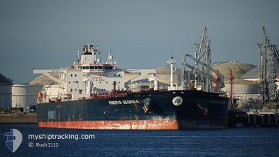
MINERVA GEORGIA
Crude Oil Tanker
Current Trip
| Time Travelled | --- |
|---|---|
| Remaining Time | --- |
| Distance Travelled | 11962.19 nm |
| Remaining Distance | 1566.52 nm |
| AVG Speed | 13.1 Knots |
| MAX Speed | 17.7 Knots |
| AVG Wind | 13.7 knots |
| MAX Wind | 32.2 knots |
| MIN Temp | 13.5°C / 56.3°F |
| MAX Temp | 33.6°C / 92.48°F |
| Dybgang | 13 m |
| Position Modtaget | 5 d siden |
Current Position
| Longitude | --- |
|---|---|
| Latitude | --- |
| Status | Under way using engine |
| Fart | 11.1 Knots |
| Kurs | 227.9° |
| Område | South Atlantic Ocean |
| Station | T-AIS |
| Position Modtaget | 5 d siden |
Info
Information
The current position of MINERVA GEORGIA is in South Atlantic Ocean with coordinates -33.90243° / 18.09098° as reported on 2024-11-19 17:08 by AIS to our vessel tracker app. The vessel's current speed is 11.1 Knots and is heading at the port of CAPE TOWN. The estimated time of arrival as calculated by MyShipTracking vessel tracking app is 2024-11-19 12:00 LT
The vessel MINERVA GEORGIA (IMO: 9332157, MMSI: 240715000) is a Crude Oil Tanker that was built in 2008 ( 16 år gamle ). It's sailing under the flag of [GR] Greece.
In this page you can find informations about the vessels current position, last detected port calls, and current voyage information. If the vessels is not in coverage by AIS you will find the latest position.
The current position of MINERVA GEORGIA is detected by our AIS receivers and we are not responsible for the reliability of the data. The last position was recorded while the vessel was in Coverage by the Ais receivers of our vessel tracking app.
The current draught of MINERVA GEORGIA as reported by AIS is 13 meters
Weather
| Temperature | 24.3°C / 75.74°F |
|---|---|
| Wind Speed | 13 knots |
| Direction | 121° ESE |
| Pressure | 1014.4 hPa |
| Humidity | 87.7 % |
| Cloud Coverage | 13 % |
Featured Company
Last Port Calls
| Port | Arrival | Departure | Time In Port |
|---|---|---|---|
| 2024-09-05 20:54 | 2024-09-07 06:13 | 1 d |
Last Trips
| Origin | Departure | Destination | Arrival | Distance | |
|---|---|---|---|---|---|
| 2024-08-04 05:19 | 2024-09-05 20:54 | 5837.00 nm |
Events
| Tid | Hændelsen | Detaljer | Position / Dest | Info |
|---|---|---|---|---|
| 2024-11-19 17:14 | Status er ændret | Default Under way using engine |
-33.91747 / 18.07174
OPL CAPE TOWN
|
Fart: 11.1 kn Kurs: 227.9° |
| 2024-11-19 17:08 | Status er ændret | Under way using engine Default |
-33.90243 / 18.09098
OPL CAPE TOWN
|
Fart: 9.9 kn Kurs: 236° |
| 2024-11-19 17:08 | Udenfor Dækning |
-33.90243 / 18.09098
South Atlantic Ocean
|
Fart: 11.1 kn Kurs: 227.9° |
|
| 2024-11-19 17:03 | Indenfor Dækning |
-33.90243 / 18.09098
South Atlantic Ocean
|
Fart: 11.1 kn Kurs: 227.9° |
|
| 2024-11-19 16:42 | START Sejllads | 13.01 nm, West of ROBBEN ISLAND |
-33.87576 / 18.13457
OPL CAPE TOWN
|
Fart: 3.1 kn Kurs: 225° |
| 2024-11-19 15:31 | STOP Sejllads | 13 nm, South West of ROBBEN ISLAND |
-33.89731 / 18.14637
OPL CAPE TOWN
|
Fart: 0.3 kn Kurs: 180° |
| 2024-11-19 14:15 | Status er ændret | Default Under way using engine |
-33.84759 / 18.25444
OPL CAPE TOWN
|
Fart: 4.8 kn Kurs: 334° |
| 2024-11-19 14:10 | Udenfor Dækning |
-33.85270 / 18.25848
South Atlantic Ocean
|
Fart: 4.8 kn Kurs: 9.7° |
|
| 2024-11-19 13:57 | Status er ændret | Under way using engine Default |
-33.85744 / 18.24575
OPL CAPE TOWN
|
Fart: 0.7 kn Kurs: 145° |
| 2024-11-19 13:51 | Status er ændret | Default Under way using engine |
-33.85775 / 18.24437
OPL CAPE TOWN
|
Fart: 0.5 kn Kurs: 161° |