
MILAS
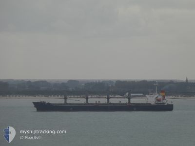
Bulk Carrier
Current Trip
| Time Travelled | 3 days |
|---|---|
| Remaining Time | 17 h, 15 mins |
| Distance Travelled | 1111.29 nm |
| Remaining Distance | 229.93 nm |
| AVG Speed | 12.6 Knots |
| MAX Speed | 14.3 Knots |
| AVG Wind | 8.6 knots |
| MAX Wind | 21 knots |
| MIN Temp | 8°C / 46.4°F |
| MAX Temp | 17.3°C / 63.14°F |
| Dybgang | 6.4 m |
| Position Modtaget | 1 m siden |
Current Position
| Longitude | 22.03254° |
|---|---|
| Latitude | 59.19817° |
| Status | Under way using engine |
| Fart | 13.4 Knots |
| Kurs | 53.3° |
| Område | Baltic Sea |
| Station | T-AIS |
| Position Modtaget | 1 m siden |
Info
Information
The current position of MILAS is in Baltic Sea with coordinates 59.19817° / 22.03254° as reported on 2024-05-21 05:22 by AIS to our vessel tracker app. The vessel's current speed is 13.4 Knots and is heading at the port of UST-LUGA. The estimated time of arrival as calculated by MyShipTracking vessel tracking app is 2024-05-21 22:39 LT
The vessel MILAS (IMO: 9279379, MMSI: 271051202) is a Bulk Carrier that was built in 2004 ( 20 år gamle ). It's sailing under the flag of [TR] Turkey.
In this page you can find informations about the vessels current position, last detected port calls, and current voyage information. If the vessels is not in coverage by AIS you will find the latest position.
The current position of MILAS is detected by our AIS receivers and we are not responsible for the reliability of the data. The last position was recorded while the vessel was in Coverage by the Ais receivers of our vessel tracking app.
The current draught of MILAS as reported by AIS is 6.4 meters
Weather
| Temperature | 8.1°C / 46.58°F |
|---|---|
| Wind Speed | 10 knots |
| Direction | 64° ENE |
| Pressure | 1022.5 hPa |
| Humidity | 81.6 % |
| Cloud Coverage | 10 % |
Featured Company
Last Port Calls
| Port | Arrival | Departure | Time In Port |
|---|---|---|---|
| 2024-05-11 05:18 | 2024-05-17 16:56 | 6 d | |
| 2024-04-27 12:13 | 2024-04-27 13:31 | 1 h | |
| 2024-04-22 15:04 | 2024-04-25 08:05 | 2 d | |
| 2024-04-14 21:34 | 2024-04-19 16:32 | 4 d | |
| 2024-04-14 11:03 | 2024-04-14 12:43 | 1 h | |
| 2024-04-01 22:39 | 2024-04-09 06:41 | 7 d | |
| 2024-03-22 23:48 |
Most Visited Ports (Last year)
| Port | Arrivals | |
|---|---|---|
| 5 | ||
| 2 | ||
| 1 | ||
| 1 | ||
| 1 | ||
| 1 |
Last Trips
| Origin | Departure | Destination | Arrival | Distance | |
|---|---|---|---|---|---|
| 2024-04-27 16:31 | 2024-05-11 07:18 | 3321.02 nm | |||
| 2024-04-25 11:05 | 2024-04-27 15:13 | 358.87 nm | |||
| 2024-04-19 19:32 | 2024-04-22 18:04 | 454.71 nm | |||
| 2024-04-14 15:43 | 2024-04-15 00:34 | 104.77 nm | |||
| 2024-04-09 09:41 | 2024-04-14 14:03 | 918.69 nm | |||
| 2024-03-23 01:48 | 2024-04-02 01:39 | 516.99 nm |
Events
| Tid | Hændelsen | Detaljer | Position / Dest | Info |
|---|---|---|---|---|
| 2024-05-21 00:08 | ETA er ændret | 2024/05/21 21:30 2024/05/21 20:30 |
58.28662 / 20.73378
RU ULU
|
Fart: 12.6 kn Kurs: 33.9° |
| 2024-05-20 22:41 | Ændre havområde | Estonian part of the Baltic Sea Latvian part of the Baltic Sea |
58.02721 / 20.41501
Baltic Sea
RU ULU
|
Fart: 12.8 kn Kurs: 33.7° |
| 2024-05-20 22:38 | Ændre havområde | Latvian part of the Baltic Sea Swedish part of the Baltic Sea |
58.01848 / 20.40391
Baltic Sea
RU ULU
|
Fart: 12.8 kn Kurs: 34.7° |
| 2024-05-20 19:04 | Status er ændret | Under way using engine Default |
57.32609 / 19.83321
RU ULU
|
Fart: 12.2 kn Kurs: 26° |
| 2024-05-20 19:00 | Status er ændret | Default Under way using engine |
57.31542 / 19.82385
RU ULU
|
Fart: 12.1 kn Kurs: 25.8° |
| 2024-05-20 18:23 | Status er ændret | Under way using engine Default |
57.20108 / 19.72038
RU ULU
|
Fart: 12.5 kn Kurs: 27° |
| 2024-05-20 18:09 | Indenfor Dækning |
57.20108 / 19.72038
Baltic Sea
RU ULU
|
Fart: 12.5 kn Kurs: 26.6° |
|
| 2024-05-20 14:00 | Status er ændret | Default Under way using engine |
56.40646 / 18.93502
RU ULU
|
Fart: 12.8 kn Kurs: 30.5° |
| 2024-05-20 13:55 | Udenfor Dækning |
56.39065 / 18.91877
Baltic Sea
RU ULU
|
Fart: 12.8 kn Kurs: 30.5° |
|
| 2024-05-20 13:40 | Status er ændret | Under way using engine Default |
56.34414 / 18.87016
RU ULU
|
Fart: 13.1 kn Kurs: 29° |