
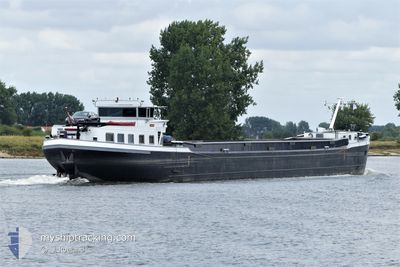
MILA
Cargo
Current Trip
GRUBBENVORST
| Time Travelled | 18 days |
|---|---|
| Remaining Time | --- |
| Distance Travelled | 141.92 nm |
| Remaining Distance | --- |
| AVG Speed | 7.6 Knots |
| MAX Speed | 12.1 Knots |
| AVG Wind | 8 knots |
| MAX Wind | 19.9 knots |
| MIN Temp | 8.5°C / 47.3°F |
| MAX Temp | 25.2°C / 77.36°F |
| Dybgang | 3.2 m |
| Position Modtaget | 7 h, 49 m siden |
Current Position
| Longitude | 6.02590° |
|---|---|
| Latitude | 51.59568° |
| Status | Under way using engine |
| Fart | 5.5 Knots |
| Kurs | 162° |
| Område | North Sea |
| Station | T-AIS |
| Position Modtaget | 7 h, 49 m siden |
Info
Information
The current position of MILA is in North Sea with coordinates 51.59568° / 6.02590° as reported on 2024-05-14 12:39 by AIS to our vessel tracker app. The vessel's current speed is 5.5 Knots
The vessel MILA (MMSI: 244660557) is a Cargo It's sailing under the flag of [NL] Netherlands.
In this page you can find informations about the vessels current position, last detected port calls, and current voyage information. If the vessels is not in coverage by AIS you will find the latest position.
The current position of MILA is detected by our AIS receivers and we are not responsible for the reliability of the data. The last position was recorded while the vessel was in Coverage by the Ais receivers of our vessel tracking app.
The current draught of MILA as reported by AIS is 3.2 meters
Weather
| Temperature | 25.1°C / 77.18°F |
|---|---|
| Wind Speed | 12 knots |
| Direction | 139° SE |
| Pressure | 1004.6 hPa |
| Humidity | 50.2 % |
| Cloud Coverage | 7 % |
Featured Company
Last Port Calls
| Port | Arrival | Departure | Time In Port |
|---|---|---|---|
| 2024-04-25 17:19 | 2024-04-26 15:33 | 22 h | |
| 2024-04-15 04:55 | |||
| 2024-04-07 17:07 | |||
| 2024-04-03 12:17 | |||
| 2024-03-15 19:42 | 2024-03-16 09:20 | 13 h | |
| 2024-03-09 15:23 | 2024-03-09 16:55 | 1 h | |
| 2024-03-08 20:39 | 2024-03-09 09:36 | 12 h | |
| 2024-03-07 15:58 | 2024-03-08 07:16 | 15 h | |
| 2024-03-07 12:32 | 2024-03-07 12:45 | 12 m | |
| 2024-03-07 01:23 | 2024-03-07 08:49 | 7 h |
Last Trips
| Origin | Departure | Destination | Arrival | Distance | |
|---|---|---|---|---|---|
| 2024-04-15 06:55 | 2024-04-25 19:19 | 100.89 nm | |||
| 2024-03-09 17:55 | 2024-03-15 20:42 | 326.85 nm | |||
| 2024-03-09 10:36 | 2024-03-09 16:23 | 43.81 nm | |||
| 2024-03-08 08:16 | 2024-03-08 21:39 | 67.17 nm | |||
| 2024-03-07 13:45 | 2024-03-07 16:58 | 20.67 nm | |||
| 2024-03-07 09:49 | 2024-03-07 13:32 | 1.46 nm | |||
| 2024-03-07 02:10 | 2024-03-07 02:23 | 0.64 nm | |||
| 2024-03-06 11:50 | 2024-03-07 01:51 | 98.74 nm | |||
| 2024-03-06 11:18 | 2024-03-06 11:24 | 1.01 nm | |||
| 2024-03-06 10:39 | 2024-03-06 10:44 | 0.56 nm |
Events
| Tid | Hændelsen | Detaljer | Position / Dest | Info |
|---|---|---|---|---|
| 2024-05-14 12:39 | Udenfor Dækning |
51.59568 / 6.02590
North Sea
|
Fart: 5.5 kn Kurs: 162° |
|
| 2024-05-14 12:05 | START Sejllads | 1.97 nm, South East of BOXMEER |
51.64058 / 5.98360
GRUBBENVORST
|
Fart: 3.2 kn Kurs: 123.6° |
| 2024-05-14 11:45 | Status er ændret | Under way using engine Moored |
51.64211 / 5.97896
GRUBBENVORST
|
Fart: Kurs: 511° |
| 2024-05-14 11:29 | Status er ændret | Moored Under way using engine |
51.64236 / 5.97805
GRUBBENVORST
|
Fart: Kurs: 511° |
| 2024-05-14 11:03 | STOP Sejllads | 1.77 nm, South East of BOXMEER |
51.64237 / 5.97803
GRUBBENVORST
|
Fart: 0.3 kn Kurs: 511° |
| 2024-05-14 10:59 | Indenfor Dækning |
51.64292 / 5.97658
North Sea
|
Fart: 2.9 kn Kurs: 121.8° |
|
| 2024-05-14 09:46 | Udenfor Dækning |
51.64561 / 5.97187
North Sea
|
Fart: Kurs: 264.1° |
|
| 2024-05-14 09:29 | STOP Sejllads | 1.5 nm, South of BOXMEER |
51.64561 / 5.97187
GRUBBENVORST
|
Fart: Kurs: 511° |
| 2024-05-14 09:22 | START Sejllads | 1.86 nm, South East of BOXMEER |
51.64107 / 5.97934
GRUBBENVORST
|
Fart: 9.1 kn Kurs: 299.5° |
| 2024-05-14 09:08 | STOP Sejllads | 1.96 nm, South East of BOXMEER |
51.64012 / 5.98210
GRUBBENVORST
|
Fart: Kurs: 511° |