
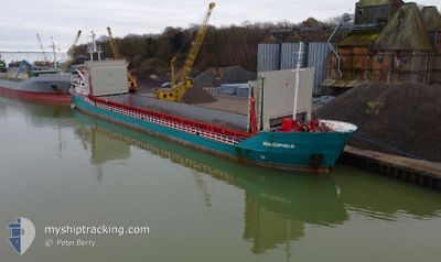
MIA SOPHIE-B
General Cargo
Current Trip
| Time Travelled | 1 day |
|---|---|
| Remaining Time | --- |
| Distance Travelled | 201.89 nm |
| Remaining Distance | --- |
| AVG Speed | 7.3 Knots |
| MAX Speed | 9.9 Knots |
| AVG Wind | 12.8 knots |
| MAX Wind | 18 knots |
| MIN Temp | 2.7°C / 36.86°F |
| MAX Temp | 7.4°C / 45.32°F |
| Dybgang | 4.4 m |
| Position Modtaget | 1 m siden |
Current Position
| Longitude | --- |
|---|---|
| Latitude | --- |
| Status | Under way using engine |
| Fart | 5.4 Knots |
| Kurs | 199.8° |
| Område | Baltic Sea |
| Station | T-AIS |
| Position Modtaget | 1 m siden |
Info
Information
The current position of MIA SOPHIE-B is in Baltic Sea with coordinates 54.24374° / 9.61290° as reported on 2025-03-02 18:10 by AIS to our vessel tracker app. The vessel's current speed is 5.4 Knots and is heading at the port of KINGS LYNN. The estimated time of arrival as calculated by MyShipTracking vessel tracking app is 2025-03-04 09:30 LT
The vessel MIA SOPHIE-B (IMO: 9113599, MMSI: 211734040) is a General Cargo that was built in 1995 ( 30 år gamle ). It's sailing under the flag of [DE] Germany.
In this page you can find informations about the vessels current position, last detected port calls, and current voyage information. If the vessels is not in coverage by AIS you will find the latest position.
The current position of MIA SOPHIE-B is detected by our AIS receivers and we are not responsible for the reliability of the data. The last position was recorded while the vessel was in Coverage by the Ais receivers of our vessel tracking app.
The current draught of MIA SOPHIE-B as reported by AIS is 4.4 meters
Weather
| Temperature | 5.4°C / 41.72°F |
|---|---|
| Wind Speed | 8 knots |
| Direction | 263° W |
| Pressure | 1030.5 hPa |
| Humidity | 87.9 % |
| Cloud Coverage | 100 % |
Featured Company
Last Port Calls
| Port | Arrival | Departure | Time In Port |
|---|---|---|---|
| 2025-02-28 16:37 | 2025-03-01 17:10 | 1 d | |
| 2025-02-20 04:13 | 2025-02-24 17:24 | 4 d | |
| 2025-02-19 15:21 | 2025-02-19 15:25 | 4 m | |
| 2025-02-06 14:57 | 2025-02-13 11:46 | 6 d | |
| 2025-02-04 01:15 | 2025-02-05 17:30 | 1 d | |
| 2025-01-16 09:04 | 2025-01-30 17:45 | 14 d | |
| 2025-01-10 16:12 | 2025-01-14 05:48 | 3 d | |
| 2025-01-09 02:37 | 2025-01-09 09:34 | 6 h | |
| 2025-01-08 09:34 | 2025-01-09 01:58 | 16 h |
Last Trips
| Origin | Departure | Destination | Arrival | Distance | |
|---|---|---|---|---|---|
| 2025-02-24 18:24 | 2025-02-28 17:37 | 260.39 nm | |||
| 2025-02-19 16:25 | 2025-02-20 05:13 | 111.17 nm | |||
| 2025-02-13 11:46 | 2025-02-19 16:21 | 1264.61 nm | |||
| 2025-02-05 17:30 | 2025-02-06 14:57 | 187.21 nm | |||
| 2025-01-30 18:45 | 2025-02-04 01:15 | 891.38 nm | |||
| 2025-01-14 05:48 | 2025-01-16 10:04 | 504.07 nm | |||
| 2025-01-09 10:34 | 2025-01-10 16:12 | 243.33 nm | |||
| 2025-01-09 02:58 | 2025-01-09 03:37 | 4.94 nm | |||
| 2024-12-28 09:07 | 2025-01-08 10:34 | 385.37 nm |
Events
| Tid | Hændelsen | Detaljer | Position / Dest | Info |
|---|---|---|---|---|
| 2025-03-02 14:24 | START Sejllads | 1.41 nm, South West of STICKENHΟRN SPORT |
54.36648 / 10.13906
GBKLN
|
Fart: 4.1 kn Kurs: 282° |
| 2025-03-02 13:57 | STOP Sejllads | 1.36 nm, South West of STICKENHΟRN SPORT |
54.36595 / 10.14225
GBKLN
|
Fart: 0.3 kn Kurs: 284° |
| 2025-03-02 13:42 | START Sejllads | 0.86 nm, South of STICKENHΟRN SPORT |
54.36870 / 10.16552
GBKLN
|
Fart: 4.8 kn Kurs: 213° |
| 2025-03-02 13:31 | STOP Sejllads | 0.75 nm, South of STICKENHΟRN SPORT |
54.37047 / 10.16649
GBKLN
|
Fart: 0.3 kn Kurs: 212° |
| 2025-03-02 11:07 | Ændre havområde | German part of the Baltic Sea Danish part of the Baltic Sea |
54.56732 / 10.55528
Baltic Sea
GBKLN
|
Fart: 9.5 kn Kurs: 244.8° |
| 2025-03-02 10:10 | Fundet i havområde | Danish part of the Baltic Sea |
54.58696 / 10.80288
Baltic Sea
GBKLN
|
Fart: 9 kn Kurs: 265.7° |
| 2025-03-02 07:52 | Ændre havområde | German part of the Baltic Sea Danish part of the Baltic Sea |
54.54963 / 11.35315
Baltic Sea
GBKLN
|
Fart: 8.3 kn Kurs: 294.4° |
| 2025-03-02 04:18 | ETA er ændret | 2025/03/04 09:30 2026/02/25 19:00 |
54.45538 / 12.16040
GBKLN
|
Fart: 9.1 kn Kurs: 217° |
| 2025-03-02 02:56 | Ændre havområde | Danish part of the Baltic Sea German part of the Baltic Sea |
54.54980 / 12.27160
Baltic Sea
|
Fart: 6.8 kn Kurs: 316.3° |
| 2025-03-01 21:52 | Dybgangen er ændret | 4.4 3.2 |
54.70099 / 13.46877
GBKLN
|
Fart: 9.8 kn Kurs: 292.8° |