
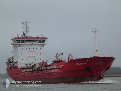
MED TUNCER
Tanker
Current Trip
| Time Travelled | 2 days |
|---|---|
| Remaining Time | 3 h, 1 mins |
| Distance Travelled | 615.03 nm |
| Remaining Distance | 42.30 nm |
| AVG Speed | 12.4 Knots |
| MAX Speed | 13.9 Knots |
| AVG Wind | 12 knots |
| MAX Wind | 23 knots |
| MIN Temp | 9.5°C / 49.1°F |
| MAX Temp | 15.4°C / 59.72°F |
| Dybgang | 5.2 m |
| Position Modtaget | 13 m siden |
Current Position
| Longitude | --- |
|---|---|
| Latitude | --- |
| Status | Under way using engine |
| Fart | 13.2 Knots |
| Kurs | 229.3° |
| Område | Ionian Sea |
| Station | T-AIS |
| Position Modtaget | 13 m siden |
Info
Information
The current position of MED TUNCER is in Ionian Sea with coordinates 37.62907° / 15.90696° as reported on 2025-03-17 21:49 by AIS to our vessel tracker app. The vessel's current speed is 13.2 Knots and is heading at the port of AUGUSTA. The estimated time of arrival as calculated by MyShipTracking vessel tracking app is 2025-03-18 02:04 LT
The vessel MED TUNCER (IMO: 9830599, MMSI: 215033000) is a Tanker It's sailing under the flag of [MT] Malta.
In this page you can find informations about the vessels current position, last detected port calls, and current voyage information. If the vessels is not in coverage by AIS you will find the latest position.
The current position of MED TUNCER is detected by our AIS receivers and we are not responsible for the reliability of the data. The last position was recorded while the vessel was in Coverage by the Ais receivers of our vessel tracking app.
The current draught of MED TUNCER as reported by AIS is 5.2 meters
Weather
| Temperature | 14.9°C / 58.82°F |
|---|---|
| Wind Speed | 6 knots |
| Direction | 6° N |
| Pressure | 1017.9 hPa |
| Humidity | 55.7 % |
| Cloud Coverage | 5 % |
Featured Company
Last Port Calls
| Port | Arrival | Departure | Time In Port |
|---|---|---|---|
| 2025-03-14 15:13 | 2025-03-15 21:13 | 1 d | |
| 2025-03-08 13:53 | 2025-03-09 14:29 | 1 d | |
| 2025-03-05 06:30 | 2025-03-05 12:11 | 5 h | |
| 2025-03-02 16:00 | 2025-03-03 15:53 | 23 h | |
| 2025-02-28 17:10 | 2025-03-02 06:38 | 1 d | |
| 2025-02-27 08:10 | 2025-02-28 07:47 | 23 h | |
| 2025-02-25 22:03 | 2025-02-26 16:45 | 18 h | |
| 2025-02-17 23:57 | 2025-02-25 21:28 | 7 d | |
| 2025-02-14 01:34 | 2025-02-16 05:38 | 2 d | |
| 2025-02-09 20:39 | 2025-02-11 06:11 | 1 d |
Most Visited Ports (Last year)
| Port | Arrivals | |
|---|---|---|
| 8 | ||
| 7 | ||
| 5 | ||
| 4 | ||
| 2 | ||
| 2 |
Last Trips
| Origin | Departure | Destination | Arrival | Distance | |
|---|---|---|---|---|---|
| 2025-03-09 14:29 | 2025-03-14 15:13 | 1358.21 nm | |||
| 2025-03-05 12:11 | 2025-03-08 13:53 | 5.73 nm | |||
| 2025-03-03 15:53 | 2025-03-05 06:30 | 7.55 nm | |||
| 2025-03-02 06:38 | 2025-03-02 16:00 | 3.30 nm | |||
| 2025-02-28 07:47 | 2025-02-28 17:10 | 104.20 nm | |||
| 2025-02-26 16:45 | 2025-02-27 08:10 | 101.40 nm | |||
| 2025-02-25 21:28 | 2025-02-25 22:03 | 3.32 nm | |||
| 2025-02-16 05:38 | 2025-02-17 23:57 | 184.05 nm | |||
| 2025-02-11 06:11 | 2025-02-14 01:34 | 196.19 nm | |||
| 2025-02-08 02:04 | 2025-02-09 20:39 | 416.54 nm |
Events
| Tid | Hændelsen | Detaljer | Position / Dest | Info |
|---|---|---|---|---|
| 2025-03-17 20:53 | Ændre havområde | Italian part of the Ionian Sea Italian part of the Adriatic Sea |
37.76599 / 16.10351
Ionian Sea
HRRJK>ITAUG
|
Fart: 13.4 kn Kurs: 229.4° |
| 2025-03-17 20:52 | Status er ændret | Under way using engine Default |
37.76721 / 16.10528
HRRJK>ITAUG
|
Fart: 13.3 kn Kurs: 229° |
| 2025-03-17 20:39 | Indenfor Dækning |
37.76599 / 16.10351
Ionian Sea
HRRJK>ITAUG
|
Fart: 13.4 kn Kurs: 229.4° |
|
| 2025-03-17 05:46 | Status er ændret | Default Under way using engine |
40.06435 / 18.72448
HRRJK>ITAUG
|
Fart: 12.3 kn Kurs: 195.3° |
| 2025-03-17 05:40 | Udenfor Dækning |
40.08478 / 18.73154
Adriatic Sea
HRRJK>ITAUG
|
Fart: 12.3 kn Kurs: 195.3° |
|
| 2025-03-17 05:32 | Status er ændret | Under way using engine Default |
40.10958 / 18.73995
HRRJK>ITAUG
|
Fart: 12.4 kn Kurs: 195° |
| 2025-03-17 05:30 | Status er ændret | Default Under way using engine |
40.11796 / 18.74293
HRRJK>ITAUG
|
Fart: 12.5 kn Kurs: 195.7° |
| 2025-03-17 05:15 | Status er ændret | Under way using engine Default |
40.16790 / 18.76104
HRRJK>ITAUG
|
Fart: 12 kn Kurs: 170° |
| 2025-03-17 05:10 | Status er ændret | Default Under way using engine |
40.18285 / 18.75352
HRRJK>ITAUG
|
Fart: 12.7 kn Kurs: 150.2° |
| 2025-03-17 04:55 | Status er ændret | Under way using engine Default |
40.22892 / 18.71893
HRRJK>ITAUG
|
Fart: 12.9 kn Kurs: 150° |