

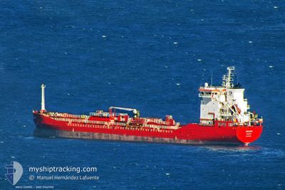
MED EMRE
Tanker

Current Trip
| Time Travelled | 4 days |
|---|---|
| Remaining Time | 23 h, 22 mins |
| Distance Travelled | 1097.46 nm |
| Remaining Distance | 318.50 nm |
| AVG Speed | 11.5 Knots |
| MAX Speed | 14.4 Knots |
| AVG Wind | 10.6 knots |
| MAX Wind | 19 knots |
| MIN Temp | 6.9°C / 44.42°F |
| MAX Temp | 14.6°C / 58.28°F |
| Dybgang | 7.4 m |
| Position Modtaget | 1 h, 56 m siden |
Current Position
| Longitude | --- |
|---|---|
| Latitude | --- |
| Status | Under way using engine |
| Fart | 13.3 Knots |
| Kurs | 57° |
| Område | English Channel |
| Station | T-AIS |
| Position Modtaget | 1 h, 56 m siden |
Information
The current position of MED EMRE is in English Channel with coordinates 49.59226° / -3.54331° as reported on 2025-03-27 18:46 by AIS to our vessel tracker app. The vessel's current speed is 13.3 Knots and is heading at the port of ANTWERP. The estimated time of arrival as calculated by MyShipTracking vessel tracking app is 2025-03-28 21:04 LT
The vessel MED EMRE (IMO: 9461910, MMSI: 215402000) is a Tanker It's sailing under the flag of [MT] Malta.
In this page you can find informations about the vessels current position, last detected port calls, and current voyage information. If the vessels is not in coverage by AIS you will find the latest position.
The current position of MED EMRE is detected by our AIS receivers and we are not responsible for the reliability of the data. The last position was recorded while the vessel was in Coverage by the Ais receivers of our vessel tracking app.
The current draught of MED EMRE as reported by AIS is 7.4 meters
Weather
| Temperature | 11°C / 51.8°F |
|---|---|
| Wind Speed | 9 knots |
| Direction | 241° WSW |
| Pressure | 1019.3 hPa |
| Humidity | 87.6 % |
| Cloud Coverage | 6 % |


Featured Company
Last Port Calls
| Port | Arrival | Departure | Time In Port |
|---|---|---|---|
| 2025-03-22 13:07 | 2025-03-23 21:07 | 1 d | |
| 2025-03-18 18:54 | 2025-03-18 22:45 | 3 h | |
| 2025-03-16 15:22 | 2025-03-17 16:39 | 1 d | |
| 2025-03-15 00:47 | 2025-03-15 16:35 | 15 h | |
| 2025-03-09 06:57 | 2025-03-09 16:44 | 9 h | |
| 2025-03-05 12:23 | 2025-03-06 22:40 | 1 d | |
| 2025-02-28 20:13 | 2025-03-01 13:53 | 17 h | |
| 2025-02-24 15:45 | 2025-02-24 23:31 | 7 h | |
| 2025-02-22 11:46 | 2025-02-23 09:30 | 22 h | |
| 2025-02-20 07:49 | 2025-02-21 09:49 | 1 d |
Most Visited Ports (Last year)
| Port | Arrivals | |
|---|---|---|
| 25 | ||
| 9 | ||
| 7 | ||
| 7 | ||
| 3 | ||
| 3 |
Last Trips
| Origin | Departure | Destination | Arrival | Distance | |
|---|---|---|---|---|---|
| 2025-03-18 22:45 | 2025-03-22 13:07 | 281.86 nm | |||
| 2025-03-17 16:39 | 2025-03-18 18:54 | 52.00 nm | |||
| 2025-03-15 16:35 | 2025-03-16 15:22 | 252.39 nm | |||
| 2025-03-09 16:44 | 2025-03-15 00:47 | 181.64 nm | |||
| 2025-03-06 22:40 | 2025-03-09 06:57 | 602.64 nm | |||
| 2025-03-01 13:53 | 2025-03-05 12:23 | 473.04 nm | |||
| 2025-02-24 23:31 | 2025-02-28 20:13 | 23.10 nm | |||
| 2025-02-23 09:30 | 2025-02-24 15:45 | 233.02 nm | |||
| 2025-02-21 09:49 | 2025-02-22 11:46 | 297.60 nm | |||
| 2025-02-12 21:49 | 2025-02-20 07:49 | 471.94 nm |
Events
| Tid | Hændelsen | Detaljer | Position / Dest | Info |
|---|---|---|---|---|
| 2025-03-27 18:52 | Status er ændret | Default Under way using engine |
49.60434 / -3.51390
BEANR
|
Fart: 13.3 kn Kurs: 57° |
| 2025-03-27 18:46 | Udenfor Dækning |
49.59226 / -3.54331
English Channel
BEANR
|
Fart: 13.3 kn Kurs: 57° |
|
| 2025-03-27 18:44 | Status er ændret | Under way using engine Default |
49.58978 / -3.54919
BEANR
|
Fart: 13.3 kn Kurs: 57° |
| 2025-03-27 18:32 | Status er ændret | Default Under way using engine |
49.56417 / -3.60944
BEANR
|
Fart: 13.4 kn Kurs: 57.8° |
| 2025-03-27 18:24 | Ændre havområde | Guernsey part of the English Channel French part of the English Channel |
49.54814 / -3.64801
English Channel
BEANR
|
Fart: 13.4 kn Kurs: 57.8° |
| 2025-03-27 18:24 | Status er ændret | Under way using engine Default |
49.54814 / -3.64801
BEANR
|
Fart: 13.5 kn Kurs: 57° |
| 2025-03-27 18:20 | Status er ændret | Default Under way using engine |
49.54042 / -3.66651
BEANR
|
Fart: 13.5 kn Kurs: 56.9° |
| 2025-03-27 18:13 | Status er ændret | Under way using engine Default |
49.52737 / -3.69819
BEANR
|
Fart: 13.4 kn Kurs: 57° |
| 2025-03-27 18:04 | Status er ændret | Default Under way using engine |
49.50764 / -3.74649
BEANR
|
Fart: 13.5 kn Kurs: 56.9° |
| 2025-03-27 17:51 | Status er ændret | Under way using engine Default |
49.48197 / -3.80897
BEANR
|
Fart: 13.7 kn Kurs: 61° |