

MEANDI
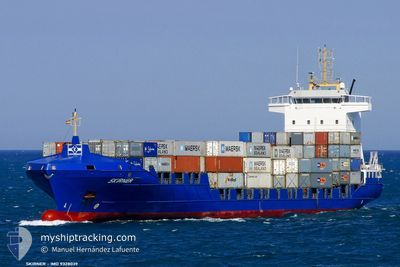
Container Ship

Current Trip
| Time Travelled | 1 day |
|---|---|
| Remaining Time | --- |
| Distance Travelled | 668.28 nm |
| Remaining Distance | --- |
| AVG Speed | 14.2 Knots |
| MAX Speed | 15.8 Knots |
| AVG Wind | 13.6 knots |
| MAX Wind | 22 knots |
| MIN Temp | 13.3°C / 55.94°F |
| MAX Temp | 18°C / 64.4°F |
| Dybgang | 6.3 m |
| Position Modtaget | 2 m siden |
Current Position
| Longitude | --- |
|---|---|
| Latitude | --- |
| Status | Under way using engine |
| Fart | 11.8 Knots |
| Kurs | 40° |
| Område | North Atlantic Ocean |
| Station | T-AIS |
| Position Modtaget | 2 m siden |
Information
The current position of MEANDI is in North Atlantic Ocean with coordinates 36.63757° / -6.86498° as reported on 2025-03-26 20:04 by AIS to our vessel tracker app. The vessel's current speed is 11.8 Knots and is heading at the port of CHIPIONA. The estimated time of arrival as calculated by MyShipTracking vessel tracking app is 2025-03-26 23:30 LT
The vessel MEANDI (IMO: 9328039, MMSI: 255805841) is a Container Ship that was built in 2006 ( 19 år gamle ). It's sailing under the flag of [PT] Portugal.
In this page you can find informations about the vessels current position, last detected port calls, and current voyage information. If the vessels is not in coverage by AIS you will find the latest position.
The current position of MEANDI is detected by our AIS receivers and we are not responsible for the reliability of the data. The last position was recorded while the vessel was in Coverage by the Ais receivers of our vessel tracking app.
The current draught of MEANDI as reported by AIS is 6.3 meters
Weather
| Temperature | 16.1°C / 60.98°F |
|---|---|
| Wind Speed | 11 knots |
| Direction | 268° W |
| Pressure | 1020.5 hPa |
| Humidity | 79.7 % |
| Cloud Coverage | --- |


Featured Company
Last Port Calls
| Port | Arrival | Departure | Time In Port |
|---|---|---|---|
| 2025-03-24 10:59 | 2025-03-24 21:56 | 10 h | |
| 2025-03-24 02:57 | 2025-03-24 06:45 | 3 h | |
| 2025-03-21 07:15 | 2025-03-22 05:30 | 22 h | |
| 2025-03-18 08:51 | 2025-03-18 20:27 | 11 h | |
| 2025-03-17 22:52 | 2025-03-18 04:40 | 5 h | |
| 2025-03-14 12:08 | 2025-03-15 02:38 | 14 h | |
| 2025-03-11 03:03 | 2025-03-11 14:54 | 11 h | |
| 2025-03-10 18:06 | 2025-03-10 23:05 | 4 h | |
| 2025-03-07 07:14 | 2025-03-08 05:48 | 22 h | |
| 2025-03-04 07:01 | 2025-03-04 12:39 | 5 h |
Last Trips
| Origin | Departure | Destination | Arrival | Distance | |
|---|---|---|---|---|---|
| 2025-03-24 06:45 | 2025-03-24 10:59 | 58.12 nm | |||
| 2025-03-22 05:30 | 2025-03-24 02:57 | 705.48 nm | |||
| 2025-03-18 20:27 | 2025-03-21 07:15 | 707.74 nm | |||
| 2025-03-18 04:40 | 2025-03-18 08:51 | 54.18 nm | |||
| 2025-03-15 02:38 | 2025-03-17 22:52 | 1016.08 nm | |||
| 2025-03-11 14:54 | 2025-03-14 12:08 | 1014.84 nm | |||
| 2025-03-10 23:05 | 2025-03-11 03:03 | 55.31 nm | |||
| 2025-03-08 05:48 | 2025-03-10 18:06 | 726.93 nm | |||
| 2025-03-04 12:39 | 2025-03-07 07:14 | 702.37 nm | |||
| 2025-03-04 03:05 | 2025-03-04 07:01 | 53.52 nm |
Events
| Tid | Hændelsen | Detaljer | Position / Dest | Info |
|---|---|---|---|---|
| 2025-03-26 19:52 | Status er ændret | Under way using engine Default |
36.60641 / -6.89734
CHIPIONA PLT
|
Fart: 11.7 kn Kurs: 41° |
| 2025-03-26 19:16 | Status er ændret | Default Under way using engine |
36.51512 / -6.99053
CHIPIONA PLT
|
Fart: 12 kn Kurs: 39.8° |
| 2025-03-26 19:10 | Status er ændret | Under way using engine Default |
36.49959 / -7.00718
CHIPIONA PLT
|
Fart: 12.1 kn Kurs: 39° |
| 2025-03-26 19:08 | Status er ændret | Default Under way using engine |
36.49445 / -7.01260
CHIPIONA PLT
|
Fart: 12.3 kn Kurs: 40° |
| 2025-03-26 19:01 | Status er ændret | Under way using engine Default |
36.47724 / -7.03068
CHIPIONA PLT
|
Fart: 12.2 kn Kurs: 39° |
| 2025-03-26 18:36 | Status er ændret | Default Under way using engine |
36.41107 / -7.10033
CHIPIONA PLT
|
Fart: 12.7 kn Kurs: 41.5° |
| 2025-03-26 18:29 | Destination er ændret | CHIPIONA PLT ESSVQ |
36.39049 / -7.12232
CHIPIONA PLT
|
Fart: 12.6 kn Kurs: 41° |
| 2025-03-26 18:28 | Status er ændret | Under way using engine Default |
36.39009 / -7.12279
ESSVQ
|
Fart: 12.6 kn Kurs: 41° |
| 2025-03-26 18:20 | Status er ændret | Default Under way using engine |
36.36716 / -7.14661
ESSVQ
|
Fart: 13.1 kn Kurs: 41.2° |
| 2025-03-26 18:14 | Fundet i havområde | Spanish part of the North Atlantic Ocean |
36.35237 / -7.16188
North Atlantic Ocean
ESSVQ
|
Fart: 13.1 kn Kurs: 41.2° |