
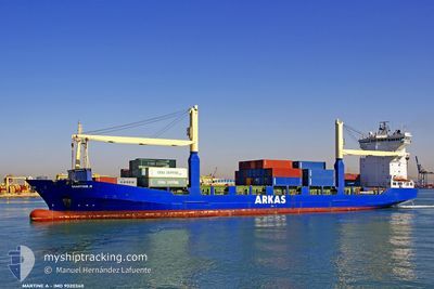
MARTINE A
Container Ship
Current Trip
| Trip Time | --- |
|---|---|
| Trip Distance | --- |
| AVG Speed | --- |
| MAX Speed | --- |
| Dybgang | --- |
| AVG Wind | --- |
| MAX Wind | --- |
| MIN Temp | --- |
| MAX Temp | --- |
| Position Modtaget | 4 d siden |
Current Position
| Longitude | --- |
|---|---|
| Latitude | --- |
| Status | Under way using engine |
| Fart | 10 Knots |
| Kurs | 241.2° |
| Område | Mediterranean Sea - Eastern Basin |
| Station | T-AIS |
| Position Modtaget | 4 d siden |
Information
The current position of MARTINE A is in Mediterranean Sea - Eastern Basin with coordinates 35.86062° / 22.75673° as reported on 2025-03-23 18:33 by AIS to our vessel tracker app. The vessel's current speed is 10 Knots and is currently inside the port of TRIPOLI.
The vessel MARTINE A (IMO: 9020340, MMSI: 271041000) is a Container Ship that was built in 1993 ( 32 år gamle ). It's sailing under the flag of [TR] Turkey.
In this page you can find informations about the vessels current position, last detected port calls, and current voyage information. If the vessels is not in coverage by AIS you will find the latest position.
The current position of MARTINE A is detected by our AIS receivers and we are not responsible for the reliability of the data. The last position was recorded while the vessel was in Coverage by the Ais receivers of our vessel tracking app.
The current draught of MARTINE A as reported by AIS is 8.2 meters
Weather
| Temperature | 16.7°C / 62.06°F |
|---|---|
| Wind Speed | 13 knots |
| Direction | 246° WSW |
| Pressure | 1013.8 hPa |
| Humidity | 57.7 % |
| Cloud Coverage | 3 % |
Featured Company
Last Port Calls
| Port | Arrival | Departure | Time In Port |
|---|---|---|---|
| 2025-03-25 14:06 | 2025-03-27 01:32 | 1 d | |
| 2025-03-21 07:21 | 2025-03-21 20:05 | 12 h | |
| 2025-03-19 15:19 | 2025-03-20 02:31 | 11 h | |
| 2025-03-18 15:37 | 2025-03-19 05:33 | 13 h | |
| 2025-03-15 07:29 | 2025-03-16 00:04 | 16 h | |
| 2025-03-06 13:56 | 2025-03-08 10:17 | 1 d | |
| 2025-03-02 14:26 | 2025-03-04 19:31 | 2 d | |
| 2025-02-25 09:26 | 2025-02-26 20:29 | 1 d | |
| 2025-02-24 07:22 | 2025-02-24 23:46 | 16 h | |
| 2025-02-14 09:56 | 2025-02-20 05:28 | 5 d |
Last Trips
| Origin | Departure | Destination | Arrival | Distance | |
|---|---|---|---|---|---|
| 2025-03-21 23:05 | 2025-03-25 16:06 | 897.54 nm | |||
| 2025-03-20 05:31 | 2025-03-21 10:21 | 50.78 nm | |||
| 2025-03-19 08:33 | 2025-03-19 18:19 | 64.84 nm | |||
| 2025-03-16 03:04 | 2025-03-18 18:37 | 840.11 nm | |||
| 2025-03-08 12:17 | 2025-03-15 10:29 | 836.01 nm | |||
| 2025-03-04 21:31 | 2025-03-06 15:56 | 247.53 nm | |||
| 2025-02-26 23:29 | 2025-03-02 16:26 | 921.01 nm | |||
| 2025-02-25 02:46 | 2025-02-25 12:26 | 66.94 nm | |||
| 2025-02-20 06:28 | 2025-02-24 10:22 | 1018.42 nm | |||
| 2025-02-12 15:17 | 2025-02-14 10:56 | 186.14 nm |
Events
| Tid | Hændelsen | Detaljer | Position / Dest | Info |
|---|---|---|---|---|
| 2025-03-27 01:32 | Afsejlet fra sidste havn |
|
32.69941 / 14.85634
LYMRA
|
Fart: Kurs: 2° |
| 2025-03-25 14:37 | STOP Sejllads |
32.36591 / 15.21716
[LY] MISURATA
|
Fart: Kurs: 1° |
|
| 2025-03-25 14:06 | Skibe i havn |
|
32.37202 / 15.22571
[LY] MISURATA
|
Fart: 3.8 kn Kurs: 265° |
| 2025-03-25 13:30 | START Sejllads | 1.95 nm, North East of MISURATA |
32.37622 / 15.26928
LYMRA
|
Fart: 6.2 kn Kurs: 263° |
| 2025-03-25 12:50 | STOP Sejllads | 2.74 nm, East of MISURATA |
32.37288 / 15.28826
LYMRA
|
Fart: Kurs: 277° |
| 2025-03-23 18:35 | Status er ændret | Default Under way using engine |
35.85820 / 22.75144
LYMRA
|
Fart: 10 kn Kurs: 241.2° |
| 2025-03-23 18:33 | Udenfor Dækning |
35.86062 / 22.75673
Mediterranean Sea - Eastern Basin
LYMRA
|
Fart: 10 kn Kurs: 241.2° |
|
| 2025-03-23 17:09 | Ændre havområde | Greek part of the Mediterranean Sea - Eastern Basin Greek part of the Aegean Sea |
35.97002 / 23.00223
Mediterranean Sea - Eastern Basin
LYMRA
|
Fart: 9.3 kn Kurs: 238.4° |
| 2025-03-23 17:09 | Status er ændret | Under way using engine Default |
35.97002 / 23.00223
LYMRA
|
Fart: 9.5 kn Kurs: 238° |
| 2025-03-23 16:55 | Indenfor Dækning |
35.97002 / 23.00223
Mediterranean Sea - Eastern Basin
LYMRA
|
Fart: 9.3 kn Kurs: 238.4° |