
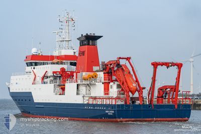
MARIA S. MERIAN
Research/Survey Vessel
Current Trip
| Trip Time | 28 days |
|---|---|
| Trip Distance | 4026.41 nm |
| AVG Speed | 9.1 Knots |
| MAX Speed | 12.1 Knots |
| Dybgang | 7 m |
| AVG Wind | 12.9 knots |
| MAX Wind | 26.9 knots |
| MIN Temp | 0.1°C / 32.18°F |
| MAX Temp | 9.5°C / 49.1°F |
| Position Modtaget | 29 d siden |
Current Position
| Longitude | -52.35201° |
|---|---|
| Latitude | 47.70236° |
| Status | Under way using engine |
| Fart | 10.7 Knots |
| Kurs | 11.5° |
| Område | North Atlantic Ocean |
| Station | T-AIS |
| Position Modtaget | 29 d siden |
Info
Information
The current position of MARIA S. MERIAN is in North Atlantic Ocean with coordinates 47.70236° / -52.35201° as reported on 2024-06-07 12:52 by AIS to our vessel tracker app. The vessel's current speed is 10.7 Knots and is currently inside the port of REYKJAVIK.
The vessel MARIA S. MERIAN (IMO: 9274197, MMSI: 211753000) is a Research/Survey Vessel that was built in 2006 ( 18 år gamle ). It's sailing under the flag of [DE] Germany.
In this page you can find informations about the vessels current position, last detected port calls, and current voyage information. If the vessels is not in coverage by AIS you will find the latest position.
The current position of MARIA S. MERIAN is detected by our AIS receivers and we are not responsible for the reliability of the data. The last position was recorded while the vessel was in Coverage by the Ais receivers of our vessel tracking app.
The current draught of MARIA S. MERIAN as reported by AIS is 7 meters
Weather
| Temperature | 12.2°C / 53.96°F |
|---|---|
| Wind Speed | 10 knots |
| Direction | 4° N |
| Pressure | 1006.5 hPa |
| Humidity | 65.8 % |
| Cloud Coverage | 100 % |
Featured Company
Events
| Tid | Hændelsen | Detaljer | Position / Dest | Info |
|---|---|---|---|---|
| 2024-07-06 08:38 | STOP Sejllads |
64.15411 / -21.94237
[IS] REYKJAVIK
|
Fart: 0.3 kn Kurs: 320° |
|
| 2024-07-06 08:23 | Skibe i havn |
|
64.15353 / -21.92703
[IS] REYKJAVIK
|
Fart: 8.4 kn Kurs: 156° |
| 2024-07-03 18:05 | START Sejllads |
59.74789 / -37.24913
ISREY
|
Fart: 4.2 kn Kurs: 219° |
|
| 2024-07-03 16:02 | STOP Sejllads |
59.75422 / -37.21822
ISREY
|
Fart: 0.3 kn Kurs: 209° |
|
| 2024-07-03 13:27 | START Sejllads |
59.61530 / -36.48180
ISREY
|
Fart: 9.3 kn Kurs: 282° |
|
| 2024-07-03 11:11 | STOP Sejllads |
59.60350 / -36.42396
ISREY
|
Fart: 0.1 kn Kurs: 226° |
|
| 2024-07-03 02:13 | START Sejllads |
59.67514 / -39.29838
ISREY
|
Fart: 4.2 kn Kurs: 227° |
|
| 2024-07-03 00:23 | STOP Sejllads |
59.68029 / -39.30432
ISREY
|
Fart: 0.1 kn Kurs: 249° |
|
| 2024-07-02 22:27 | START Sejllads |
59.72503 / -39.82693
ISREY
|
Fart: 10 kn Kurs: 99° |
|
| 2024-07-02 20:31 | STOP Sejllads |
59.73071 / -39.82567
ISREY
|
Fart: 0.3 kn Kurs: 249° |