
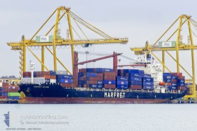
MARFRET GUYANE
Container Ship
Current Trip
| Time Travelled | 2 days |
|---|---|
| Remaining Time | --- |
| Distance Travelled | 725.71 nm |
| Remaining Distance | --- |
| AVG Speed | 13 Knots |
| MAX Speed | 14.9 Knots |
| AVG Wind | 12.8 knots |
| MAX Wind | 23 knots |
| MIN Temp | 18.9°C / 66.02°F |
| MAX Temp | 31.3°C / 88.34°F |
| Dybgang | 7.8 m |
| Position Modtaget | 2 d siden |
Current Position
| Longitude | -69.58483° |
|---|---|
| Latitude | 18.40250° |
| Status | Under way using engine |
| Fart | 13.7 Knots |
| Kurs | 129° |
| Område | Caribbean Sea |
| Station | T-AIS |
| Position Modtaget | 2 d siden |
Info
Information
The current position of MARFRET GUYANE is in Caribbean Sea with coordinates 18.40250° / -69.58483° as reported on 2024-04-26 17:27 by AIS to our vessel tracker app. The vessel's current speed is 13.7 Knots and is heading at the port of SAINT JOHN. The estimated time of arrival as calculated by MyShipTracking vessel tracking app is 2024-05-03 09:00 LT
The vessel MARFRET GUYANE (IMO: 9362334, MMSI: 226324000) is a Container Ship that was built in 2007 ( 17 år gamle ). It's sailing under the flag of [FR] France.
In this page you can find informations about the vessels current position, last detected port calls, and current voyage information. If the vessels is not in coverage by AIS you will find the latest position.
The current position of MARFRET GUYANE is detected by our AIS receivers and we are not responsible for the reliability of the data. The last position was recorded while the vessel was in Coverage by the Ais receivers of our vessel tracking app.
The current draught of MARFRET GUYANE as reported by AIS is 7.8 meters
Weather
| Temperature | 18.9°C / 66.02°F |
|---|---|
| Wind Speed | 13 knots |
| Direction | 27° NNE |
| Pressure | 1022.5 hPa |
| Humidity | 59.8 % |
| Cloud Coverage | 100 % |
Featured Company
Last Port Calls
| Port | Arrival | Departure | Time In Port |
|---|---|---|---|
| 2024-04-25 21:52 | 2024-04-26 17:18 | 19 h | |
| 2024-04-23 23:00 | 2024-04-24 08:38 | 9 h | |
| 2024-04-21 09:14 | 2024-04-22 05:06 | 19 h | |
| 2024-04-15 09:11 | 2024-04-15 10:30 | 1 h | |
| 2024-04-12 09:11 | 2024-04-13 02:44 | 17 h | |
| 2024-04-05 19:00 | 2024-04-06 04:16 | 9 h | |
| 2024-04-04 22:37 | 2024-04-05 11:09 | 12 h | |
| 2024-03-27 22:19 | 2024-04-03 15:07 | 6 d | |
| 2024-03-24 18:37 | 2024-03-25 11:09 | 16 h | |
| 2024-03-24 18:05 | 2024-03-24 18:17 | 12 m |
Most Visited Ports (Last year)
| Port | Arrivals | |
|---|---|---|
| 22 | ||
| 13 | ||
| 11 | ||
| 10 | ||
| 7 | ||
| 7 |
Last Trips
| Origin | Departure | Destination | Arrival | Distance | |
|---|---|---|---|---|---|
| 2024-04-24 04:38 | 2024-04-25 17:52 | 75.91 nm | |||
| 2024-04-22 00:06 | 2024-04-23 19:00 | 443.62 nm | |||
| 2024-04-15 06:30 | 2024-04-21 04:14 | 1525.41 nm | |||
| 2024-04-12 23:44 | 2024-04-15 05:11 | 582.91 nm | |||
| 2024-04-06 00:16 | 2024-04-12 06:11 | 1750.60 nm | |||
| 2024-04-05 07:09 | 2024-04-05 15:00 | 37.50 nm | |||
| 2024-04-03 10:07 | 2024-04-04 18:37 | 430.61 nm | |||
| 2024-03-25 07:09 | 2024-03-27 17:19 | 770.89 nm | |||
| 2024-03-24 14:17 | 2024-03-24 14:37 | 0.98 nm | |||
| 2024-03-21 17:35 | 2024-03-24 14:05 | 871.64 nm |
Events
| Tid | Hændelsen | Detaljer | Position / Dest | Info |
|---|---|---|---|---|
| 2024-04-26 17:30 | Status er ændret | Default Under way using engine |
18.39567 / -69.57567
CASJB
|
Fart: 13.7 kn Kurs: 129° |
| 2024-04-26 17:27 | Udenfor Dækning |
18.40250 / -69.58483
Caribbean Sea
CASJB
|
Fart: 13.7 kn Kurs: 129° |
|
| 2024-04-26 17:18 | Afsejlet fra sidste havn |
|
18.42300 / -69.61167
CASJB
|
Fart: 8.3 kn Kurs: 117° |
| 2024-04-26 17:09 | START Sejllads |
18.42683 / -69.62967
[DO] BOCA CHIKA
|
Fart: 3.6 kn Kurs: 22° |
|
| 2024-04-26 17:07 | Status er ændret | Under way using engine Default |
18.42550 / -69.63017
[DO] BOCA CHIKA
|
Fart: Kurs: 349° |
| 2024-04-26 17:07 | Indenfor Dækning |
18.42583 / -69.63000
Caribbean Sea
[DO] BOCA CHIKA
|
Fart: 2.2 kn Kurs: 20° |
|
| 2024-04-26 16:26 | Status er ændret | Default Moored |
18.42500 / -69.63050
[DO] BOCA CHIKA
|
Fart: Kurs: 349° |
| 2024-04-26 16:05 | Status er ændret | Moored Default |
18.42517 / -69.63050
[DO] BOCA CHIKA
|
Fart: Kurs: 349° |
| 2024-04-26 16:05 | Indenfor Dækning |
18.42517 / -69.63050
Caribbean Sea
[DO] BOCA CHIKA
|
Fart: Kurs: 318° |
|
| 2024-04-26 16:05 | Udenfor Dækning |
18.42517 / -69.63050
Caribbean Sea
[DO] BOCA CHIKA
|
Fart: Kurs: 318° |