
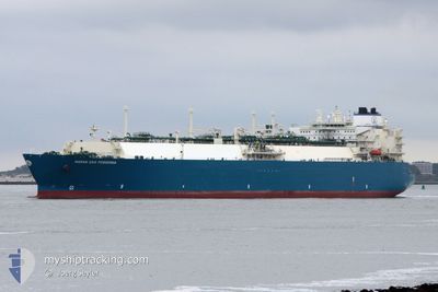
MARAN GAS POSIDONIA
Lng Tanker
Current Trip
| Time Travelled | 7 days |
|---|---|
| Remaining Time | --- |
| Distance Travelled | 1957.79 nm |
| Remaining Distance | --- |
| AVG Speed | 13.4 Knots |
| MAX Speed | 16.4 Knots |
| AVG Wind | 18.3 knots |
| MAX Wind | 30 knots |
| MIN Temp | 23.8°C / 74.84°F |
| MAX Temp | 28.6°C / 83.48°F |
| Dybgang | 9.2 m |
| Position Modtaget | 2025-10-27 22:07 |
Current Position
| Longitude | --- |
|---|---|
| Latitude | --- |
| Status | Under way using engine |
| Fart | 15.8 Knots |
| Kurs | 183.2° |
| Område | Philippine Sea |
| Station | T-AIS |
| Position Modtaget | 2025-10-27 22:07 |
Info
Information
The current position of MARAN GAS POSIDONIA is in Philippine Sea with coordinates 24.57374° / 122.64543° as reported on 2025-10-27 22:07 by AIS to our vessel tracker app. The vessel's current speed is 15.8 Knots and is heading at the port of TERNEUZEN.
The vessel MARAN GAS POSIDONIA (IMO: 9633434, MMSI: 241290000) is a Lng Tanker that was built in 2014 ( 11 år gamle ). It's sailing under the flag of [GR] Greece.
In this page you can find informations about the vessels current position, last detected port calls, and current voyage information. If the vessels is not in coverage by AIS you will find the latest position.
The current position of MARAN GAS POSIDONIA is detected by our AIS receivers and we are not responsible for the reliability of the data. The last position was recorded while the vessel was in Coverage by the Ais receivers of our vessel tracking app.
The current draught of MARAN GAS POSIDONIA as reported by AIS is 9.2 meters
Weather
| Temperature | 23.9°C / 75.02°F |
|---|---|
| Wind Speed | 6 knots |
| Direction | 109° ESE |
| Pressure | 1015.6 hPa |
| Humidity | 73.5 % |
| Cloud Coverage | --- |
Featured Company
Last Port Calls
| Port | Arrival | Departure | Time In Port |
|---|---|---|---|
| 2025-12-04 04:08 | 2025-12-05 04:42 | 1 d | |
| 2025-11-17 04:24 | 2025-11-18 03:08 | 22 h | |
| 2025-11-07 00:02 | 2025-11-08 02:42 | 1 d | |
| 2025-10-04 22:56 | 2025-10-06 01:12 | 1 d | |
| 2025-10-04 03:24 |
Most Visited Ports (Last year)
| Port | Arrivals | |
|---|---|---|
| 5 | ||
| 4 | ||
| 3 | ||
| 2 | ||
| 2 | ||
| 1 |
Last Trips
| Origin | Departure | Destination | Arrival | Distance | |
|---|---|---|---|---|---|
| 2025-11-18 12:08 | 2025-12-04 12:08 | 3817.88 nm | |||
| 2025-11-08 10:42 | 2025-11-17 13:24 | 2860.48 nm | |||
| 2025-10-06 05:12 | 2025-11-07 08:02 | 9389.48 nm | |||
| 2025-09-07 13:20 | 2025-10-04 07:24 | 6687.02 nm |
Events
| Tid | Hændelsen | Detaljer | Position / Dest | Info |
|---|---|---|---|---|
| 2025-12-05 08:08 | START Sejllads | 12.05 nm, North West of BINTULU |
3.36940 / 112.90460
FOR ORDERS
|
Fart: 6 kn Kurs: 298° |
| 2025-12-05 07:25 | STOP Sejllads | 11.83 nm, North West of BINTULU |
3.36979 / 112.91040
FOR ORDERS
|
Fart: 0.3 kn Kurs: 270° |
| 2025-12-05 04:42 | Afsejlet fra sidste havn |
|
3.26036 / 113.04470
FOR ORDERS
|
Fart: 5.4 kn Kurs: 262° |
| 2025-12-05 04:35 | START Sejllads |
3.25956 / 113.05547
[MY] BINTULU
|
Fart: 5.4 kn Kurs: 262° |
|
| 2025-12-04 04:08 | STOP Sejllads |
3.26459 / 113.06345
[MY] BINTULU
|
Fart: 0.1 kn Kurs: 229° |
|
| 2025-12-04 04:08 | Skibe i havn |
|
3.26459 / 113.06345
[MY] BINTULU
|
Fart: 0.9 kn Kurs: 117° |