
MANULANI
Cargo
Current Trip
| Trip Time | 4 days |
|---|---|
| Trip Distance | 2103.65 nm |
| AVG Speed | 18.1 Knots |
| MAX Speed | 23 Knots |
| Dybgang | 11.1 m |
| AVG Wind | 13.3 knots |
| MAX Wind | 26.9 knots |
| MIN Temp | 14.9°C / 58.82°F |
| MAX Temp | 25.8°C / 78.44°F |
| Position Modtaget | 1 m siden |
Current Position
| Longitude | --- |
|---|---|
| Latitude | --- |
| Status | Under way using engine |
| Fart | |
| Kurs | 124° |
| Område | North Pacific Ocean |
| Station | T-AIS |
| Position Modtaget | 1 m siden |
Info
Information
The current position of MANULANI is in North Pacific Ocean with coordinates 21.31268° / -157.87919° as reported on 2024-10-05 17:02 by AIS to our vessel tracker app. The vessel's current speed is 0 Knots and is currently inside the port of HONOLULU .
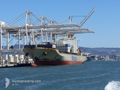
The vessel MANULANI (IMO: 9273674, MMSI: 368305000) is a Cargo It's sailing under the flag of [US] USA.
In this page you can find informations about the vessels current position, last detected port calls, and current voyage information. If the vessels is not in coverage by AIS you will find the latest position.
The current position of MANULANI is detected by our AIS receivers and we are not responsible for the reliability of the data. The last position was recorded while the vessel was in Coverage by the Ais receivers of our vessel tracking app.
The current draught of MANULANI as reported by AIS is 11.1 meters
Weather
| Temperature | 24.3°C / 75.74°F |
|---|---|
| Wind Speed | 7 knots |
| Direction | 34° NE |
| Pressure | 1015 hPa |
| Humidity | 74.1 % |
| Cloud Coverage | 80 % |
Featured Company
Last Port Calls
| Port | Arrival | Departure | Time In Port |
|---|---|---|---|
| 2024-10-05 15:35 | |||
| 2024-09-30 11:57 | 2024-10-01 10:05 | 22 h | |
| 2024-09-27 13:20 | 2024-09-28 10:27 | 21 h | |
| 2024-09-21 15:15 | 2024-09-23 02:12 | 1 d | |
| 2024-09-16 08:14 | 2024-09-17 11:03 | 1 d | |
| 2024-09-13 15:22 | 2024-09-14 10:19 | 18 h | |
| 2024-09-07 23:19 | 2024-09-09 03:45 | 1 d | |
| 2024-09-02 10:41 | 2024-09-03 23:47 | 1 d | |
| 2024-08-30 11:29 | 2024-08-31 15:30 | 1 d | |
| 2024-08-24 15:26 | 2024-08-26 00:11 | 1 d |
Last Trips
| Origin | Departure | Destination | Arrival | Distance | |
|---|---|---|---|---|---|
| 2024-10-01 03:05 | 2024-10-05 05:35 | 2103.65 nm | |||
| 2024-09-28 03:27 | 2024-09-30 04:57 | 915.02 nm | |||
| 2024-09-22 16:12 | 2024-09-27 06:20 | 2438.41 nm | |||
| 2024-09-17 04:03 | 2024-09-21 05:15 | 2101.89 nm | |||
| 2024-09-14 03:19 | 2024-09-16 01:14 | 919.13 nm | |||
| 2024-09-08 17:45 | 2024-09-13 08:22 | 2435.54 nm | |||
| 2024-09-03 16:47 | 2024-09-07 13:19 | 2101.52 nm | |||
| 2024-08-31 08:30 | 2024-09-02 03:41 | 899.32 nm | |||
| 2024-08-25 14:11 | 2024-08-30 04:29 | 2437.47 nm | |||
| 2024-08-20 03:16 | 2024-08-24 05:26 | 2101.43 nm |
Events
| Tid | Hændelsen | Detaljer | Position / Dest | Info |
|---|---|---|---|---|
| 2024-10-05 16:13 | STOP Sejllads |
21.31276 / -157.87900
[US] HONOLULU
|
Fart: 0.3 kn Kurs: 124° |
|
| 2024-10-05 15:35 | Skibe i havn |
|
21.29525 / -157.87106
[US] HONOLULU
|
Fart: 6.4 kn Kurs: 27.9° |
| 2024-10-05 13:40 | Status er ændret | Under way using engine Default |
21.19131 / -157.64062
US HON
|
Fart: 16.1 kn Kurs: 232° |
| 2024-10-05 13:27 | Status er ændret | Default Under way using engine |
21.22431 / -157.59155
US HON
|
Fart: 15.9 kn Kurs: 232.5° |
| 2024-10-05 10:56 | Ændre havområde | United States (Hawaii) part of the North Pacific Ocean High seas of the North Pacific Ocean |
21.67672 / -156.94804
North Pacific Ocean
US HON
|
Fart: 20.7 kn Kurs: 233.6° |
| 2024-10-05 10:56 | Status er ændret | Under way using engine Default |
21.67672 / -156.94804
US HON
|
Fart: 20.7 kn Kurs: 235° |
| 2024-10-05 10:43 | Indenfor Dækning |
21.67672 / -156.94804
North Pacific Ocean
US HON
|
Fart: 20.7 kn Kurs: 233.6° |
|
| 2024-10-02 16:38 | Status er ændret | Default Under way using engine |
33.98119 / -133.92961
US HON
|
Fart: 22.4 kn Kurs: 244.6° |
| 2024-10-02 16:33 | Udenfor Dækning |
33.99248 / -133.89822
North Pacific Ocean
US HON
|
Fart: 22.4 kn Kurs: 244.6° |
|
| 2024-10-02 16:16 | Ændre havområde | High seas of the North Pacific Ocean United States part of the North Pacific Ocean |
34.03541 / -133.78341
North Pacific Ocean
US HON
|
Fart: 21.9 kn Kurs: 245.4° |