

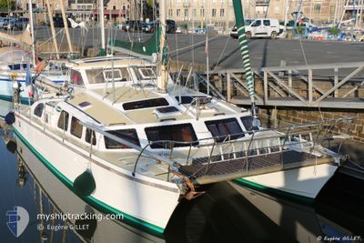
MANIMAY
Pleasure Craft

Current Trip
| Trip Time | 11 days |
|---|---|
| Trip Distance | 64.33 nm |
| AVG Speed | 5.1 Knots |
| MAX Speed | 6.4 Knots |
| Dybgang | --- |
| AVG Wind | 9.9 knots |
| MAX Wind | 15.7 knots |
| MIN Temp | 8.6°C / 47.48°F |
| MAX Temp | 12.4°C / 54.32°F |
| Position Modtaget | 6 m siden |
Current Position
| Longitude | --- |
|---|---|
| Latitude | --- |
| Status | Default |
| Fart | |
| Kurs | --- |
| Område | English Channel |
| Station | T-AIS |
| Position Modtaget | 6 m siden |
Information
The current position of MANIMAY is in English Channel with coordinates 49.45501° / -2.53459° as reported on 2025-04-10 13:49 by AIS to our vessel tracker app. The vessel's current speed is 0 Knots and is currently inside the port of GUERNSEY.
The vessel MANIMAY (MMSI: 227077920) is a Pleasure Craft It's sailing under the flag of [FR] France.
In this page you can find informations about the vessels current position, last detected port calls, and current voyage information. If the vessels is not in coverage by AIS you will find the latest position.
The current position of MANIMAY is detected by our AIS receivers and we are not responsible for the reliability of the data. The last position was recorded while the vessel was in Coverage by the Ais receivers of our vessel tracking app.
Weather
| Temperature | 9°C / 48.2°F |
|---|---|
| Wind Speed | 17 knots |
| Direction | 46° NE |
| Pressure | 1029.8 hPa |
| Humidity | 82.3 % |
| Cloud Coverage | 11 % |


Featured Company
Most Visited Ports (Last year)
| Port | Arrivals | |
|---|---|---|
| 3 | ||
| 2 | ||
| 2 | ||
| 1 | ||
| 1 | ||
| 1 |
Events
| Tid | Hændelsen | Detaljer | Position / Dest | Info |
|---|---|---|---|---|
| 2025-04-08 09:46 | Indenfor Dækning |
49.45504 / -2.53458
English Channel
[GG] GUERNSEY
|
Fart: Kurs: 511° |
|
| 2025-04-08 08:07 | Udenfor Dækning |
49.45501 / -2.53459
English Channel
[GG] GUERNSEY
|
Fart: Kurs: 511° |
|
| 2025-04-08 01:28 | Indenfor Dækning |
49.45506 / -2.53458
English Channel
[GG] GUERNSEY
|
Fart: Kurs: 511° |
|
| 2025-04-08 00:10 | Udenfor Dækning |
49.45506 / -2.53457
English Channel
[GG] GUERNSEY
|
Fart: Kurs: 511° |
|
| 2025-04-07 23:40 | Indenfor Dækning |
49.45503 / -2.53461
English Channel
[GG] GUERNSEY
|
Fart: Kurs: 511° |
|
| 2025-04-07 17:52 | Udenfor Dækning |
49.45502 / -2.53457
English Channel
[GG] GUERNSEY
|
Fart: Kurs: 511° |
|
| 2025-04-07 13:10 | STOP Sejllads |
49.45408 / -2.53013
[GG] GUERNSEY
|
Fart: Kurs: 511° |
|
| 2025-04-07 12:51 | Skibe i havn |
|
49.45559 / -2.52521
[GG] GUERNSEY
|
Fart: 5.5 kn Kurs: 250.9° |
| 2025-04-07 10:14 | Fundet i havområde | Guernsey part of the English Channel |
49.22294 / -2.62801
English Channel
|
Fart: 5.4 kn Kurs: 18.4° |
| 2025-04-07 10:14 | Indenfor Dækning |
49.22294 / -2.62801
English Channel
|
Fart: 5.4 kn Kurs: 18.4° |