
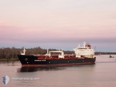
MAGNOLIA STATE
Tanker
Current Trip
| Time Travelled | 4 days |
|---|---|
| Remaining Time | --- |
| Distance Travelled | 955.88 nm |
| Remaining Distance | --- |
| AVG Speed | 12.3 Knots |
| MAX Speed | 15.9 Knots |
| AVG Wind | 10.4 knots |
| MAX Wind | 26.8 knots |
| MIN Temp | 6.7°C / 44.06°F |
| MAX Temp | 26.7°C / 80.06°F |
| Dybgang | 8.5 m |
| Position Modtaget | 9 h, 26 m siden |
Current Position
| Longitude | --- |
|---|---|
| Latitude | --- |
| Status | Default |
| Fart | |
| Kurs | 208° |
| Område | Gulf of Mexico |
| Station | T-AIS |
| Position Modtaget | 9 h, 26 m siden |
Info
Information
The current position of MAGNOLIA STATE is in Gulf of Mexico with coordinates 30.17839° / -93.31729° as reported on 2025-12-10 01:35 by AIS to our vessel tracker app. The vessel's current speed is 0 Knots
The vessel MAGNOLIA STATE (IMO: 9697997, MMSI: 338302000) is a Tanker It's sailing under the flag of [US] USA.
In this page you can find informations about the vessels current position, last detected port calls, and current voyage information. If the vessels is not in coverage by AIS you will find the latest position.
The current position of MAGNOLIA STATE is detected by our AIS receivers and we are not responsible for the reliability of the data. The last position was recorded while the vessel was in Coverage by the Ais receivers of our vessel tracking app.
The current draught of MAGNOLIA STATE as reported by AIS is 8.5 meters
Weather
| Temperature | 10.1°C / 50.18°F |
|---|---|
| Wind Speed | 4 knots |
| Direction | 190° S |
| Pressure | 1015.1 hPa |
| Humidity | 92.7 % |
| Cloud Coverage | --- |
Featured Company
Last Port Calls
| Port | Arrival | Departure | Time In Port |
|---|---|---|---|
| 2025-12-04 13:38 | 2025-12-05 18:43 | 1 d | |
| 2025-11-29 20:56 | 2025-12-01 09:42 | 1 d | |
| 2025-11-21 02:19 | 2025-11-22 09:49 | 1 d | |
| 2025-11-18 11:57 | 2025-11-19 13:04 | 1 d | |
| 2025-11-07 13:38 | 2025-11-09 10:07 | 1 d | |
| 2025-10-29 17:38 | 2025-10-31 15:01 | 1 d | |
| 2025-10-17 20:55 | 2025-10-20 12:30 | 2 d | |
| 2025-10-09 01:06 | 2025-10-10 14:28 | 1 d | |
| 2025-10-05 16:53 | 2025-10-08 01:02 | 2 d | |
| 2025-10-02 18:18 |
Most Visited Ports (Last year)
| Port | Arrivals | |
|---|---|---|
| 28 | ||
| 3 | ||
| 3 | ||
| 2 | ||
| 2 | ||
| 2 |
Last Trips
| Origin | Departure | Destination | Arrival | Distance | |
|---|---|---|---|---|---|
| 2025-12-01 09:42 | 2025-12-04 13:38 | 621.70 nm | |||
| 2025-11-22 09:49 | 2025-11-29 20:56 | 1420.40 nm | |||
| 2025-11-19 13:04 | 2025-11-21 02:19 | 499.35 nm | |||
| 2025-11-09 10:07 | 2025-11-18 11:57 | 1677.27 nm | |||
| 2025-10-31 15:01 | 2025-11-07 13:38 | 1406.60 nm | |||
| 2025-10-20 12:30 | 2025-10-29 17:38 | 2471.45 nm | |||
| 2025-10-10 14:28 | 2025-10-17 20:55 | 1853.10 nm | |||
| 2025-10-08 01:02 | 2025-10-09 01:06 | 53.17 nm | |||
| 2025-10-02 18:18 | 2025-10-05 16:53 | 813.29 nm |
Events
| Tid | Hændelsen | Detaljer | Position / Dest | Info |
|---|---|---|---|---|
| 2025-12-10 01:35 | Udenfor Dækning |
30.17839 / -93.31729
Gulf of Mexico
|
Fart: Kurs: 168.2° |
|
| 2025-12-10 01:35 | Indenfor Dækning |
30.17839 / -93.31729
Gulf of Mexico
|
Fart: Kurs: 168.2° |
|
| 2025-12-09 15:17 | Status er ændret | Default Moored |
30.17838 / -93.31728
US LCH
|
Fart: Kurs: 207° |
| 2025-12-09 15:11 | Status er ændret | Moored Default |
30.17838 / -93.31730
US LCH
|
Fart: Kurs: 207° |
| 2025-12-09 15:11 | Indenfor Dækning |
30.17838 / -93.31730
Gulf of Mexico
|
Fart: Kurs: 238.7° |
|
| 2025-12-09 15:11 | Udenfor Dækning |
30.17838 / -93.31730
Gulf of Mexico
|
Fart: Kurs: 238.7° |
|
| 2025-12-09 03:20 | Status er ændret | Default Under way using engine |
30.17840 / -93.31731
US LCH
|
Fart: 0.2 kn Kurs: 207° |
| 2025-12-09 03:13 | Udenfor Dækning |
30.17841 / -93.31728
Gulf of Mexico
|
Fart: 0.2 kn Kurs: 207.9° |
|
| 2025-12-09 03:04 | STOP Sejllads | 5.19 nm, South West of LAKE CHARLES |
30.17851 / -93.31710
US LCH
|
Fart: 0.2 kn Kurs: 209° |
| 2025-12-09 02:32 | Status er ændret | Under way using engine Default |
30.18229 / -93.31063
US LCH
|
Fart: 1.3 kn Kurs: 70° |