
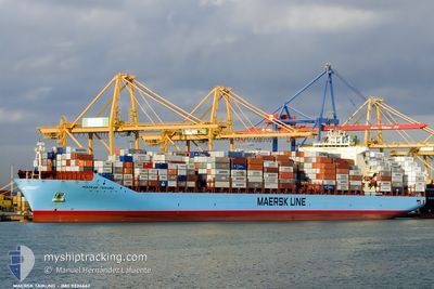
MAERSK TAIKUNG
Container Ship
Current Trip
| Time Travelled | 18 days |
|---|---|
| Remaining Time | 11 days |
| Distance Travelled | 7501.52 nm |
| Remaining Distance | 4849.65 nm |
| AVG Speed | 16.3 Knots |
| MAX Speed | 18.9 Knots |
| AVG Wind | 11.9 knots |
| MAX Wind | 20 knots |
| MIN Temp | 16.7°C / 62.06°F |
| MAX Temp | 29.3°C / 84.74°F |
| Dybgang | 10.8 m |
| Position Modtaget | 1 d siden |
Current Position
| Longitude | 18.37086° |
|---|---|
| Latitude | -34.91600° |
| Status | Under way using engine |
| Fart | 17.5 Knots |
| Kurs | 123.8° |
| Område | South Atlantic Ocean |
| Station | T-AIS |
| Position Modtaget | 1 d siden |
Info
Information
The current position of MAERSK TAIKUNG is in South Atlantic Ocean with coordinates -34.91600° / 18.37086° as reported on 2024-05-07 12:22 by AIS to our vessel tracker app. The vessel's current speed is 17.5 Knots and is heading at the port of TANJUNG PELEPAS. The estimated time of arrival as calculated by MyShipTracking vessel tracking app is 2024-05-20 23:09 LT
The vessel MAERSK TAIKUNG (IMO: 9334662, MMSI: 477178200) is a Container Ship that was built in 2007 ( 17 år gamle ). It's sailing under the flag of [HK] Hong Kong.
In this page you can find informations about the vessels current position, last detected port calls, and current voyage information. If the vessels is not in coverage by AIS you will find the latest position.
The current position of MAERSK TAIKUNG is detected by our AIS receivers and we are not responsible for the reliability of the data. The last position was recorded while the vessel was in Coverage by the Ais receivers of our vessel tracking app.
The current draught of MAERSK TAIKUNG as reported by AIS is 10.8 meters
Weather
| Temperature | 23.2°C / 73.76°F |
|---|---|
| Wind Speed | 16 knots |
| Direction | 359° N |
| Pressure | 1016.9 hPa |
| Humidity | 83.8 % |
| Cloud Coverage | 47 % |
Featured Company
Last Port Calls
| Port | Arrival | Departure | Time In Port |
|---|---|---|---|
| 2024-04-19 00:21 | 2024-04-20 17:06 | 1 d | |
| 2024-04-14 08:08 | 2024-04-15 08:40 | 1 d | |
| 2024-04-12 05:35 | 2024-04-13 12:41 | 1 d | |
| 2024-04-07 11:12 | 2024-04-08 06:10 | 18 h | |
| 2024-03-07 21:35 | 2024-03-09 06:21 | 1 d | |
| 2024-03-01 14:38 |
Most Visited Ports (Last year)
| Port | Arrivals | |
|---|---|---|
| 6 | ||
| 4 | ||
| 4 | ||
| 4 | ||
| 3 | ||
| 3 |
Last Trips
| Origin | Departure | Destination | Arrival | Distance | |
|---|---|---|---|---|---|
| 2024-04-15 04:40 | 2024-04-18 20:21 | 629.59 nm | |||
| 2024-04-13 08:41 | 2024-04-14 04:08 | 138.39 nm | |||
| 2024-04-08 02:10 | 2024-04-12 01:35 | 712.59 nm | |||
| 2024-03-09 14:21 | 2024-04-07 07:12 | 12419.88 nm | |||
| 2024-03-01 22:38 | 2024-03-08 05:35 | 1480.43 nm |
Events
| Tid | Hændelsen | Detaljer | Position / Dest | Info |
|---|---|---|---|---|
| 2024-05-07 12:26 | Status er ændret | Default Under way using engine |
-34.92749 / 18.39141
USMIA>>MYTPP
|
Fart: 17.5 kn Kurs: 123.8° |
| 2024-05-07 12:22 | Udenfor Dækning |
-34.91600 / 18.37086
South Atlantic Ocean
USMIA>>MYTPP
|
Fart: 17.5 kn Kurs: 123.8° |
|
| 2024-05-07 11:42 | ETA er ændret | 2024/05/21 07:00 2024/05/21 08:00 |
-34.80368 / 18.17005
USMIA>>MYTPP
|
Fart: 17.5 kn Kurs: 124.4° |
| 2024-05-07 11:01 | Status er ændret | Under way using engine Default |
-34.68447 / 17.98830
USMIA>>MYTPP
|
Fart: 16 kn Kurs: 137° |
| 2024-05-07 10:55 | Status er ændret | Default Under way using engine |
-34.66167 / 17.96500
USMIA>>MYTPP
|
Fart: 16.9 kn Kurs: 139.3° |
| 2024-05-07 10:10 | Status er ændret | Under way using engine Default |
-34.50370 / 17.79526
USMIA>>MYTPP
|
Fart: 16 kn Kurs: 138° |
| 2024-05-07 10:07 | Status er ændret | Default Under way using engine |
-34.49166 / 17.78333
USMIA>>MYTPP
|
Fart: 16.8 kn Kurs: 139.2° |
| 2024-05-07 09:53 | Status er ændret | Under way using engine Default |
-34.44550 / 17.73457
USMIA>>MYTPP
|
Fart: 16.7 kn Kurs: 138° |
| 2024-05-07 09:18 | Status er ændret | Default Under way using engine |
-34.31577 / 17.60791
USMIA>>MYTPP
|
Fart: 16.6 kn Kurs: 141.3° |
| 2024-05-07 09:07 | Ændre havområde | South African part of the South Atlantic Ocean Bahamas part of the North Atlantic Ocean |
-34.27776 / 17.57289
South Atlantic Ocean
USMIA>>MYTPP
|
Fart: 16.5 kn Kurs: 144.3° |