
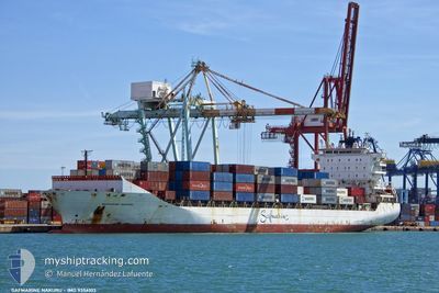
MAERSK NAKURU
Container Ship
Current Trip
| Time Travelled | 1 day |
|---|---|
| Remaining Time | 3 h, 19 mins |
| Distance Travelled | 563.43 nm |
| Remaining Distance | 63.15 nm |
| AVG Speed | 12.3 Knots |
| MAX Speed | 15 Knots |
| AVG Wind | 19.2 knots |
| MAX Wind | 26 knots |
| MIN Temp | 13.4°C / 56.12°F |
| MAX Temp | 19.6°C / 67.28°F |
| Dybgang | 10.1 m |
| Position Modtaget | 19 h, 47 m siden |
Current Position
| Longitude | 27.87451° |
|---|---|
| Latitude | 35.26003° |
| Status | Under way using engine |
| Fart | 12.1 Knots |
| Kurs | 134.4° |
| Område | Mediterranean Sea - Eastern Basin |
| Station | T-AIS |
| Position Modtaget | 19 h, 47 m siden |
Info
Information
The current position of MAERSK NAKURU is in Mediterranean Sea - Eastern Basin with coordinates 35.26003° / 27.87451° as reported on 2024-05-12 02:51 by AIS to our vessel tracker app. The vessel's current speed is 12.1 Knots and is heading at the port of PORT SAID. The estimated time of arrival as calculated by MyShipTracking vessel tracking app is 2024-05-13 01:58 LT
The vessel MAERSK NAKURU (IMO: 9356103, MMSI: 477552900) is a Container Ship that was built in 2008 ( 16 år gamle ). It's sailing under the flag of [HK] Hong Kong.
In this page you can find informations about the vessels current position, last detected port calls, and current voyage information. If the vessels is not in coverage by AIS you will find the latest position.
The current position of MAERSK NAKURU is detected by our AIS receivers and we are not responsible for the reliability of the data. The last position was recorded while the vessel was in Coverage by the Ais receivers of our vessel tracking app.
The current draught of MAERSK NAKURU as reported by AIS is 10.1 meters
Weather
| Temperature | 19.3°C / 66.74°F |
|---|---|
| Wind Speed | 13 knots |
| Direction | 286° WNW |
| Pressure | 1013.9 hPa |
| Humidity | 72.3 % |
| Cloud Coverage | 4 % |
Featured Company
Last Port Calls
| Port | Arrival | Departure | Time In Port |
|---|---|---|---|
| 2024-05-09 19:05 | 2024-05-11 02:36 | 1 d | |
| 2024-05-06 16:00 | 2024-05-07 05:15 | 13 h | |
| 2024-05-02 19:41 | 2024-05-04 02:41 | 1 d | |
| 2024-04-29 02:52 | 2024-04-29 22:00 | 19 h | |
| 2024-04-25 08:40 | 2024-04-27 03:06 | 1 d | |
| 2024-04-22 08:35 | 2024-04-23 00:21 | 15 h | |
| 2024-04-18 19:52 | 2024-04-20 10:02 | 1 d | |
| 2024-04-16 08:23 | 2024-04-17 03:34 | 19 h | |
| 2024-04-12 21:57 | 2024-04-14 01:46 | 1 d | |
| 2024-04-10 08:31 | 2024-04-11 07:30 | 22 h |
Last Trips
| Origin | Departure | Destination | Arrival | Distance | |
|---|---|---|---|---|---|
| 2024-05-04 05:41 | 2024-05-09 22:05 | 1288.76 nm | |||
| 2024-05-04 05:41 | 2024-05-06 18:00 | 644.97 nm | |||
| 2024-04-27 06:06 | 2024-05-02 22:41 | 1306.42 nm | |||
| 2024-04-27 06:06 | 2024-04-29 04:52 | 638.27 nm | |||
| 2024-04-20 13:02 | 2024-04-25 11:40 | 1277.46 nm | |||
| 2024-04-20 13:02 | 2024-04-22 10:35 | 639.90 nm | |||
| 2024-04-14 04:46 | 2024-04-18 22:52 | 1265.95 nm | |||
| 2024-04-14 04:46 | 2024-04-16 10:23 | 636.86 nm | |||
| 2024-04-08 03:10 | 2024-04-13 00:57 | 1249.51 nm | |||
| 2024-04-08 03:10 | 2024-04-10 10:31 | 616.76 nm |
Events
| Tid | Hændelsen | Detaljer | Position / Dest | Info |
|---|---|---|---|---|
| 2024-05-12 03:20 | Status er ændret | Default Under way using engine |
35.18999 / 27.95993
TRIZM - EGPSD
|
Fart: 12.1 kn Kurs: 134.4° |
| 2024-05-12 02:51 | Udenfor Dækning |
35.26003 / 27.87451
Mediterranean Sea - Eastern Basin
TRIZM - EGPSD
|
Fart: 12.1 kn Kurs: 134.4° |
|
| 2024-05-12 00:04 | Ændre havområde | Greek part of the Mediterranean Sea - Eastern Basin Greek part of the Aegean Sea |
35.72570 / 27.46075
Mediterranean Sea - Eastern Basin
TRIZM - EGPSD
|
Fart: 12.5 kn Kurs: 157.5° |
| 2024-05-11 22:56 | Status er ændret | Under way using engine Default |
35.91885 / 27.29982
TRIZM - EGPSD
|
Fart: 12.6 kn Kurs: 136° |
| 2024-05-11 22:56 | Indenfor Dækning |
35.91793 / 27.30091
Aegean Sea
TRIZM - EGPSD
|
Fart: 12.5 kn Kurs: 135.7° |
|
| 2024-05-11 22:30 | Status er ændret | Default Under way using engine |
35.98510 / 27.22135
TRIZM - EGPSD
|
Fart: 12.5 kn Kurs: 147° |
| 2024-05-11 21:44 | Udenfor Dækning |
36.11072 / 27.09778
Aegean Sea
TRIZM - EGPSD
|
Fart: 12.5 kn Kurs: 147° |
|
| 2024-05-11 09:32 | Status er ændret | Under way using engine Default |
38.15008 / 25.67570
TRIZM - EGPSD
|
Fart: 12.2 kn Kurs: 178° |
| 2024-05-11 08:45 | Status er ændret | Default Under way using engine |
38.30837 / 25.66428
TRIZM - EGPSD
|
Fart: 12.2 kn Kurs: 176.2° |
| 2024-05-11 04:08 | Ændre havområde | Greek part of the Aegean Sea Turkish part of the Aegean Sea |
38.78708 / 26.50850
Aegean Sea
TRIZM - EGPSD
|
Fart: 12.2 kn Kurs: 270.4° |