
MAERSK ENSHI
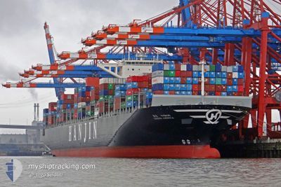
Container Ship
Current Trip
| Trip Time | 6 days |
|---|---|
| Trip Distance | 1272.74 nm |
| AVG Speed | 11.2 Knots |
| MAX Speed | 14.6 Knots |
| Dybgang | 15.6 m |
| AVG Wind | 8 knots |
| MAX Wind | 20.8 knots |
| MIN Temp | 26.8°C / 80.24°F |
| MAX Temp | 29.9°C / 85.82°F |
| Position Modtaget | 29 d siden |
Current Position
| Longitude | 18.10383° |
|---|---|
| Latitude | -34.87712° |
| Status | Under way using engine |
| Fart | 18.7 Knots |
| Kurs | 292.4° |
| Område | South Atlantic Ocean |
| Station | T-AIS |
| Position Modtaget | 29 d siden |
Info
Information
The current position of MAERSK ENSHI is in South Atlantic Ocean with coordinates -34.87712° / 18.10383° as reported on 2024-04-03 12:53 by AIS to our vessel tracker app. The vessel's current speed is 18.7 Knots and is currently inside the port of POINTE NOIRE.
The vessel MAERSK ENSHI (IMO: 9502946, MMSI: 355288000) is a Container Ship that was built in 2012 ( 12 år gamle ). It's sailing under the flag of [PA] Panama.
In this page you can find informations about the vessels current position, last detected port calls, and current voyage information. If the vessels is not in coverage by AIS you will find the latest position.
The current position of MAERSK ENSHI is detected by our AIS receivers and we are not responsible for the reliability of the data. The last position was recorded while the vessel was in Coverage by the Ais receivers of our vessel tracking app.
The current draught of MAERSK ENSHI as reported by AIS is 15.6 meters
Weather
| Temperature | 26.4°C / 79.52°F |
|---|---|
| Wind Speed | 5 knots |
| Direction | 126° SE |
| Pressure | 1011.1 hPa |
| Humidity | 90.5 % |
| Cloud Coverage | 79 % |
Featured Company
Last Port Calls
| Port | Arrival | Departure | Time In Port |
|---|---|---|---|
| 2024-04-28 17:07 | |||
| 2024-04-18 21:47 | 2024-04-21 18:18 | 2 d | |
| 2024-03-20 19:51 | 2024-03-22 06:06 | 1 d | |
| 2024-03-19 15:34 | 2024-03-20 09:19 | 17 h | |
| 2024-03-10 14:42 | 2024-03-11 17:29 | 1 d | |
| 2024-03-01 16:38 | 2024-03-03 02:48 | 1 d |
Most Visited Ports (Last year)
| Port | Arrivals | |
|---|---|---|
| 7 | ||
| 7 | ||
| 6 | ||
| 4 | ||
| 4 | ||
| 4 |
Last Trips
| Origin | Departure | Destination | Arrival | Distance | |
|---|---|---|---|---|---|
| 2024-04-21 18:18 | 2024-04-28 18:07 | 1272.74 nm | |||
| 2024-03-22 14:06 | 2024-04-18 21:47 | 9197.58 nm | |||
| 2024-03-20 17:19 | 2024-03-21 03:51 | 42.57 nm | |||
| 2024-03-12 01:29 | 2024-03-19 23:34 | 1492.52 nm | |||
| 2024-03-03 11:48 | 2024-03-10 22:42 | 1314.35 nm | |||
| 2024-02-27 23:39 | 2024-03-02 01:38 | 596.65 nm |
Events
| Tid | Hændelsen | Detaljer | Position / Dest | Info |
|---|---|---|---|---|
| 2024-04-28 17:47 | STOP Sejllads |
-4.77925 / 11.83082
[CG] POINTE NOIRE
|
Fart: 0.3 kn Kurs: 95° |
|
| 2024-04-28 17:07 | Skibe i havn |
|
-4.77484 / 11.83307
[CG] POINTE NOIRE
|
Fart: 3.5 kn Kurs: 143° |
| 2024-04-28 15:24 | START Sejllads | 6.7 nm, South West of POINTE NOIRE |
-4.82294 / 11.73206
MY TPP
|
Fart: 3.1 kn Kurs: 64° |
| 2024-04-28 12:27 | STOP Sejllads | 6.72 nm, South West of POINTE NOIRE |
-4.84167 / 11.74167
MY TPP
|
Fart: Kurs: -1° |
| 2024-04-28 11:57 | START Sejllads | 5.97 nm, South West of POINTE NOIRE |
-4.81833 / 11.74333
MY TPP
|
Fart: 5 kn Kurs: 201° |
| 2024-04-28 10:23 | STOP Sejllads | 5.5 nm, South West of POINTE NOIRE |
-4.83367 / 11.76107
MY TPP
|
Fart: 0.3 kn Kurs: 137° |
| 2024-04-28 10:00 | START Sejllads | 6.49 nm, South West of POINTE NOIRE |
-4.82956 / 11.73911
MY TPP
|
Fart: 4.3 kn Kurs: 130° |
| 2024-04-28 09:06 | STOP Sejllads | 5.7 nm, South West of POINTE NOIRE |
-4.81833 / 11.74833
MY TPP
|
Fart: Kurs: -1° |
| 2024-04-28 04:21 | START Sejllads |
-5.12047 / 11.19168
MY TPP
|
Fart: 6.6 kn Kurs: 90° |
|
| 2024-04-27 23:09 | STOP Sejllads |
-5.15167 / 11.22333
MY TPP
|
Fart: Kurs: -1° |