
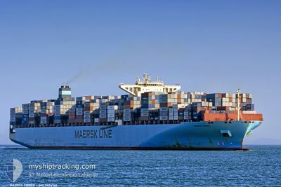
MAERSK EMDEN
Container Ship
Current Trip
| Time Travelled | 9 days |
|---|---|
| Remaining Time | --- |
| Distance Travelled | 2534.81 nm |
| Remaining Distance | 451.83 nm |
| AVG Speed | 11.2 Knots |
| MAX Speed | 14 Knots |
| AVG Wind | 14.9 knots |
| MAX Wind | 32 knots |
| MIN Temp | 7°C / 44.6°F |
| MAX Temp | 28.6°C / 83.48°F |
| Dybgang | 11.9 m |
| Position Modtaget | 9 d siden |
Current Position
| Longitude | --- |
|---|---|
| Latitude | --- |
| Status | Under way using engine |
| Fart | 11.1 Knots |
| Kurs | 83.6° |
| Område | Singapore Strait |
| Station | T-AIS |
| Position Modtaget | 9 d siden |
Info
Information
The current position of MAERSK EMDEN is in Singapore Strait with coordinates 1.26726° / 104.23148° as reported on 2024-12-20 23:35 by AIS to our vessel tracker app. The vessel's current speed is 11.1 Knots and is heading at the port of QINGDAO. The estimated time of arrival as calculated by MyShipTracking vessel tracking app is 2024-12-30 21:00 LT
The vessel MAERSK EMDEN (IMO: 9456769, MMSI: 219056000) is a Container Ship that was built in 2010 ( 14 år gamle ). It's sailing under the flag of [DK] Denmark.
In this page you can find informations about the vessels current position, last detected port calls, and current voyage information. If the vessels is not in coverage by AIS you will find the latest position.
The current position of MAERSK EMDEN is detected by our AIS receivers and we are not responsible for the reliability of the data. The last position was recorded while the vessel was in Coverage by the Ais receivers of our vessel tracking app.
The current draught of MAERSK EMDEN as reported by AIS is 11.9 meters
Weather
| Temperature | 8.8°C / 47.84°F |
|---|---|
| Wind Speed | 16 knots |
| Direction | 229° SW |
| Pressure | 1022 hPa |
| Humidity | 56.3 % |
| Cloud Coverage | 100 % |
Featured Company
Last Port Calls
| Port | Arrival | Departure | Time In Port |
|---|---|---|---|
| 2024-12-19 23:33 | 2024-12-20 20:21 | 20 h | |
| 2024-12-14 01:20 | 2024-12-14 20:57 | 19 h | |
| 2024-11-24 15:43 | 2024-11-27 06:23 | 2 d | |
| 2024-11-13 23:22 | 2024-11-16 12:54 | 2 d | |
| 2024-10-15 22:25 | 2024-10-16 15:53 | 17 h | |
| 2024-10-14 21:42 | 2024-10-15 18:43 | 21 h | |
| 2024-10-10 14:21 | 2024-10-11 16:52 | 1 d | |
| 2024-10-02 08:53 | 2024-10-03 07:17 | 22 h |
Most Visited Ports (Last year)
| Port | Arrivals | |
|---|---|---|
| 8 | ||
| 4 | ||
| 4 | ||
| 4 | ||
| 4 | ||
| 3 |
Last Trips
| Origin | Departure | Destination | Arrival | Distance | |
|---|---|---|---|---|---|
| 2024-12-15 02:27 | 2024-12-20 07:33 | 1640.54 nm | |||
| 2024-11-27 07:23 | 2024-12-14 06:50 | 6277.86 nm | |||
| 2024-11-16 12:54 | 2024-11-24 16:43 | 1547.09 nm | |||
| 2024-10-16 23:53 | 2024-11-13 23:22 | 8726.46 nm | |||
| 2024-10-16 02:43 | 2024-10-16 06:25 | 30.41 nm | |||
| 2024-10-12 00:52 | 2024-10-15 05:42 | 1457.21 nm | |||
| 2024-10-03 15:17 | 2024-10-10 22:21 | 1237.06 nm | |||
| 2024-09-29 16:33 | 2024-10-02 16:53 | 670.72 nm |
Events
| Tid | Hændelsen | Detaljer | Position / Dest | Info |
|---|---|---|---|---|
| 2024-12-20 23:41 | Status er ændret | Default Under way using engine |
1.26916 / 104.24882
SGSIN > CNQDG
|
Fart: 11.1 kn Kurs: 83.6° |
| 2024-12-20 23:35 | Udenfor Dækning |
1.26726 / 104.23148
Singapore Strait
SGSIN > CNQDG
|
Fart: 11.1 kn Kurs: 83.6° |
|
| 2024-12-20 23:32 | Status er ændret | Under way using engine Default |
1.26635 / 104.22296
SGSIN > CNQDG
|
Fart: 11.1 kn Kurs: 84° |
| 2024-12-20 23:25 | Status er ændret | Default Under way using engine |
1.26373 / 104.19988
SGSIN > CNQDG
|
Fart: 11 kn Kurs: 82.8° |
| 2024-12-20 23:19 | Status er ændret | Under way using engine Default |
1.26151 / 104.18117
SGSIN > CNQDG
|
Fart: 11 kn Kurs: 84° |
| 2024-12-20 23:17 | Status er ændret | Default Under way using engine |
1.26084 / 104.17561
SGSIN > CNQDG
|
Fart: 11 kn Kurs: 83.7° |
| 2024-12-20 23:12 | Ændre havområde | Malaysian part of the Singapore Strait Indonesian part of the Singapore Strait |
1.25913 / 104.16084
Singapore Strait
SGSIN > CNQDG
|
Fart: 11.1 kn Kurs: 81.9° |
| 2024-12-20 22:58 | Status er ændret | Under way using engine Default |
1.25253 / 104.12014
SGSIN > CNQDG
|
Fart: 10.7 kn Kurs: 80° |
| 2024-12-20 22:57 | Status er ændret | Default Under way using engine |
1.25160 / 104.11469
SGSIN > CNQDG
|
Fart: 10.9 kn Kurs: 85° |
| 2024-12-20 21:05 | Ændre havområde | Indonesian part of the Singapore Strait Singaporean part of the Singapore Strait |
1.18169 / 103.82792
Singapore Strait
SGSIN > CNQDG
|
Fart: 4.1 kn Kurs: 106.6° |