

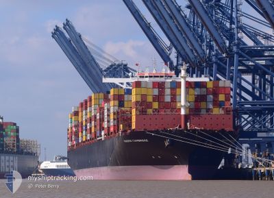
MAERSK CAMBRIDGE
Cargo A

Current Trip
SGSIN>XINGANG
| Time Travelled | 11 h, 33 mins |
|---|---|
| Remaining Time | --- |
| Distance Travelled | 80.93 nm |
| Remaining Distance | --- |
| AVG Speed | 9.9 Knots |
| MAX Speed | 12.2 Knots |
| AVG Wind | 16.9 knots |
| MAX Wind | 26.7 knots |
| MIN Temp | 2.2°C / 35.96°F |
| MAX Temp | 5.7°C / 42.26°F |
| Dybgang | 12 m |
| Position Modtaget | 9 d siden |
Current Position
| Longitude | --- |
|---|---|
| Latitude | --- |
| Status | Under way using engine |
| Fart | 17.7 Knots |
| Kurs | 44.8° |
| Område | Singapore Strait |
| Station | T-AIS |
| Position Modtaget | 9 d siden |
Information
The current position of MAERSK CAMBRIDGE is in Singapore Strait with coordinates 1.30710° / 104.35736° as reported on 2025-03-07 23:29 by AIS to our vessel tracker app. The vessel's current speed is 17.7 Knots
The vessel MAERSK CAMBRIDGE (IMO: 9924182, MMSI: 636021337) is a Cargo A It's sailing under the flag of [LR] Liberia.
In this page you can find informations about the vessels current position, last detected port calls, and current voyage information. If the vessels is not in coverage by AIS you will find the latest position.
The current position of MAERSK CAMBRIDGE is detected by our AIS receivers and we are not responsible for the reliability of the data. The last position was recorded while the vessel was in Coverage by the Ais receivers of our vessel tracking app.
The current draught of MAERSK CAMBRIDGE as reported by AIS is 12 meters
Weather
| Temperature | 1.9°C / 35.42°F |
|---|---|
| Wind Speed | 23 knots |
| Direction | 349° N |
| Pressure | 1022.9 hPa |
| Humidity | 53.4 % |
| Cloud Coverage | 67 % |


Featured Company
Most Visited Ports (Last year)
| Port | Arrivals | |
|---|---|---|
| 6 | ||
| 4 | ||
| 4 | ||
| 3 | ||
| 3 | ||
| 2 |
Last Trips
Events
| Tid | Hændelsen | Detaljer | Position / Dest | Info |
|---|---|---|---|---|
| 2025-03-17 13:09 | STOP Sejllads |
38.91102 / 119.48182
SGSIN>XINGANG
|
Fart: Kurs: 18° |
|
| 2025-03-17 04:57 | Afsejlet fra sidste havn |
|
38.95513 / 117.88738
SGSIN>XINGANG
|
Fart: 11.6 kn Kurs: 98° |
| 2025-03-17 04:26 | START Sejllads |
38.98724 / 117.78683
[CN] TIANJIN
|
Fart: 5.6 kn Kurs: 157° |
|
| 2025-03-15 19:46 | STOP Sejllads |
38.99849 / 117.78556
[CN] TIANJIN
|
Fart: 0.3 kn Kurs: 80° |
|
| 2025-03-15 18:49 | Skibe i havn |
|
38.95799 / 117.86972
[CN] TIANJIN
|
Fart: 12.3 kn Kurs: 280° |
| 2025-03-07 23:38 | Status er ændret | Default Under way using engine |
1.33666 / 104.38647
SGSIN>XINGANG
|
Fart: 17.7 kn Kurs: 44.8° |
| 2025-03-07 23:29 | Udenfor Dækning |
1.30710 / 104.35736
Singapore Strait
SGSIN>XINGANG
|
Fart: 17.7 kn Kurs: 44.8° |
|
| 2025-03-07 23:26 | Ændre havområde | Malaysian part of the Singapore Strait Indonesian part of the Singapore Strait |
1.29526 / 104.34540
Singapore Strait
SGSIN>XINGANG
|
Fart: 16.9 kn Kurs: 48° |
| 2025-03-07 23:26 | Status er ændret | Under way using engine Default |
1.29526 / 104.34540
SGSIN>XINGANG
|
Fart: 17.2 kn Kurs: 74° |
| 2025-03-07 22:46 | Status er ændret | Default Under way using engine |
1.26620 / 104.16395
SGSIN>XINGANG
|
Fart: 15.1 kn Kurs: 77.8° |