
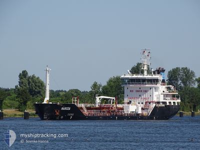
M/T NARCEA
Chemical Tanker
Current Trip
| Time Travelled | 3 days |
|---|---|
| Remaining Time | 2 days |
| Distance Travelled | 644.33 nm |
| Remaining Distance | 605.11 nm |
| AVG Speed | 7.8 Knots |
| MAX Speed | 15.1 Knots |
| AVG Wind | 14.2 knots |
| MAX Wind | 38.9 knots |
| MIN Temp | -2°C / 28.4°F |
| MAX Temp | 15.1°C / 59.18°F |
| Dybgang | 6 m |
| Position Modtaget | 1 m siden |
Current Position
| Longitude | --- |
|---|---|
| Latitude | --- |
| Status | Under way using engine |
| Fart | 8.5 Knots |
| Kurs | 221.1° |
| Område | English Channel |
| Station | T-AIS |
| Position Modtaget | 1 m siden |
Info
Information
The current position of M/T NARCEA is in English Channel with coordinates 50.95435° / 1.35406° as reported on 2024-11-25 17:56 by AIS to our vessel tracker app. The vessel's current speed is 8.5 Knots and is heading at the port of AVILES. The estimated time of arrival as calculated by MyShipTracking vessel tracking app is 2024-11-28 12:08 LT
The vessel M/T NARCEA (IMO: 9344320, MMSI: 255803560) is a Chemical Tanker that was built in 2006 ( 18 år gamle ). It's sailing under the flag of [PT] Portugal.
In this page you can find informations about the vessels current position, last detected port calls, and current voyage information. If the vessels is not in coverage by AIS you will find the latest position.
The current position of M/T NARCEA is detected by our AIS receivers and we are not responsible for the reliability of the data. The last position was recorded while the vessel was in Coverage by the Ais receivers of our vessel tracking app.
The current draught of M/T NARCEA as reported by AIS is 6 meters
Weather
| Temperature | 11.3°C / 52.34°F |
|---|---|
| Wind Speed | 20 knots |
| Direction | 255° WSW |
| Pressure | 1006.6 hPa |
| Humidity | 68.2 % |
| Cloud Coverage | 80 % |
Featured Company
Last Port Calls
| Port | Arrival | Departure | Time In Port |
|---|---|---|---|
| 2024-11-18 09:27 | 2024-11-22 00:26 | 3 d | |
| 2024-11-18 06:03 | 2024-11-18 06:18 | 15 m | |
| 2024-11-12 05:18 | 2024-11-12 20:14 | 14 h | |
| 2024-11-10 08:53 | 2024-11-11 12:26 | 1 d | |
| 2024-11-05 14:21 | 2024-11-07 12:28 | 1 d | |
| 2024-11-03 19:07 | 2024-11-03 20:41 | 1 h | |
| 2024-11-01 05:48 | 2024-11-02 20:55 | 1 d | |
| 2024-10-25 15:46 | 2024-10-27 06:15 | 1 d | |
| 2024-10-19 12:51 | 2024-10-20 09:05 | 20 h | |
| 2024-10-19 08:34 | 2024-10-19 08:43 | 9 m |
Last Trips
| Origin | Departure | Destination | Arrival | Distance | |
|---|---|---|---|---|---|
| 2024-11-18 07:18 | 2024-11-18 10:27 | 29.61 nm | |||
| 2024-11-18 07:18 | 2024-11-18 07:03 | 29.61 nm | |||
| 2024-11-11 13:26 | 2024-11-12 06:18 | 143.49 nm | |||
| 2024-11-07 13:28 | 2024-11-10 09:53 | 712.71 nm | |||
| 2024-11-03 21:41 | 2024-11-05 15:21 | 431.11 nm | |||
| 2024-11-02 21:55 | 2024-11-03 20:07 | 228.31 nm | |||
| 2024-10-27 07:15 | 2024-11-01 06:48 | 1263.62 nm | |||
| 2024-10-20 11:05 | 2024-10-25 17:46 | 1272.71 nm | |||
| 2024-10-19 10:43 | 2024-10-19 14:51 | 31.67 nm | |||
| 2024-10-14 15:27 | 2024-10-19 10:34 | 1232.68 nm |
Events
| Tid | Hændelsen | Detaljer | Position / Dest | Info |
|---|---|---|---|---|
| 2024-11-25 17:01 | Fundet i havområde | United Kingdom part of the English Channel |
51.05558 / 1.50422
English Channel
AVILES
|
Fart: 9.1 kn Kurs: 225.8° |
| 2024-11-25 12:44 | ETA er ændret | 2024/11/28 08:00 2024/11/28 05:00 |
51.60067 / 2.21324
AVILES
|
Fart: 9.2 kn Kurs: 225.3° |
| 2024-11-25 12:05 | Fundet i havområde | United Kingdom part of the North Sea |
51.67024 / 2.32075
North Sea
AVILES
|
Fart: 8.6 kn Kurs: 222.3° |
| 2024-11-25 11:53 | Status er ændret | Under way using engine Default |
51.69203 / 2.35136
AVILES
|
Fart: 8.9 kn Kurs: 218° |
| 2024-11-25 11:35 | Status er ændret | Default Under way using engine |
51.72293 / 2.39501
AVILES
|
Fart: 8.1 kn Kurs: 221.2° |
| 2024-11-25 11:31 | Status er ændret | Under way using engine Default |
51.73005 / 2.40506
AVILES
|
Fart: 8.2 kn Kurs: 222° |
| 2024-11-25 11:14 | Status er ændret | Default Under way using engine |
51.75965 / 2.44764
AVILES
|
Fart: 8.5 kn Kurs: 222.6° |
| 2024-11-25 11:05 | Status er ændret | Under way using engine Default |
51.77459 / 2.46958
AVILES
|
Fart: 8.5 kn Kurs: 222° |
| 2024-11-25 10:56 | Status er ændret | Default Under way using engine |
51.78942 / 2.49109
AVILES
|
Fart: 8.5 kn Kurs: 220.8° |
| 2024-11-25 10:23 | Fundet i havområde | Belgian part of the North Sea |
51.84983 / 2.57346
North Sea
AVILES
|
Fart: 8.5 kn Kurs: 219.2° |