
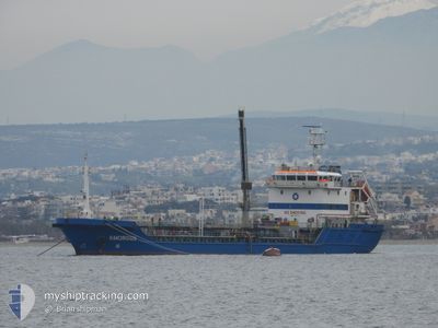
M/T AMORGOS
Oil Products Tanker
Current Trip
| Time Travelled | 2 days |
|---|---|
| Remaining Time | --- |
| Distance Travelled | 262.59 nm |
| Remaining Distance | --- |
| AVG Speed | 9.2 Knots |
| MAX Speed | 10.2 Knots |
| AVG Wind | 8.7 knots |
| MAX Wind | 13 knots |
| MIN Temp | 14.7°C / 58.46°F |
| MAX Temp | 21.9°C / 71.42°F |
| Dybgang | 5.9 m |
| Position Modtaget | 2 m siden |
Current Position
| Longitude | 26.90126° |
|---|---|
| Latitude | 37.77799° |
| Status | Moored |
| Fart | |
| Kurs | 359° |
| Område | Aegean Sea |
| Station | T-AIS |
| Position Modtaget | 2 m siden |
Info
Information
The current position of M/T AMORGOS is in Aegean Sea with coordinates 37.77799° / 26.90126° as reported on 2024-04-28 13:07 by AIS to our vessel tracker app. The vessel's current speed is 0 Knots
The vessel M/T AMORGOS (IMO: 9371270, MMSI: 241710000) is a Oil Products Tanker that was built in 2007 ( 17 år gamle ). It's sailing under the flag of [GR] Greece.
In this page you can find informations about the vessels current position, last detected port calls, and current voyage information. If the vessels is not in coverage by AIS you will find the latest position.
The current position of M/T AMORGOS is detected by our AIS receivers and we are not responsible for the reliability of the data. The last position was recorded while the vessel was in Coverage by the Ais receivers of our vessel tracking app.
The current draught of M/T AMORGOS as reported by AIS is 5.9 meters
Weather
| Temperature | 19.6°C / 67.28°F |
|---|---|
| Wind Speed | 12 knots |
| Direction | 305° NW |
| Pressure | 1014.2 hPa |
| Humidity | 64.9 % |
| Cloud Coverage | --- |
Featured Company
Last Port Calls
| Port | Arrival | Departure | Time In Port |
|---|---|---|---|
| 2024-04-25 07:13 | 2024-04-26 04:45 | 21 h | |
| 2024-04-16 05:45 | 2024-04-17 04:20 | 22 h | |
| 2024-04-16 05:25 | 2024-04-16 05:34 | 8 m | |
| 2024-04-01 08:06 | 2024-04-02 05:50 | 21 h | |
| 2024-03-27 05:44 | 2024-03-28 06:04 | 1 d | |
| 2024-03-15 05:30 | |||
| 2024-03-04 06:10 | 2024-03-05 05:13 | 23 h | |
| 2024-03-01 11:40 | 2024-03-02 14:05 | 1 d | |
| 2024-02-27 06:04 | 2024-02-28 05:16 | 23 h | |
| 2024-02-23 05:15 | 2024-02-23 15:51 | 10 h |
Most Visited Ports (Last year)
| Port | Arrivals | |
|---|---|---|
| 37 | ||
| 7 | ||
| 5 | ||
| 5 | ||
| 4 | ||
| 2 |
Last Trips
| Origin | Departure | Destination | Arrival | Distance | |
|---|---|---|---|---|---|
| 2024-04-17 07:20 | 2024-04-25 10:13 | 445.65 nm | |||
| 2024-04-16 08:34 | 2024-04-16 08:45 | 0.59 nm | |||
| 2024-04-02 08:50 | 2024-04-16 08:25 | 534.81 nm | |||
| 2024-03-28 08:04 | 2024-04-01 11:06 | 357.04 nm | |||
| 2024-03-05 07:13 | 2024-03-27 07:44 | 1019.60 nm | |||
| 2024-03-05 07:13 | 2024-03-15 07:30 | 469.41 nm | |||
| 2024-03-02 16:05 | 2024-03-04 08:10 | 155.40 nm | |||
| 2024-02-28 07:16 | 2024-03-01 13:40 | 158.04 nm | |||
| 2024-02-23 17:51 | 2024-02-27 08:04 | 69.84 nm | |||
| 2024-02-20 08:08 | 2024-02-23 07:15 | 294.24 nm |
Events
| Tid | Hændelsen | Detaljer | Position / Dest | Info |
|---|---|---|---|---|
| 2024-04-28 04:29 | Status er ændret | Moored Under way using engine |
37.77797 / 26.90135
SAMOS
|
Fart: Kurs: 352° |
| 2024-04-28 04:13 | STOP Sejllads | 0.31 nm, East of KOKKARI |
37.77819 / 26.90155
SAMOS
|
Fart: 0.3 kn Kurs: 357° |
| 2024-04-28 03:47 | START Sejllads | 1.76 nm, North West of SAMOS-VATHI |
37.77189 / 26.93619
SAMOS
|
Fart: 5.9 kn Kurs: 303° |
| 2024-04-27 22:26 | STOP Sejllads | 1.42 nm, North West of SAMOS-VATHI |
37.76819 / 26.94172
SAMOS
|
Fart: 0.2 kn Kurs: 329° |
| 2024-04-27 18:41 | Ændre havområde | Greek part of the Aegean Sea Turkish part of the Aegean Sea |
38.09351 / 26.37103
Aegean Sea
SAMOS
|
Fart: 9.6 kn Kurs: 125.3° |
| 2024-04-27 18:20 | Dybgangen er ændret | 5.9 6.2 |
38.12849 / 26.31675
SAMOS
|
Fart: 9.5 kn Kurs: 140.9° |
| 2024-04-27 18:20 | Destination er ændret | SAMOS LESVOS |
38.12849 / 26.31675
SAMOS
|
Fart: 9.5 kn Kurs: 140.9° |
| 2024-04-27 18:20 | ETA er ændret | 2024/04/28 00:50 2024/04/26 23:50 |
38.12849 / 26.31675
SAMOS
|
Fart: 9.5 kn Kurs: 140.9° |
| 2024-04-27 17:46 | Fundet i havområde | Turkish part of the Aegean Sea |
38.19960 / 26.24631
Aegean Sea
|
Fart: 9.7 kn Kurs: 141.7° |
| 2024-04-27 17:46 | Status er ændret | Under way using engine Default |
38.20030 / 26.24561
LESVOS
|
Fart: 9.8 kn Kurs: 141° |