

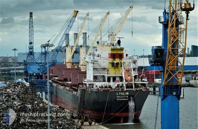
LYULIN
Bulk Carrier
Current Trip
| Time Travelled | 1 day |
|---|---|
| Remaining Time | --- |
| Distance Travelled | 312.75 nm |
| Remaining Distance | --- |
| AVG Speed | 10.8 Knots |
| MAX Speed | 13.1 Knots |
| AVG Wind | 6.9 knots |
| MAX Wind | 13 knots |
| MIN Temp | 23.8°C / 74.84°F |
| MAX Temp | 30.4°C / 86.72°F |
| Dybgang | 7.1 m |
| Position Modtaget | 1 d siden |
Current Position
| Longitude | --- |
|---|---|
| Latitude | --- |
| Status | Under way using engine |
| Fart | 10.7 Knots |
| Kurs | 126.1° |
| Område | Gulf of Mexico |
| Station | T-AIS |
| Position Modtaget | 1 d siden |
Information
The current position of LYULIN is in Gulf of Mexico with coordinates 22.25083° / -97.73332° as reported on 2025-03-29 05:28 by AIS to our vessel tracker app. The vessel's current speed is 10.7 Knots
The vessel LYULIN (IMO: 9498248, MMSI: 248938000) is a Bulk Carrier that was built in 2011 ( 14 år gamle ). It's sailing under the flag of [MT] Malta.
In this page you can find informations about the vessels current position, last detected port calls, and current voyage information. If the vessels is not in coverage by AIS you will find the latest position.
The current position of LYULIN is detected by our AIS receivers and we are not responsible for the reliability of the data. The last position was recorded while the vessel was in Coverage by the Ais receivers of our vessel tracking app.
The current draught of LYULIN as reported by AIS is 7.1 meters
Weather
| Temperature | 27.1°C / 80.78°F |
|---|---|
| Wind Speed | 11 knots |
| Direction | 70° ENE |
| Pressure | 1005.4 hPa |
| Humidity | 80.7 % |
| Cloud Coverage | 41 % |
Featured Company
Last Port Calls
| Port | Arrival | Departure | Time In Port |
|---|---|---|---|
| 2025-03-26 20:59 | 2025-03-28 22:42 | 2 d | |
| 2025-03-22 20:44 | 2025-03-26 00:41 | 3 d | |
| 2025-02-15 15:17 | 2025-02-17 23:57 | 2 d | |
| 2025-01-03 19:41 |
Most Visited Ports (Last year)
| Port | Arrivals | |
|---|---|---|
| 6 | ||
| 4 | ||
| 2 | ||
| 2 | ||
| 2 | ||
| 1 |
Events
| Tid | Hændelsen | Detaljer | Position / Dest | Info |
|---|---|---|---|---|
| 2025-03-30 08:37 | STOP Sejllads | 7.66 nm, North of COATZACOALCOS |
18.26798 / -94.36238
COATZACOALCOS
|
Fart: 0.3 kn Kurs: 135° |
| 2025-03-29 05:35 | Status er ændret | Default Under way using engine |
22.23540 / -97.71514
COATZACOALCOS
|
Fart: 10.7 kn Kurs: 126.1° |
| 2025-03-29 05:28 | Udenfor Dækning |
22.25083 / -97.73332
Gulf of Mexico
COATZACOALCOS
|
Fart: 10.7 kn Kurs: 126.1° |
|
| 2025-03-29 04:42 | Afsejlet fra sidste havn |
|
22.24345 / -97.82579
COATZACOALCOS
|
Fart: 5.6 kn Kurs: 55° |
| 2025-03-29 04:32 | Dybgangen er ændret | 7.1 7.3 |
22.22819 / -97.83712
[MX] TAMPICO
|
Fart: 6.8 kn Kurs: 12° |
| 2025-03-29 04:32 | Destination er ændret | COATZACOALCOS TAMPICO |
22.22819 / -97.83712
[MX] TAMPICO
|
Fart: 6.8 kn Kurs: 12° |
| 2025-03-29 04:32 | ETA er ændret | 2025/03/30 00:30 2025/03/27 00:30 |
22.22819 / -97.83712
[MX] TAMPICO
|
Fart: 6.8 kn Kurs: 12° |
| 2025-03-29 04:29 | Status er ændret | Under way using engine Default |
22.22255 / -97.83806
[MX] TAMPICO
|
Fart: 6.1 kn Kurs: 5° |
| 2025-03-29 04:28 | Status er ændret | Default Under way using engine |
22.22144 / -97.83818
[MX] TAMPICO
|
Fart: 6.9 kn Kurs: 358° |
| 2025-03-29 04:21 | Status er ændret | Under way using engine Default |
22.20835 / -97.84032
[MX] TAMPICO
|
Fart: 6.6 kn Kurs: 55° |