
LUMINANCE
Not available
Current Trip
| Trip Time | 56 days |
|---|---|
| Trip Distance | 867.84 nm |
| AVG Speed | 11.7 Knots |
| MAX Speed | 18.4 Knots |
| Dybgang | 5.3 m |
| AVG Wind | 6.8 knots |
| MAX Wind | 28 knots |
| MIN Temp | 10.5°C / 50.9°F |
| MAX Temp | 33.5°C / 92.3°F |
| Position Modtaget | 2 h, 33 m siden |
Current Position
| Longitude | 18.07916° |
|---|---|
| Latitude | 42.66568° |
| Status | Moored |
| Fart | |
| Kurs | 324° |
| Område | Adriatic Sea |
| Station | T-AIS |
| Position Modtaget | 2 h, 33 m siden |
Info
Information
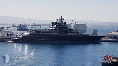
The current position of LUMINANCE is in Adriatic Sea with coordinates 42.66568° / 18.07916° as reported on 2024-09-17 02:28 by AIS to our vessel tracker app. The vessel's current speed is 0 Knots and is currently inside the port of DUBROVNIK.
The vessel LUMINANCE (IMO: 9865087, MMSI: 319271500) is a Not available It's sailing under the flag of [KY] Cayman Is.
In this page you can find informations about the vessels current position, last detected port calls, and current voyage information. If the vessels is not in coverage by AIS you will find the latest position.
The current position of LUMINANCE is detected by our AIS receivers and we are not responsible for the reliability of the data. The last position was recorded while the vessel was in Coverage by the Ais receivers of our vessel tracking app.
The current draught of LUMINANCE as reported by AIS is 5.3 meters
Weather
| Temperature | 12.8°C / 55.04°F |
|---|---|
| Wind Speed | 6 knots |
| Direction | 55° NE |
| Pressure | 1013.2 hPa |
| Humidity | 73.9 % |
| Cloud Coverage | 89 % |
Featured Company
Events
| Tid | Hændelsen | Detaljer | Position / Dest | Info |
|---|---|---|---|---|
| 2024-09-17 02:28 | Udenfor Dækning |
42.66568 / 18.07916
Adriatic Sea
[HR] DUBROVNIK
|
Fart: Kurs: 231.2° |
|
| 2024-09-17 01:46 | Indenfor Dækning |
42.66567 / 18.07915
Adriatic Sea
[HR] DUBROVNIK
|
Fart: Kurs: 260.2° |
|
| 2024-09-16 14:28 | Udenfor Dækning |
42.66569 / 18.07916
Adriatic Sea
[HR] DUBROVNIK
|
Fart: Kurs: 234.6° |
|
| 2024-09-16 07:46 | Status er ændret | Moored Under way using engine |
42.66571 / 18.07908
[HR] DUBROVNIK
|
Fart: 0.1 kn Kurs: 326° |
| 2024-09-16 07:34 | STOP Sejllads |
42.66574 / 18.07869
[HR] DUBROVNIK
|
Fart: 0.3 kn Kurs: 321° |
|
| 2024-09-16 06:59 | Skibe i havn |
|
42.67343 / 18.05861
[HR] DUBROVNIK
|
Fart: 5.1 kn Kurs: 121.4° |
| 2024-09-16 04:52 | Indenfor Dækning |
42.78883 / 17.79817
Adriatic Sea
|
Fart: 0.6 kn Kurs: 171.9° |
|
| 2024-09-16 01:41 | Udenfor Dækning |
42.78762 / 17.79809
Adriatic Sea
|
Fart: 0.4 kn Kurs: 70.9° |
|
| 2024-09-16 01:14 | Indenfor Dækning |
42.78771 / 17.79770
Adriatic Sea
|
Fart: 0.3 kn Kurs: 117.4° |
|
| 2024-09-15 23:35 | Udenfor Dækning |
42.78767 / 17.79755
Adriatic Sea
|
Fart: 0.1 kn Kurs: 288.6° |