
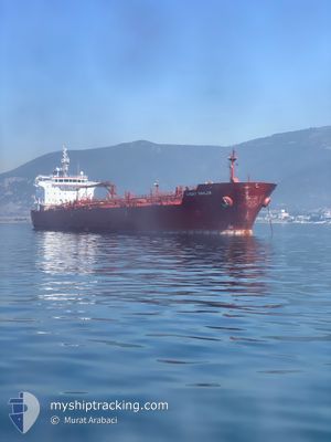
LUCKY SAILOR
Oil/Chemical Tanker
Current Trip
OPL MALTA
| Time Travelled | 4 days |
|---|---|
| Remaining Time | --- |
| Distance Travelled | 631.57 nm |
| Remaining Distance | --- |
| AVG Speed | 10.2 Knots |
| MAX Speed | 13.6 Knots |
| AVG Wind | 13.4 knots |
| MAX Wind | 32 knots |
| MIN Temp | -0.4°C / 31.28°F |
| MAX Temp | 15.9°C / 60.62°F |
| Dybgang | 10.4 m |
| Position Modtaget | 1 d siden |
Current Position
| Longitude | --- |
|---|---|
| Latitude | --- |
| Status | Under way using engine |
| Fart | 11.8 Knots |
| Kurs | 236° |
| Område | Sea of Marmara |
| Station | T-AIS |
| Position Modtaget | 1 d siden |
Info
Information
The current position of LUCKY SAILOR is in Sea of Marmara with coordinates 40.73286° / 27.53476° as reported on 2026-01-02 02:34 by AIS to our vessel tracker app. The vessel's current speed is 11.8 Knots
The vessel LUCKY SAILOR (IMO: 9464352, MMSI: 248132000) is a Oil/Chemical Tanker that was built in 2009 ( 17 år gamle ). It's sailing under the flag of [MT] Malta.
In this page you can find informations about the vessels current position, last detected port calls, and current voyage information. If the vessels is not in coverage by AIS you will find the latest position.
The current position of LUCKY SAILOR is detected by our AIS receivers and we are not responsible for the reliability of the data. The last position was recorded while the vessel was in Coverage by the Ais receivers of our vessel tracking app.
The current draught of LUCKY SAILOR as reported by AIS is 10.4 meters
Weather
| Temperature | 15.4°C / 59.72°F |
|---|---|
| Wind Speed | 22 knots |
| Direction | 218° SW |
| Pressure | 1014.8 hPa |
| Humidity | 73 % |
| Cloud Coverage | 100 % |
Featured Company
Last Port Calls
| Port | Arrival | Departure | Time In Port |
|---|---|---|---|
| 2025-12-30 12:53 | 2025-12-30 13:32 | 38 m | |
| 2025-12-29 20:19 | 2025-12-30 12:50 | 16 h | |
| 2025-12-27 19:26 | 2025-12-28 21:45 | 1 d | |
| 2025-12-27 05:24 | 2025-12-27 06:58 | 1 h | |
| 2025-12-27 03:57 | 2025-12-27 04:34 | 37 m | |
| 2025-12-27 00:21 | 2025-12-27 02:25 | 2 h | |
| 2025-12-27 00:03 | 2025-12-27 00:17 | 14 m | |
| 2025-11-18 23:29 | 2025-11-20 08:57 | 1 d | |
| 2025-11-18 08:56 | 2025-11-18 22:44 | 13 h | |
| 2025-11-08 16:37 | 2025-11-11 06:16 | 2 d |
Most Visited Ports (Last year)
| Port | Arrivals | |
|---|---|---|
| 8 | ||
| 2 | ||
| 2 | ||
| 2 | ||
| 2 | ||
| 2 |
Last Trips
| Origin | Departure | Destination | Arrival | Distance | |
|---|---|---|---|---|---|
| 2025-12-30 12:50 | 2025-12-30 12:53 | 1.04 nm | |||
| 2025-12-28 21:45 | 2025-12-29 20:19 | 62.12 nm | |||
| 2025-12-27 06:58 | 2025-12-27 19:26 | 96.84 nm | |||
| 2025-12-27 04:34 | 2025-12-27 05:24 | 16.64 nm | |||
| 2025-12-27 02:25 | 2025-12-27 03:57 | 16.15 nm | |||
| 2025-12-27 00:17 | 2025-12-27 00:21 | 1.26 nm | |||
| 2025-11-20 08:57 | 2025-12-27 00:03 | 3940.64 nm | |||
| 2025-11-18 22:44 | 2025-11-18 23:29 | 0.70 nm | |||
| 2025-11-11 06:16 | 2025-11-18 08:56 | 98.78 nm | |||
| 2025-10-27 14:46 | 2025-11-08 16:37 | 742.51 nm |
Events
| Tid | Hændelsen | Detaljer | Position / Dest | Info |
|---|---|---|---|---|
| 2026-01-03 20:50 | STOP Sejllads | 5.01 nm, West of KEMER |
40.44653 / 26.94903
OPL MALTA
|
Fart: 0.1 kn Kurs: 246° |
| 2026-01-03 20:04 | START Sejllads | 4.02 nm, North West of KEMER |
40.46389 / 26.98916
OPL MALTA
|
Fart: 3.1 kn Kurs: 240° |
| 2026-01-03 16:03 | STOP Sejllads | 4.21 nm, North of KEMER |
40.48500 / 27.03167
OPL MALTA
|
Fart: Kurs: -1° |
| 2026-01-03 12:48 | START Sejllads | 2.56 nm, North West of KEMER |
40.45170 / 27.01968
OPL MALTA
|
Fart: 3.2 kn Kurs: 254° |
| 2026-01-03 08:55 | STOP Sejllads | 3.33 nm, North West of KEMER |
40.43961 / 26.98508
OPL MALTA
|
Fart: 0.2 kn Kurs: 219° |
| 2026-01-03 06:56 | START Sejllads | 4.22 nm, North West of ICDAS |
40.50118 / 27.07567
OPL MALTA
|
Fart: 8.4 kn Kurs: 245° |
| 2026-01-03 06:44 | STOP Sejllads | 4.08 nm, North of ICDAS |
40.52067 / 27.13041
OPL MALTA
|
Fart: Kurs: 0° |
| 2026-01-03 06:06 | START Sejllads | 3.26 nm, North East of ICDAS |
40.49336 / 27.19166
OPL MALTA
|
Fart: 3.6 kn Kurs: 40° |
| 2026-01-03 01:53 | STOP Sejllads | 3.27 nm, North East of ICDAS |
40.49713 / 27.18602
OPL MALTA
|
Fart: 0.2 kn Kurs: 207° |
| 2026-01-02 23:33 | START Sejllads | 2.17 nm, South of SARKOY |
40.57456 / 27.09506
OPL MALTA
|
Fart: 5.8 kn Kurs: 235° |