
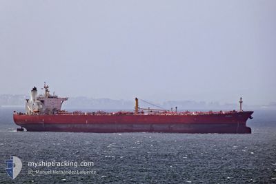
LUCIA
Crude Oil Tanker
Current Trip
| Time Travelled | 3 days |
|---|---|
| Remaining Time | --- |
| Distance Travelled | 43.45 nm |
| Remaining Distance | --- |
| AVG Speed | 6.9 Knots |
| MAX Speed | 11.2 Knots |
| AVG Wind | 5.5 knots |
| MAX Wind | 15 knots |
| MIN Temp | 3.6°C / 38.48°F |
| MAX Temp | 11.6°C / 52.88°F |
| Dybgang | 15 m |
| Position Modtaget | Nu |
Current Position
| Longitude | 28.52193° |
|---|---|
| Latitude | 60.05842° |
| Status | Under way using engine |
| Fart | 11 Knots |
| Kurs | 299.5° |
| Område | Gulf of Finland |
| Station | T-AIS |
| Position Modtaget | Nu |
Info
Information
The current position of LUCIA is in Gulf of Finland with coordinates 60.05842° / 28.52193° as reported on 2024-05-05 19:56 by AIS to our vessel tracker app. The vessel's current speed is 11 Knots and is heading at the port of SUEZ CANAL. The estimated time of arrival as calculated by MyShipTracking vessel tracking app is 2024-05-22 03:00 LT
The vessel LUCIA (IMO: 9250892, MMSI: 574005180) is a Crude Oil Tanker that was built in 2003 ( 21 år gamle ). It's sailing under the flag of [VN] Vietnam.
In this page you can find informations about the vessels current position, last detected port calls, and current voyage information. If the vessels is not in coverage by AIS you will find the latest position.
The current position of LUCIA is detected by our AIS receivers and we are not responsible for the reliability of the data. The last position was recorded while the vessel was in Coverage by the Ais receivers of our vessel tracking app.
The current draught of LUCIA as reported by AIS is 15 meters
Weather
| Temperature | 4.6°C / 40.28°F |
|---|---|
| Wind Speed | 9 knots |
| Direction | 80° E |
| Pressure | 1013.5 hPa |
| Humidity | 80.1 % |
| Cloud Coverage | 99 % |
Featured Company
Last Port Calls
| Port | Arrival | Departure | Time In Port |
|---|---|---|---|
| 2024-04-30 22:33 | 2024-05-02 03:40 | 1 d | |
| 2024-04-28 07:20 | 2024-04-29 07:40 | 1 d | |
| 2024-04-11 04:53 | 2024-04-11 14:19 | 9 h | |
| 2024-03-27 20:11 | |||
| 2024-03-13 02:11 |
Most Visited Ports (Last year)
| Port | Arrivals | |
|---|---|---|
| 7 | ||
| 4 | ||
| 2 | ||
| 2 | ||
| 1 |
Last Trips
| Origin | Departure | Destination | Arrival | Distance | |
|---|---|---|---|---|---|
| 2024-04-29 10:40 | 2024-05-01 01:33 | 73.02 nm | |||
| 2024-03-28 01:41 | 2024-04-28 10:20 | 9214.32 nm | |||
| 2024-03-28 01:41 | 2024-04-11 06:53 | 4360.83 nm |
Events
| Tid | Hændelsen | Detaljer | Position / Dest | Info |
|---|---|---|---|---|
| 2024-05-05 18:55 | Dybgangen er ændret | 15 14.4 |
59.91992 / 28.56065
SUEZ
|
Fart: 6.9 kn Kurs: 38.6° |
| 2024-05-05 18:55 | ETA er ændret | 2024/05/22 03:00 2024/05/19 08:00 |
59.91992 / 28.56065
SUEZ
|
Fart: 6.9 kn Kurs: 38.6° |
| 2024-05-05 17:55 | START Sejllads | 2.23 nm, North West of VISTINO |
59.81574 / 28.40906
SUEZ
|
Fart: 3.3 kn Kurs: 25° |
| 2024-05-05 17:41 | Status er ændret | Under way using engine Default |
59.81015 / 28.40714
SUEZ
|
Fart: 0.1 kn Kurs: 22° |
| 2024-05-05 17:26 | Status er ændret | Default At anchor |
59.81002 / 28.40658
SUEZ
|
Fart: 0.1 kn Kurs: 21° |
| 2024-05-05 16:26 | Status er ændret | At anchor Default |
59.80992 / 28.40604
SUEZ
|
Fart: 0.1 kn Kurs: 23° |
| 2024-05-05 16:23 | Status er ændret | Default At anchor |
59.80994 / 28.40616
SUEZ
|
Fart: Kurs: 25° |
| 2024-05-05 15:06 | Status er ændret | At anchor Default |
59.80988 / 28.40653
SUEZ
|
Fart: Kurs: 20° |
| 2024-05-05 15:03 | Status er ændret | Default At anchor |
59.80990 / 28.40655
SUEZ
|
Fart: 0.1 kn Kurs: 19° |
| 2024-05-05 14:30 | Status er ændret | At anchor Default |
59.80988 / 28.40686
SUEZ
|
Fart: Kurs: 14° |